Good afternoon, everyone. Rounds of heavy rain continue to push across parts of the state and could lead to local high water issues. Beyond that, we track a rain to snow system that threatens to put down accumulations for some.
Parts of the state have already picked up more than 1″ of rain and another 1″-2″ will be possible tonight and early Sunday. This may be enough to cause flooding concerns, especially in the southeastern part of the state.
Here are your radars to follow along…

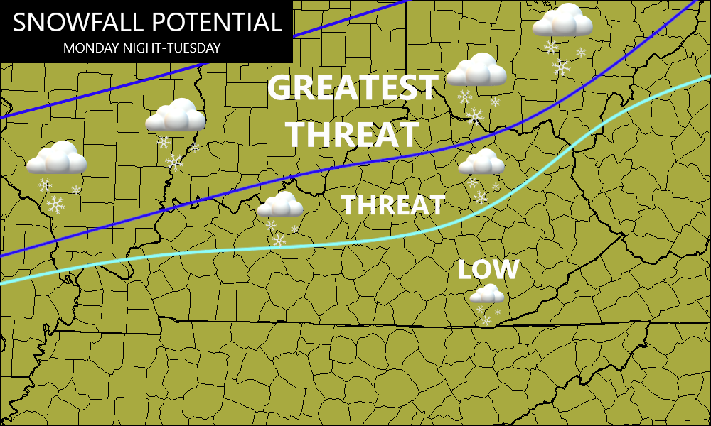
My thoughts on the next system have not changed as it’s likely a rain to snow maker. The greatest risk to put snow on the ground is across the northern half of the state. Here’s a look at the area with the best potential Monday night and Tuesday…
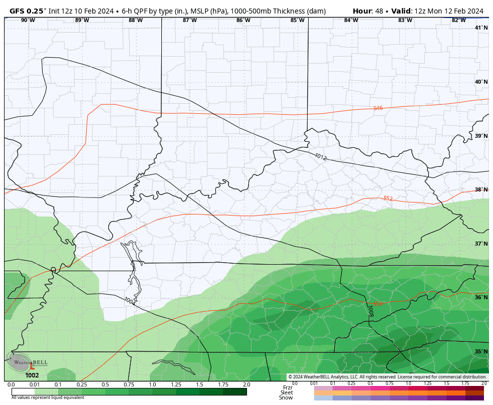
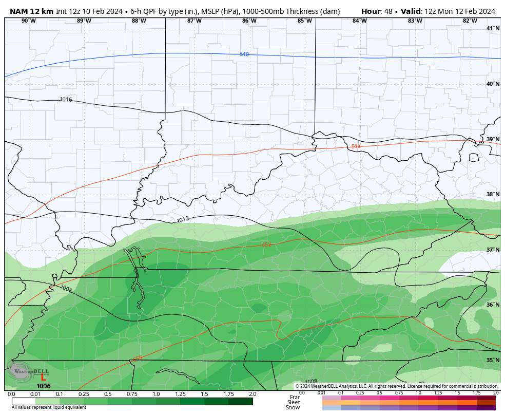
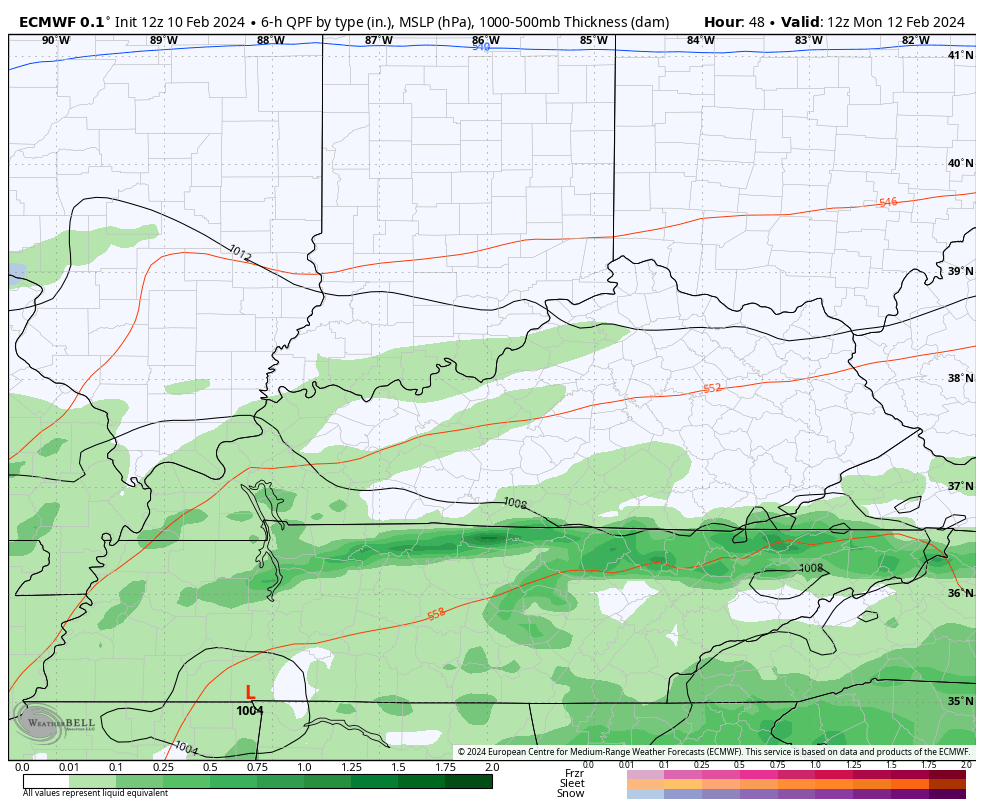
The look from the models remains fairly consistent…
GFS
NAM
EURO
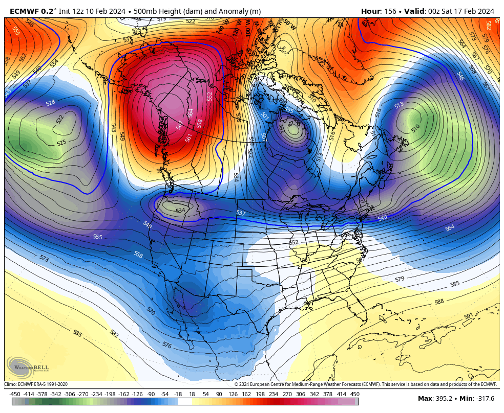
Watch late next week and weekend as another storm system comes out of the south and tries to hook up with arctic air diving into the country. As I said yesterday, the models aren’t even close to figuring this out, but the setup can lead to some setup. Watch the Polar Vortex make an appearance on the EURO…
Enjoy the rest of the day and take care.

Thanks Chris. Looks like a big heavy snow in my home town in south central Indiana. Glad to see that they can still get those late heavy wet snows in the new normal. I think here in Kentucky, snowy days with heavy accumulations is a thing of the past. At least we are receiving some good soaking rains. Ready for spring and I hope we don’t have the terrible severe weather / tornadoes this year, but I think we will because of what is going on in the negative Pacific.