Good Sunday, folks. It’s been soggy Super Bowl weekend across the Commonwealth, and we have more on the way for Monday. That’s from a system that will also bring some snow into our region Monday night and early Tuesday.
Many areas have picked up 1″-2″ of rain since Friday and rain is still widespread this morning but that thins out as the day wears on. Here are your radars…

Some peaks of afternoon sun will be possible with colder winds bringing temps back down into the normal 40s today.
The next system moves in with rain on Monday and a period of snow behind it Monday night and Tuesday morning. The best chance to put some snow on the ground is across northern Kentucky and I’m rolling with the same Snowfall Potential map I put out yesterday…
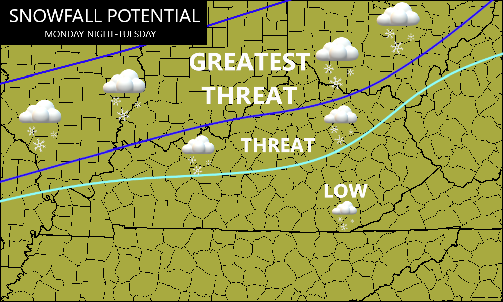
There is likely to be a band of significant snows developing and that’s essentially what the map above is for.
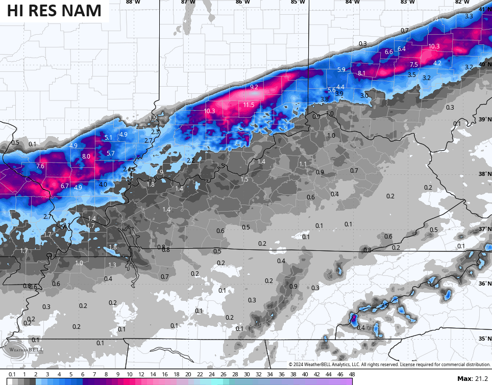
The future radar from the Hi Res NAM shows this band well, but also has a lighter period of wraparound snow for many. This animation goes from 7am Monday through 7am Tuesday…

Here’s the snowfall map from that run…
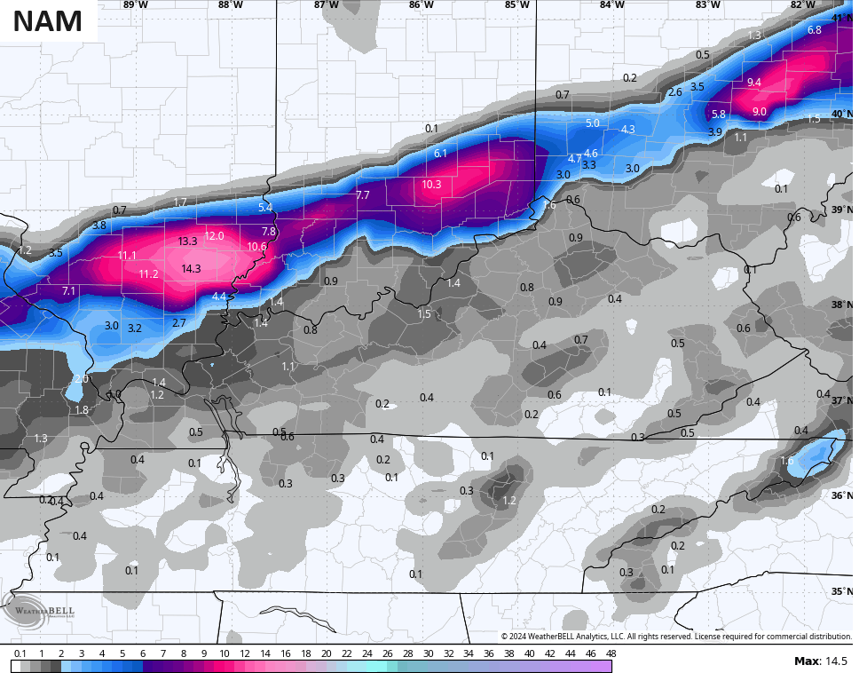
The NAM has a similar look…
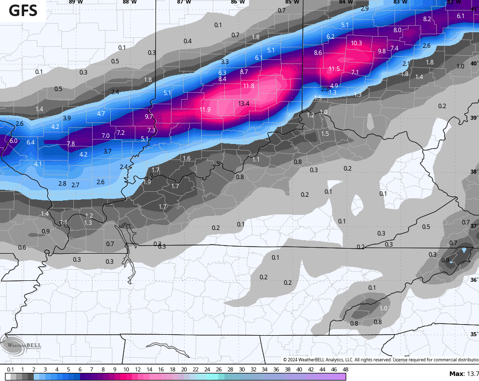
So does the GFS…
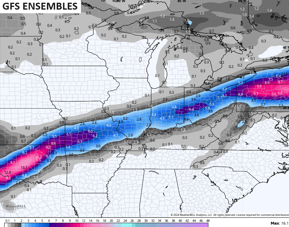
The GFS Ensembles cast a wider area of snow…
The EURO continues to have more of a west to east push and brings this heavier snow band much farther south…
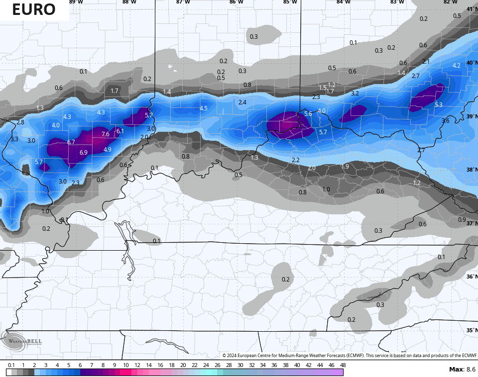
That would certainly bring a flat out snowstorm into northern Kentucky, but I’m not ready to bite on that one just yet.
Updates come later today. Make it a good one and take care.

Thanks Chris for the update. Be glad when spring / summer arrives and this awful uneventful winter is over. At least we had a week of winter weather back in January. Snowfall total at 5 inches. More than last year.
Have a bless Sunday and enjoy the Super bowl !
When I see this forecast all I think about is songs that have the lyrics “it’s a cold rain.”
What happened to the Artic air that was forecast to hit us sometime this week. Our local forecast here are saying 50- 60’s for the week. May be old Phil is right about early spring.
Good question. I don’t exactly know what happen to the Polar Vortex, It was forecast to weaken and the cold and frigid air was to enter the US. My guess the bulk of the Arctic air went into Siberia. I’m thinking now we will have an early spring, but I hope without spring freezes and tornadoes.
Nobody said it would be bitter cold.
I don’t know or heard of anyone forecasting sub- zero temperatures for the rest of the winter ?
Avg. temps in Feb. upper 40s
So temps in the low 40s would be below normal.
Found this long confusing article telling what we may expect in the coming days with the Polar Vortex :
https://www.aer.com/science-research/climate-weather/arctic-oscillation/
The severe weather event from late Thursday afternoon/early evening in Southern Wisconsin was the first time ever that a Tornado Warning was issued in the state during the month of February. The Milwaukee NWS issued five tornado warnings during this event.
There were two confirmed tornadoes there, with the strongest being an EF-2 that produced multiple damage reports.
https://weather.gov/mkx/FebruarySevereWeather