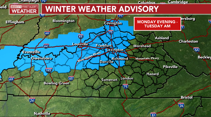
Good evening, everyone. I wanted to drop by for a very quick update on this Super Bowl Sunday. We continue with a Winter Storm THREAT for late Monday and Monday night. This is for the low we’ve been tracking for about a week or so now.
A Winter Weather Advisory is already out for many areas and I suspect we will see many more counties added to this with a possible upgrade to a Winter Storm Warning…
My updated thoughts continue to push the Greatest Threat area farther south and southeast…
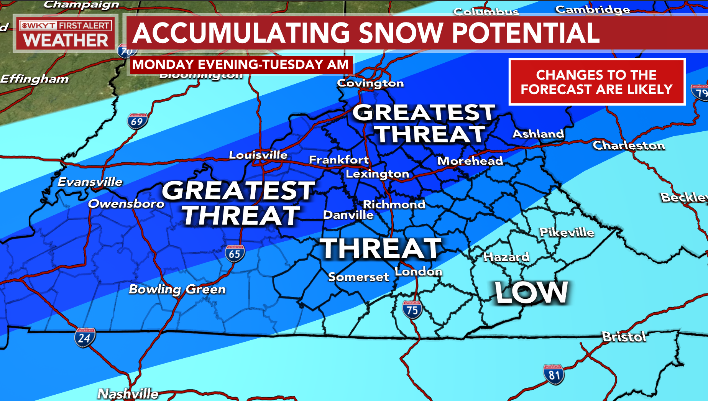
That may get pushed even farther south and east tonight and Monday.
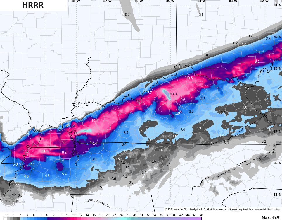
The forecast models keep trending this way with the latest HRRR on steroids and LIKELY way overdone with snow amounts…
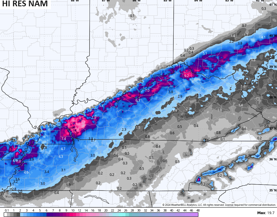
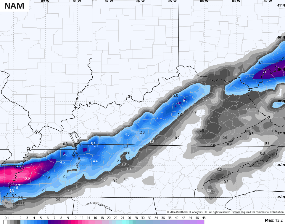
The Hi Res NAM came south from its earlier run…
The NAM looks a little too disjointed and is the farthest south…
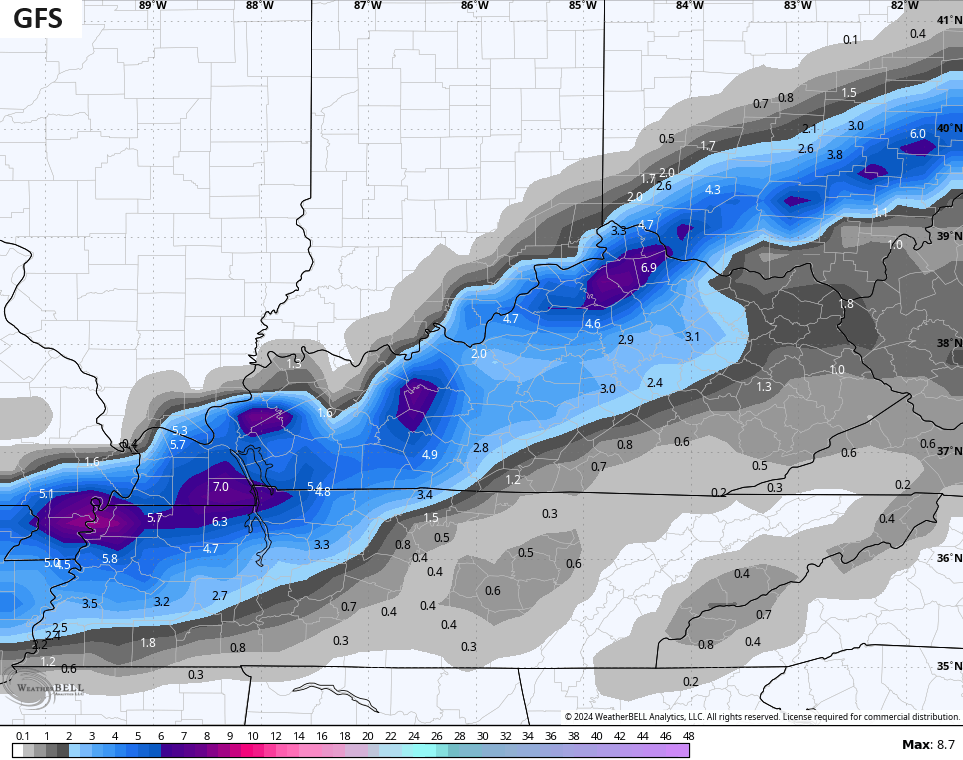
The GFS looks pretty much like my current Greatest Threat map…
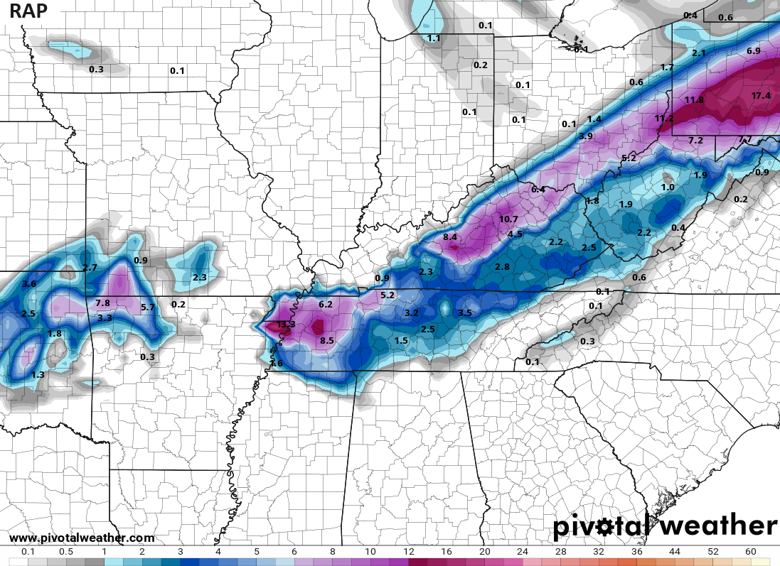
The RAP blows up the bluegrass region of central Kentucky…
Whatever snow we get will fall in a short window and that means it will snow REALLY hard for a bit.
I will have the latest on WKYT News on the CW at 10pm and on WKYT-TV later tonight after the Super Bowl and CBS Programming.
Enjoy the evening and take care.

My drive home from Rupp to Richmond might be interesting tomorrow night.
Chris can you give us the update on weather the polar air is supposed to invade our part of world that you and others were predicting on your next post.