Good Monday, folks. Our Winter Storm THREAT continues from this evening into early Tuesday morning. Rain will change to a thumping snow for parts of the state, but the location of this continues to be a work in progress.
Here’s a breakdown:
TODAY
- Things start dry with clouds thickening from south to north.
- Rain arrives from the southwest this afternoon.
- Temps may reach 50 degrees in a few spots.
THIS EVENING
- Low pressure works from central Tennessee to West Virginia.
- Rain switches to snow from southwest to northeast behind the track of the low.
- A swath of moderate to heavy wet snow is likely to trail the low.
- Bands like this can put down a thumper of a snowfall for areas getting under them.
- Several inches of snow will be possible within this band.
- Pinpointing exactly where this band sets up is the challenge of the day.
- Snowfall rates will overcome mild ground and road temps.
- NOT EVERYONE GETS A LOT OF SNOW FROM THIS.
TUESDAY
- Morning snow quickly pulls way from eastern Kentucky.
- Sun and clouds take over with temps likely topping 40 for most areas.
- Whatever snow falls will melt pretty quickly.
Here’s a look at my current thinking on where the best chance for accumulating snows will be tonight…
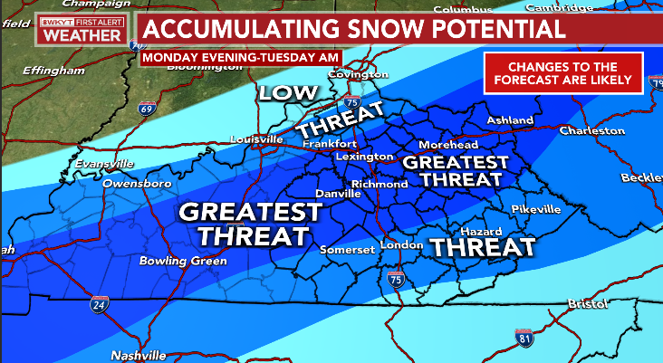
That will likely change through the day as this system comes into better focus. I will put out a First Call For Snowfall at some point before the snow starts. Y’all know if I haven’t put out a call map, yet, then you know it’s a tough forecast.
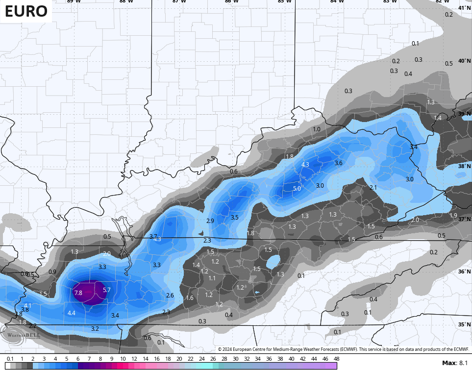
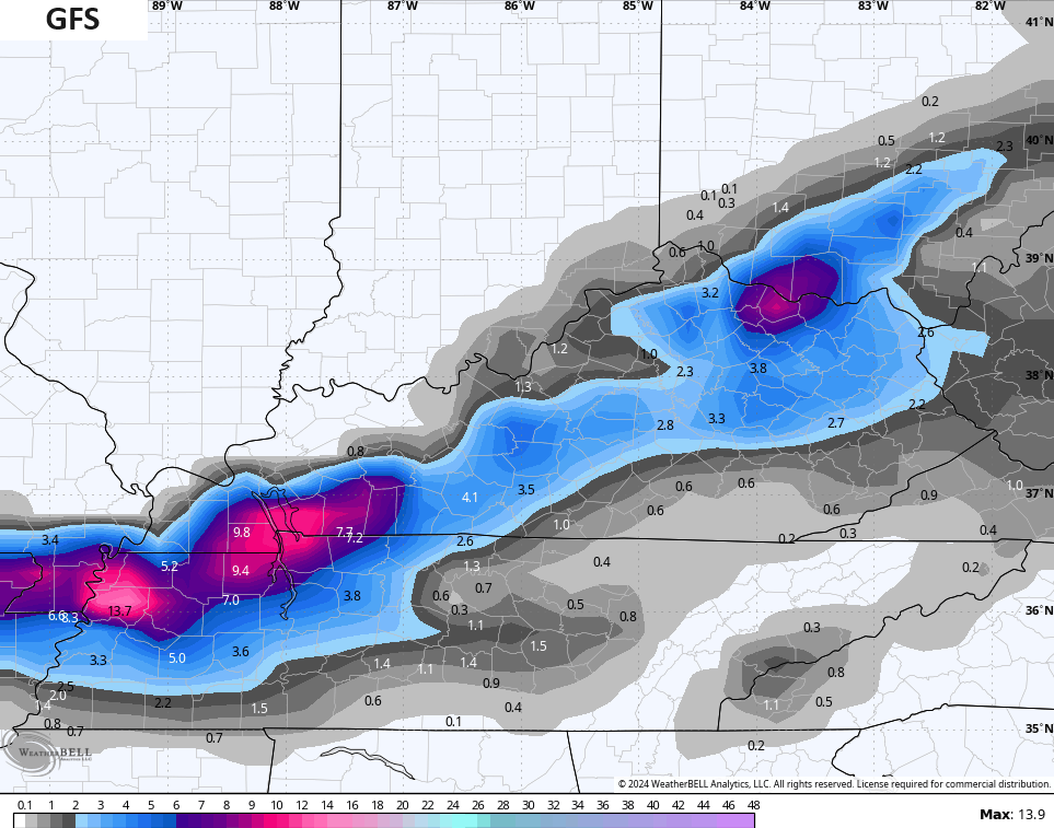
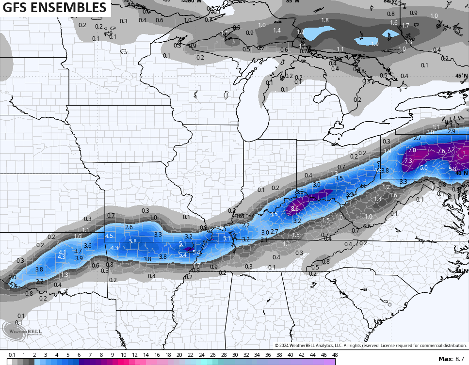
The latest forecast models are still jumping around a bit with where the track of the heavy snow band sets up.
The EURO targets more central and eastern Kentucky…
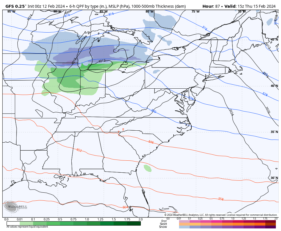
The GFS goes from southwestern Kentucky through central Kentucky and into the northeast…
The average of the 21 member GFS Ensembles has the heaviest snow into central Kentucky…
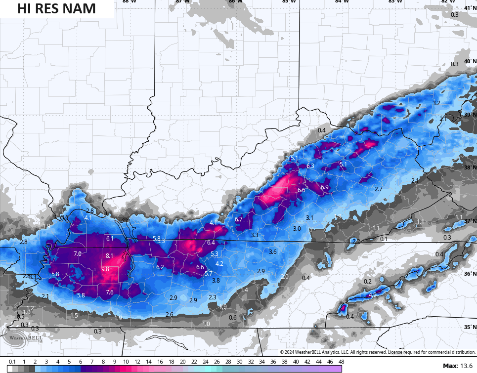
The Hi Res NAM took a big jump east…
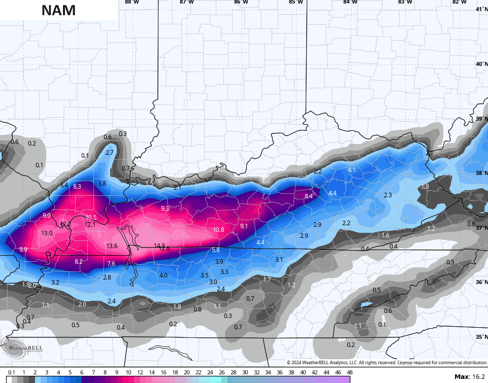
So did the NAM…
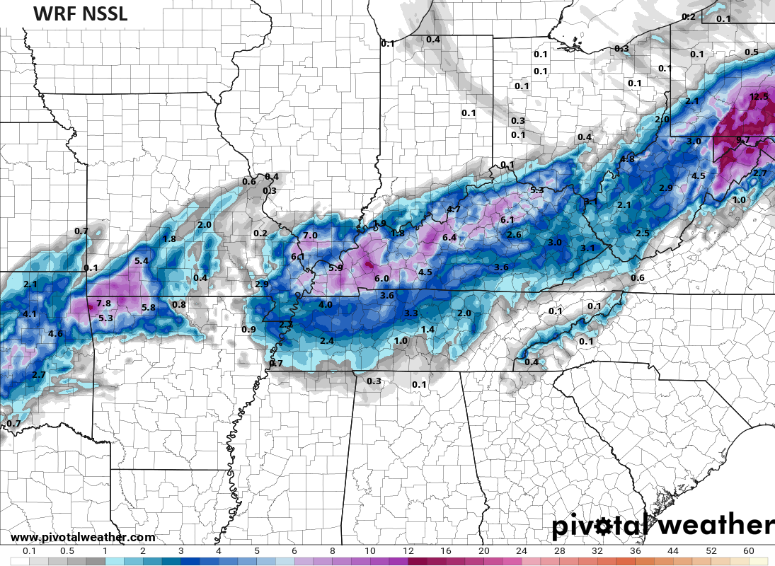
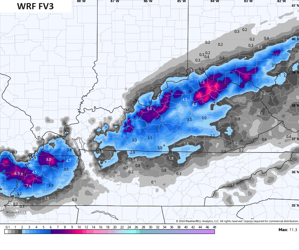
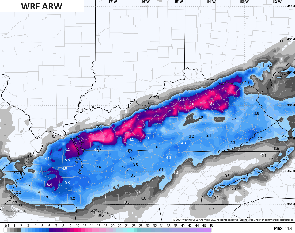
The WRF family of models show more of a widespread snowfall…
The ICON looks like this…
![]()
![]()
Looking down the road, we need to watch the setup for late week and into the weekend. The models continue to hint at a bigger system trying to come together…
GFS
CANADIAN
I will have updates through the day, so check back. Make it a good one and take care.

Thanks Chris. As the day wears on, there may be some excitement on the blog. Hoping it happens for all the snow lovers out there. I’m hoping it doesn’t get too bad on the roads as I’m undergoing surgery today to repair an inguinal hernia. My second one. Lucky me. May be off the blog for a while ?
Have a great day everyone !
Good luck with this one. Could be a coating to at least several inches and hard to pin down where.
Yesterday we were in the sweet spot for snow and now it has moved south of us. Never fells. LOL
Yeah, river counties might as well give it up.
Counties along the parkways have been the winners lately.