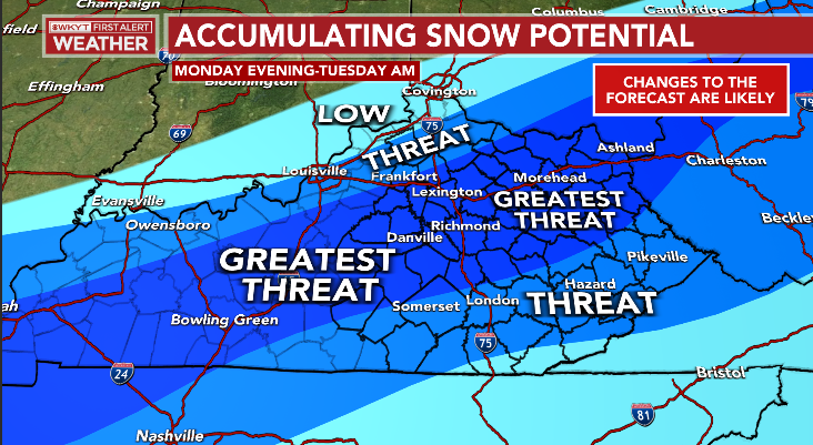
Good afternoon, everyone. We are still on pace for a band of thumping snow to set up shop across parts of Kentucky late this evening into early Tuesday. This band will put down several inches of snow. Outside of that band… forget about it.
A few thoughts:
- This band of heavy snow won’t be very wide and may only be 50-100 miles wide.
- That makes it incredibly hard to pinpoint exactly where it shows up.
- Within this band, heavy wet snow is likely and will put down several inches.
- A VERY sharp cut off on the western side of the snow is likely.
- Snow lovers in northern Kentucky and around Louisville are likely to be disappointed.
- Areas along the Bluegrass Parkway corridor toward Lexington are in the boom or bust camp it could go either way right now.
- The cutoff on the southern side won’t be as sharp, but you will still have a big drop off.
I’m rolling with my map from last night on where the best chance is for this band to set up…
I will get a First Call map out in a few hours.
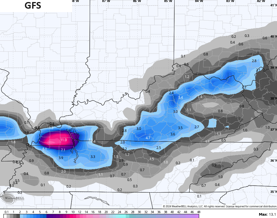
The GFS shows our band of snow setting up in my area of Greatest Threat…
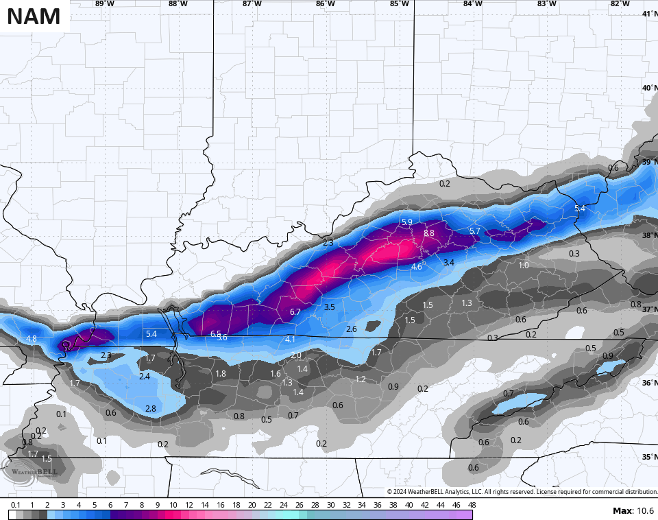
The NAM is in there as well, but farther northwest than the GFS…
The ICON is similar…
![]()
![]()
The HRRR is a bit farther southeast with the band of snow and doesn’t like western Kentucky very much…
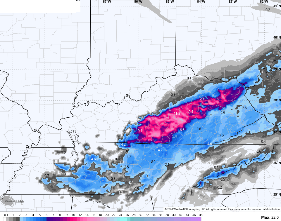
Once again, snow amounts on the HRRR are not likely to verify. That thing has been on steroids for a few days now.
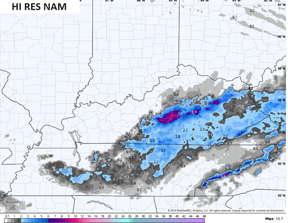
The Hi Res NAM is similar to the HRRR in placement of the snow…
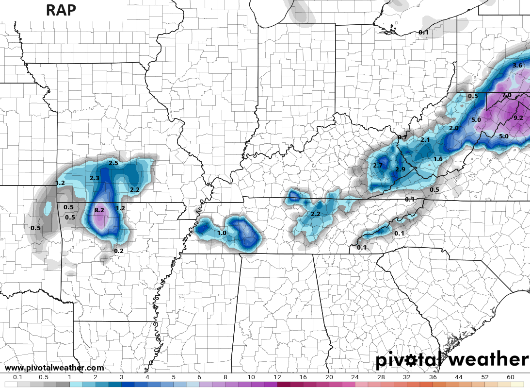
The RAP only brings snow to far southeastern Kentucky.
I will have updates later today here on KWC and on WKYT-TV starting at 4pm. Until then, here are your radars to track the rain and snow coming from the southwest…

Have a great day and take care.

Seems like on Radar at least there are two areas of Low Pressure out to the South West of Bowling Green.
We are having heavy rain Chris you were right as always.
Forecast looks like quite a bust. On to the next.
I was hoping it would snow here in Louisville.
But I am really not that disappointed because all of it is going to fall at night & the majority of it will be all melted by tomorrow afternoon.
Incorrect
It’s 43°F in Bowling Green, and we’ve received 0.50″ of rain so far today. As expected, several models are showing potential snowfall to the north, south, and east of Bowling Green, which is expected. I would be very surprised if we see more than a coating in BG.
Set your clock because it might be gone before you have a chance to see it.LOL