Good evening, everyone. Our storm system continues to trend farther south and east with a band of slushy snow showing up from late this evening into the early morning hours of Tuesday. It’s actually been quite the sight to see over the past 24 hours.
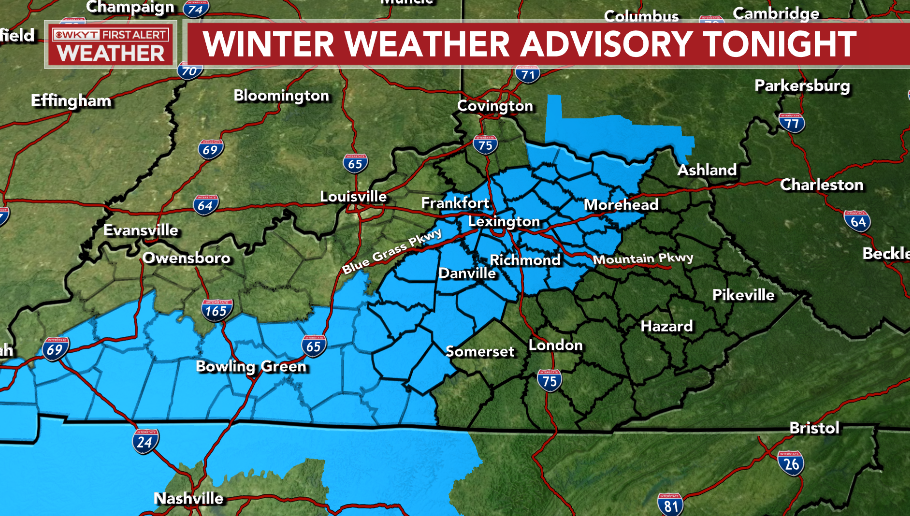
We continue to see a Winter Weather Advisory is out for much of central Kentucky and southwest…
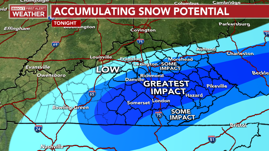
The greatest threat for some snow continues to sink toward the southeast. This puts the Lexington metro on the fence between no snow and snow…
The low is tracking a bit farther to the east and southeast than what the forecast models had been showing and that’s showing up on your radars…

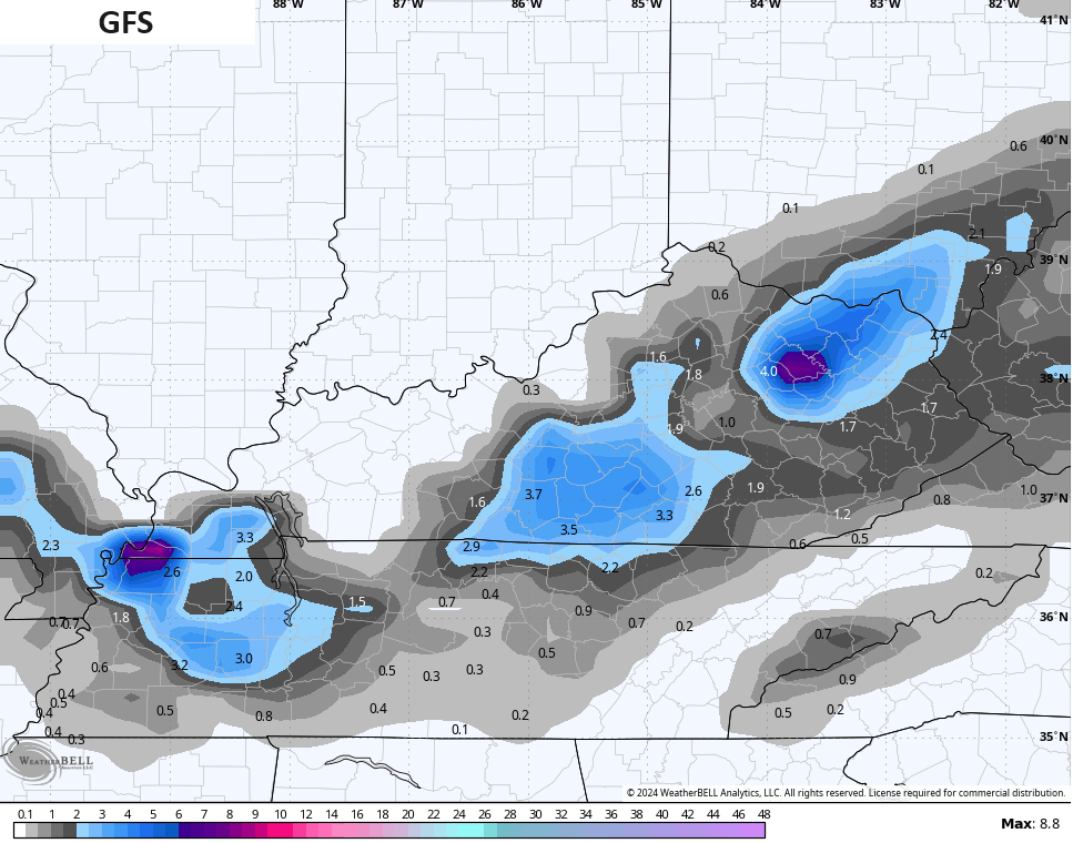
If you’re a snow lover, then you still have a few models on your side. The GFS is still back into central Kentucky…
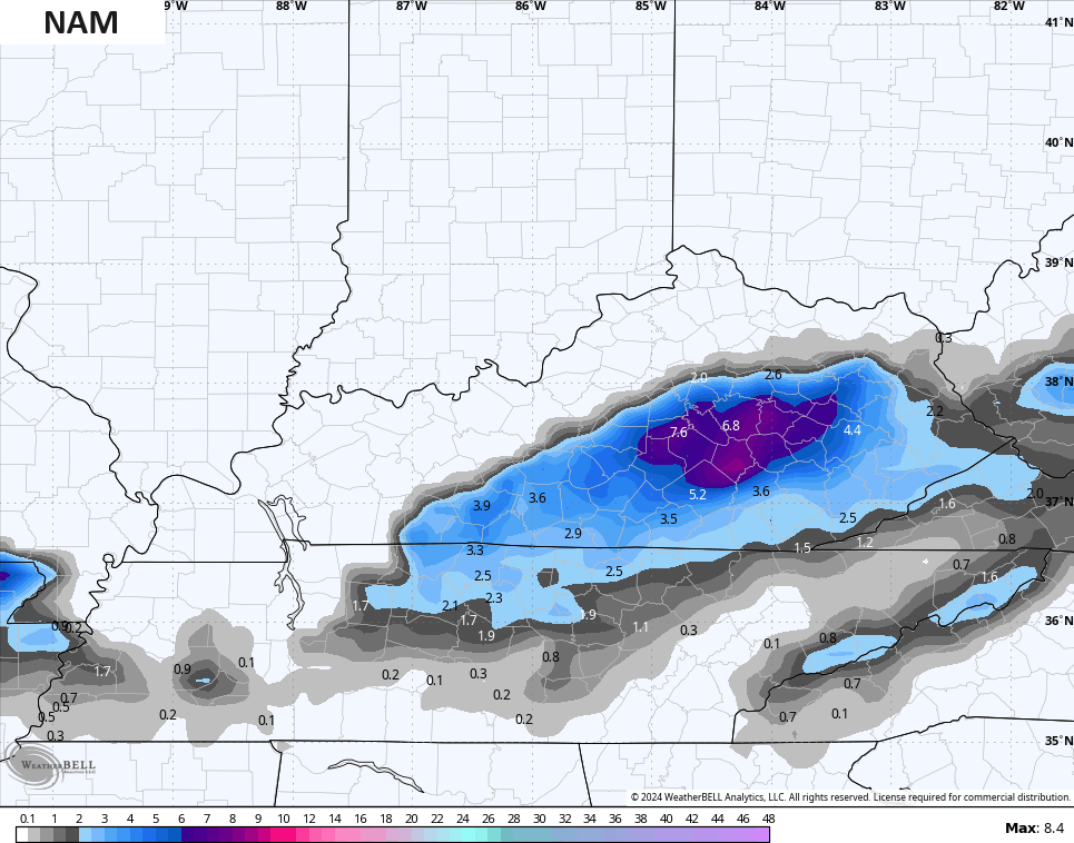
The NAM is putting out some significant totals south of Interstate 64…
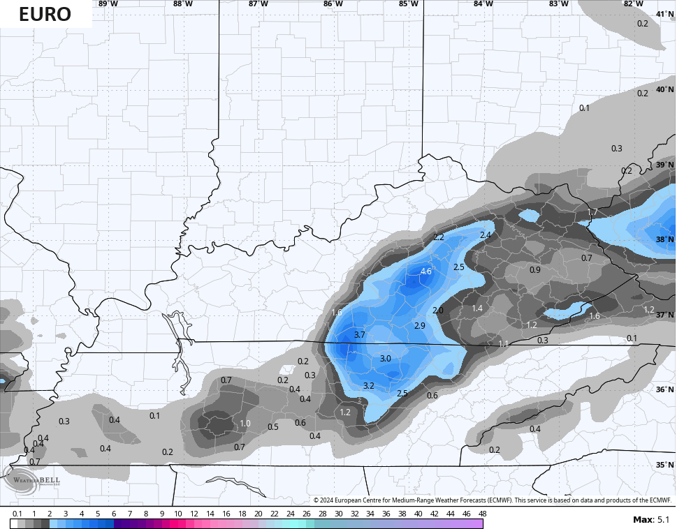
The EURO isn’t to that extreme, but likes the area south of Lexington…
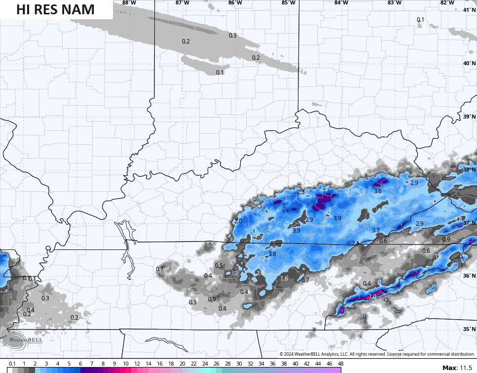
The Hi Res NAM is the farthest south…
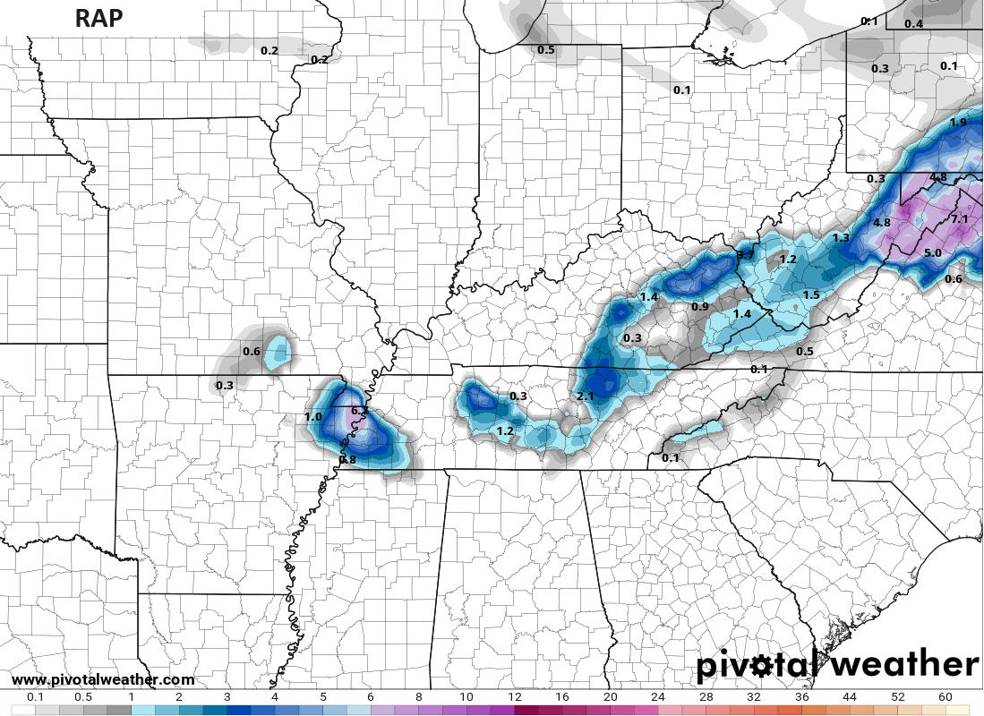
The RAP is also to the east and southeast…
As you can see, I’m not as stoked about the chance for significant snows as a few of the models, but there’s still a chance for some areas to pick up a few to several inches of snow. It’s a narrow corridor so, if you’re a snow lover, good luck!
Whatever falls will be gone very quickly on Tuesday as skies turn sunny with temps in the 40s.
Enjoy the evening and take care.

I don’t see how it’s going to snow much in eastern Ky we don’t hit the 30s till3 or 4 am according to the hourly but we certainly have had heavy rain.
My PWS near Bowling Green recorded 1.85″ of rain since Noon. The temperature has dropped to 39°F, but our chances for snow or ice have practically dropped to zero, since the precipitation shield has already cleared central Warren County. With mid-50’s temperatures forecasted for the remainder of the week in South Central Kentucky, some plants are starting to break through.