Good Tuesday, everyone. Our snow swipe is quickly pushing away from the region and is gone before many of you wake up. With some nice weather to follow, winter weather lovers are looking for anything to track at this point. That “anything” comes your way by the weekend.
The southeast trend of our departing storm was something to behold. It was a fast and furious trend and one the models just could not keep up with. Not only did this storm trend south around here, but it’s also trending south across New England. Some areas around Boston that were expecting a foot of snow may only get an inch or two.
Even with all of this, some areas across southern and southeastern Kentucky wake up to some slushy accumulations. The radar shows a fast-departing system…

The sun comes out quickly with temps reaching the 40s this afternoon, s any snow that sticks won’t stay around long. Drip, Drip, Drip.
Highs Wednesday and Thursday bounce back into the 50s with a mix of sun and clouds, further pushing your friendly weatherdude deeper into #TeamSpring mode.
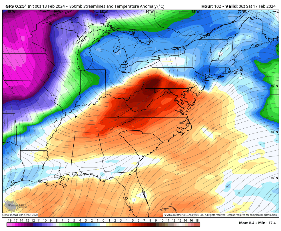
A weak cold front crosses the region Thursday and may touch off a shower. That sets the stage for a shot of cold air for the weekend and this will be ushered in by a stronger system late Friday and Saturday.
The Canadian is showing a decent round of light snow…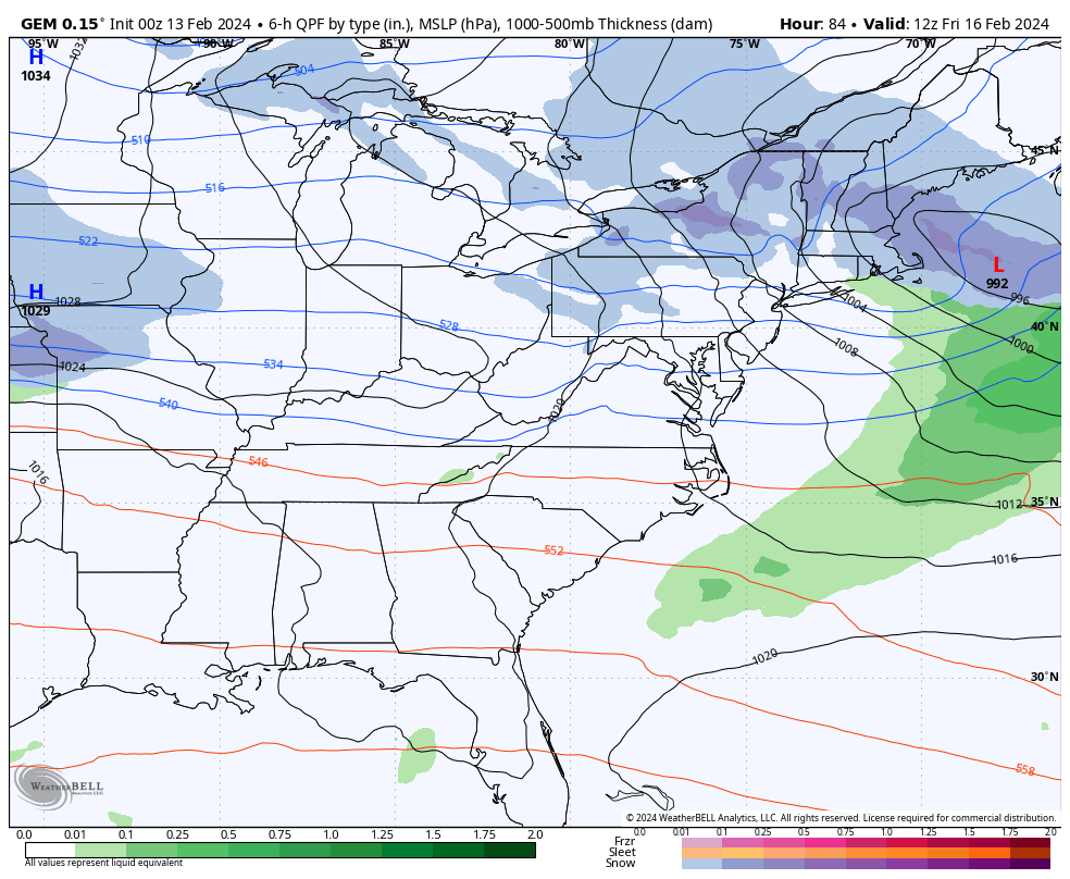
The GFS is likely too far north with the track of this low…
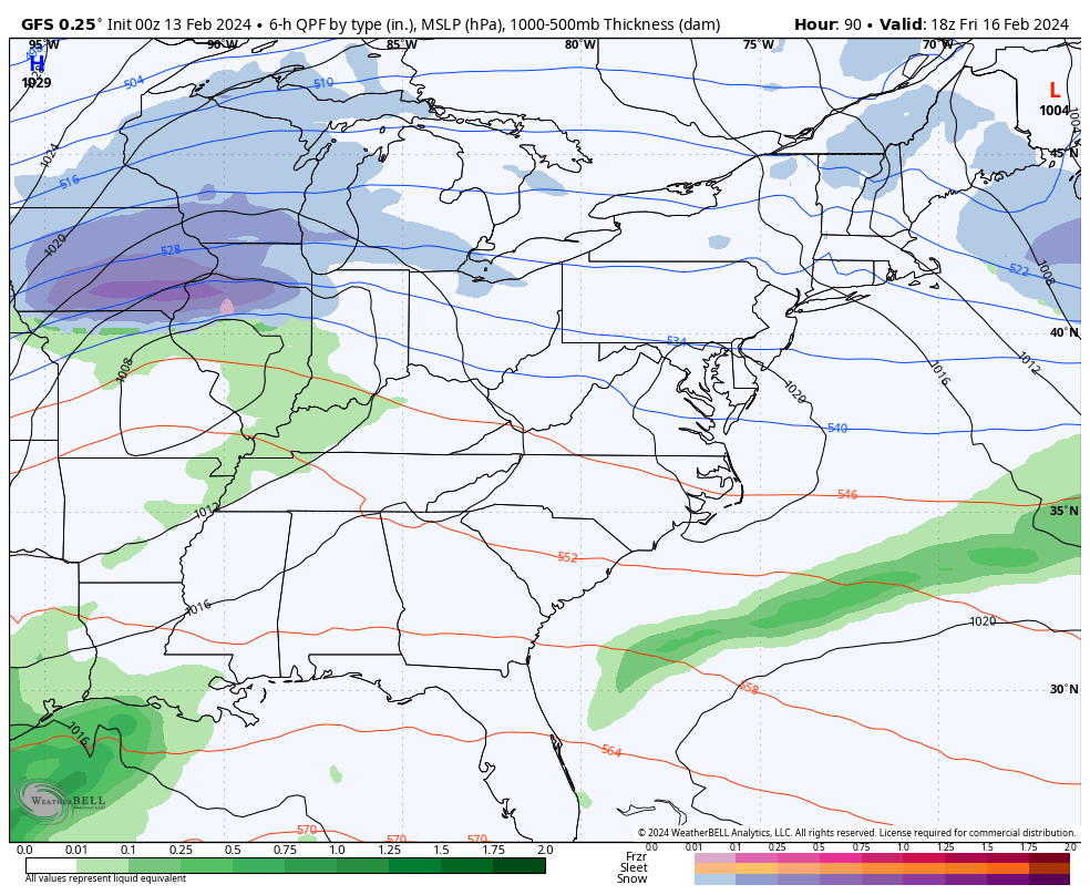
Those barney colors finally show up to give us a nice blast of cold…
I will throw you another update later today. Have a great Tuesday and take care.

I’m sure the armchair Mets will have something to say.
Yeah, I going to stop using my own personal weather model I created in my mother’s basement. It is a complete bust.
In April 1987 (El Nino) a storm system buried most of southeast Kentucky under 1 to 3 feet of snow.
I’ve had just enough of snow tease for the winter. Another winter bust here my of neck of woods, I’m calling it a snow drought that we have endure the last several winters. Were for the flowers to bloom. Teamspring!
Ready for the flowers to bloom that is
Rain was fine. Saturday & Sunday total was .84”. Yesterday dumped 1.23” on our yard, for a three day total of 2.07”.
My PWS near Bowling Green recorded 1.85″ of rain since Noon, and the system cleared central Warren County so quickly that it never switched over to snow. Mid-50 degree temperatures are forecasted for the remainder of the week in South Central Kentucky, and we’re already seeing some early season plants beginning to break through. Seems as though the arctic blast has disappeared from the forecast, which is fine by me.
Nice snow scenes at Jenkins and Pine Mountain on Chris’s weather cams. Thanks Chris, for having the weather cams on your blog. I enjoy viewing the different climates that Kentucky has. Winter lovers have another chance for snow on Friday. I think we still have a ways to go before spring arrives.
On a personal note my hernia surgery with fine and now I’m home recovering.
Have great day everyone !
Glad your surgery went well Schroeder. Got plenty heavy rain yesterday but no snow. Schroeder that’s what I mean Jenkins is just 30 minutes up the road if that they get snow and I don’t strange has to be elevation.
I hope winter is not over and Chris is not the only one who has been showing signs all the way deep into March. I just feel we are in a climate shift and we seem more rain and cool than cold and snow.
Glad that everything went well and your on the mend Schroeder! I agree think we will get a few more decent chances of winter.
Chris, would you mind touching on what happened as far as the artic air (I understand it was just supposed to be cooler, not frigid, but BG is 50’s and 60’s for forseeable future and that isn’t below average) we were supposed to receive starting this week? Just wondering what changed in the atmosphere? I’m not as knowledgeable as many who follow this blog, but after years and years of reading this daily, it is more common for things not to pan our as the models project, and I am curious what is changing! Hope that makes sense!! 🙂 Just trying to educate myself! Thanks for all you do for us daily with the blog!
The groundhog may be onto something