Good Wednesday and Happy Valentine’s Day! Love isn’t the only thing in the air today as we see quite a bit of sunshine filling the skies across the Commonwealth. This nice weather takes us into Thursday before a quick-hitting band of winter weather moves in late Friday, ushering in cold air for the weekend.
Our Valentine’s Day starts with narrow band of rain and snow showers working along the Ohio River from Covington to Ashland. This won’t last long, but the outlined area could have a touch of winter as the day starts. Whatever is there will show up here…

Sunny skies take control quickly with temps this afternoon reaching the 50s.
Thursday finds a weak front crossing the state with temps in the 50s ahead of this boundary and just a slight chance for a shower or some sprinkles.
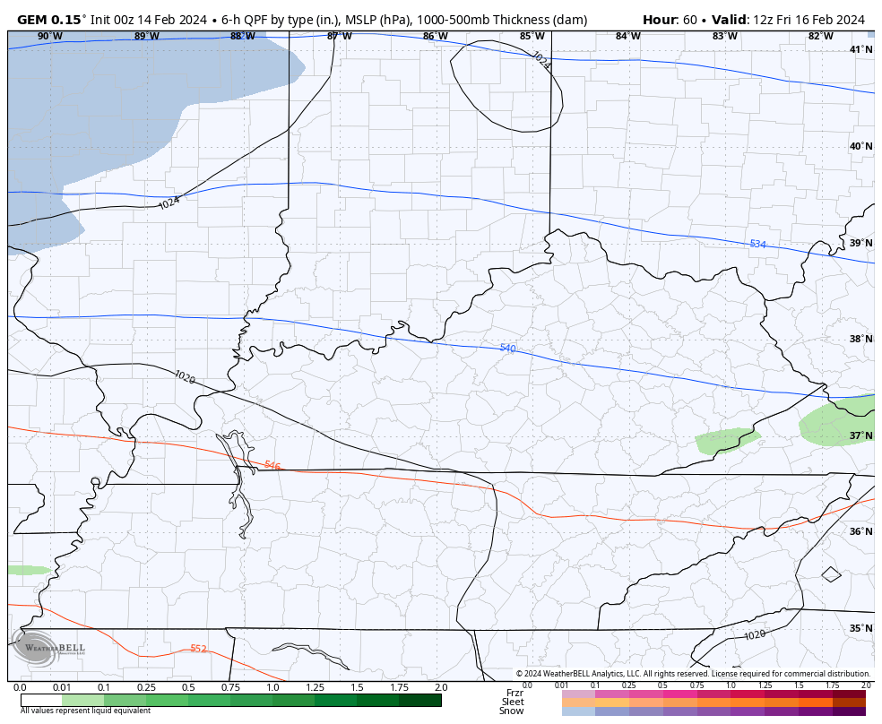
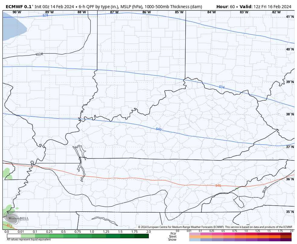
Cold air comes in behind this for Friday as another system approaches from the west. This zips across the Tennessee Valley with rain and snow along and north of it. This looks to bring the threat for accumulating snow to much of Kentucky late Friday into Friday night.
The models are growing more impressive with this system…
CANADIAN
EURO
As expected, the GFS is coming in line with the other models…
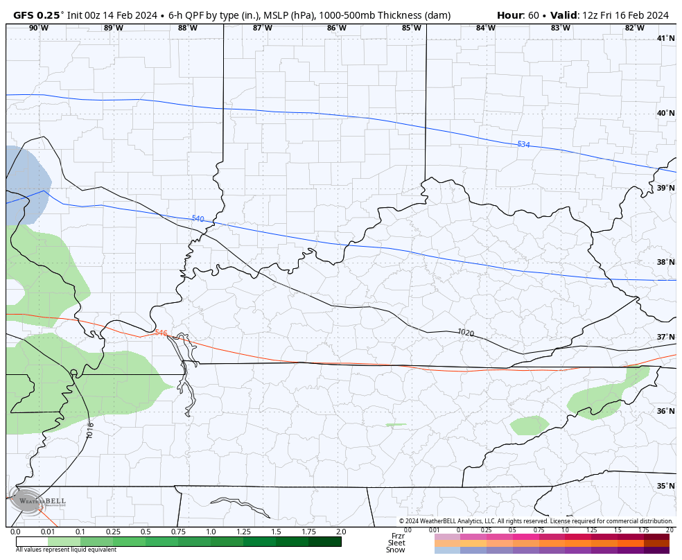
This looks to have a widespread swath of 1″-3″ of snow for much of the state.
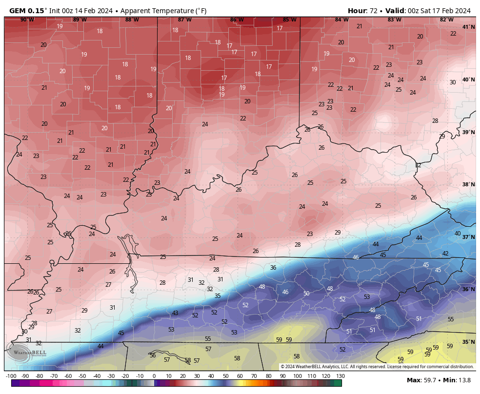
Cold air crashes in behind this giving us the coldest blast since back in January. Wind chills are way down there and may hit the single digits Saturday night. This animation goes from 7pm Friday through 7am Sunday…
That cold shot moves away with a bounce back in temps next week before another possible winter weather maker pushes in by the end of next week. It’s a repetitive pattern right now.
Updates later today so check back. Have a Happy Valentine’s Day and take care.

Thanks Chris. It’s really been tough in forecasting the weather here lately, but that’s okay, it happens. One of these winters were going to have a huge arctic high develop over northwest Canada and a weak Bermuda high that will give us a cold and snowy winter, but the Pacific has to change to positive before that happens.
Happy Valentine’s Day to All !
Heard this same old song before.
Any signs of a longer lasting cold shot?? Love to kill some more bugs!!!!
I still think we will have snow chances maybe all the way into early April.
But I doubt we will see a snowfall that lingers around on the ground for a week.
I am enjoying the wonderful Sun today.
I am seeing pictures online of Crocuses blooming early.
This does grow my mood to start planting season.