Good evening, folks. Our Valentine’s Day has been nothing short of amazing with gorgeous weather that will carry over into Thursday. That leads us closer to the weekend and a shot of winter weather moving in.
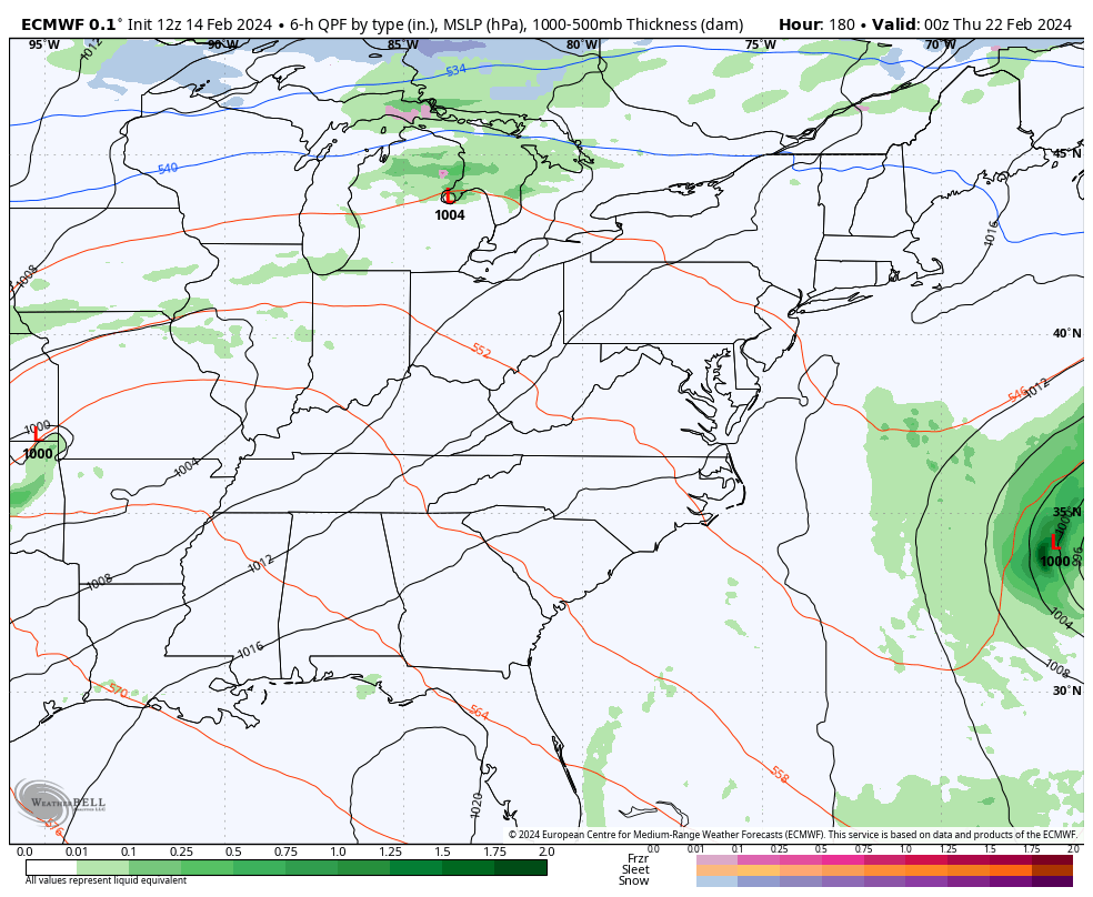
Light snow is likely for much of the state Friday afternoon into Friday night. This may start as a rain/snow mix in the north before going over to a quick-hitting band of light snow that moves from west to east. You can see that zipping through here pretty quickly…

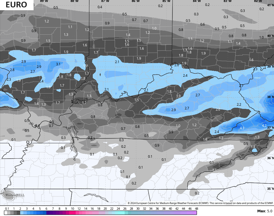
As I said earlier, this has the look of a fairly widespread 1″-3″ snowfall, but the GFS is trying to up that just a touch…

The rest of the models have the 1″-3″ swath with some slight deviations on placement. Here’s the EURO…
The Canadian looks too far north…

The ICON is centered more on the northern half of Kentucky…
![]()
![]()
Unlike the last system, this one will require me to do a First Call For Snowfall and I will have that later tonight or early Thursday.
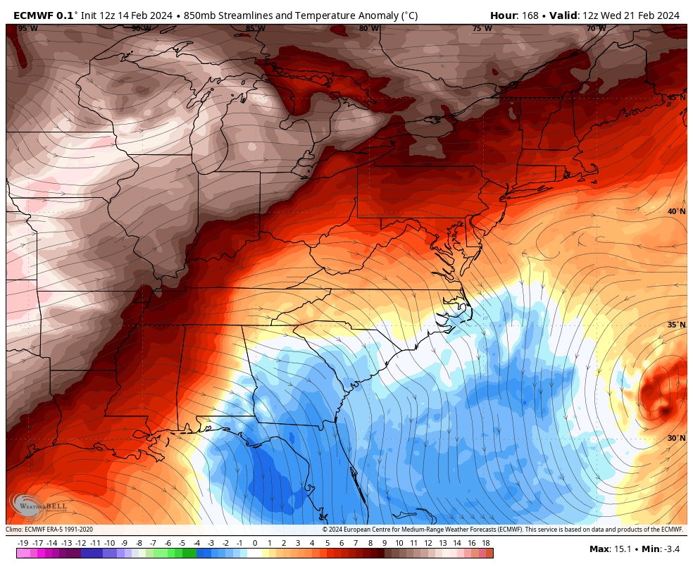
Cold air crashes in behind this on Friday with wind chills dropping into the low teens by Saturday morning. This animation goes from 7pm Friday through 7am Saturday…

Saturday’s actual temps may not get out of the 20s for some with another frigid wind chill through Sunday morning.
Milder winds blow behind that into the first half of next week with highs reaching the 50s for a few days. That will be ahead of another big drop in temps by second half of next week with the models showing the chance for a few more winter weather…
Watch how the temps go from above normal to below normal VERY quickly once again next week…
Enjoy the evening and take care.
