Good Thursday to one and all. We have one more really nice day before we change it up into the start of the weekend. That change includes a quick-hitting light snowfall for much of the state and frigid wind chills.
Temps out there today are in the 50s with gusty winds that may crank to near 30mph at times. There’s also a small chance for a shower going up as a cold front works through the region late this afternoon.
Colder air bleeds into the region into Friday, but it’s nothing out of the ordinary. Highs range from the upper 30s and low 40s with thickening clouds ahead of our blast of snow.
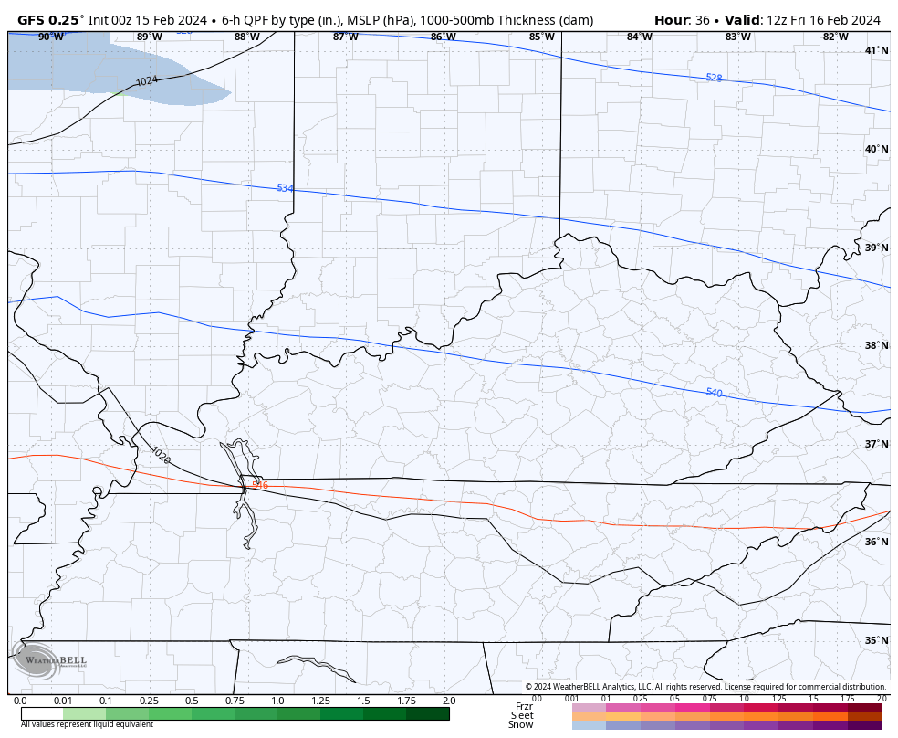
A wave of low pressure develops and rolls across Tennessee late Friday into Friday night. This brings a swath of snow and some rain from west to east across Kentucky from late in the afternoon through the wee hours of Saturday morning. This is a quick-hitting system that is likely to put snow on the ground for most of the state…
Here’s what may end up being a conservative First Call For Snowfall…
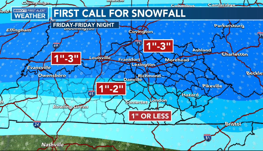
I will update that a few more times today.
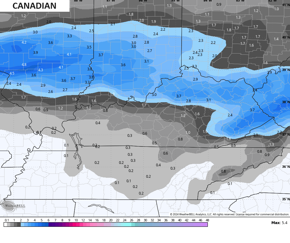
Some of the forecast models have been trying to ramp up a band of heavier snow within this overall light snow setup. The GFS and EURO are both showing this possibility…
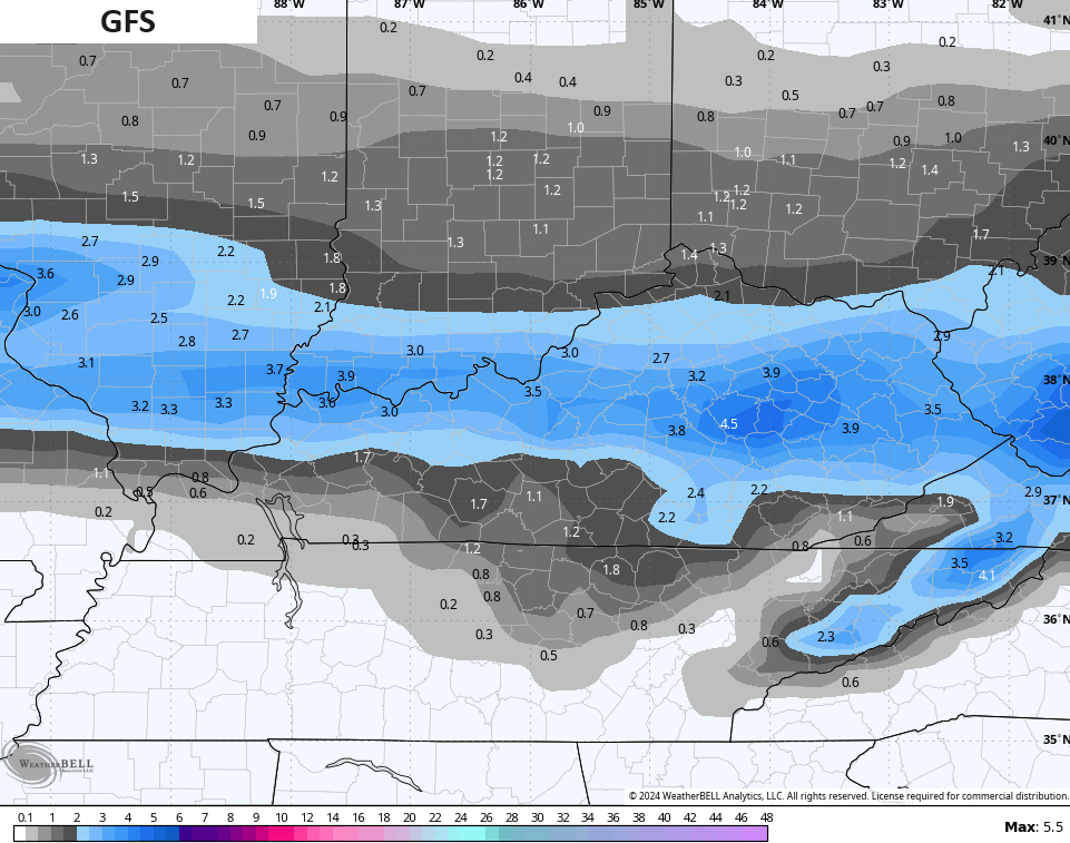
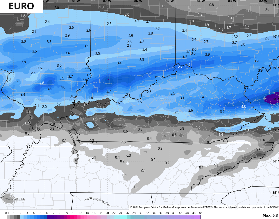
Both of those models are now spitting out some 4″+ amounts and the Canadian is getting close to those numbers…
Much colder air moves in from the northwest behind this system and this will push wind chills into the low and middle teens by Saturday morning…
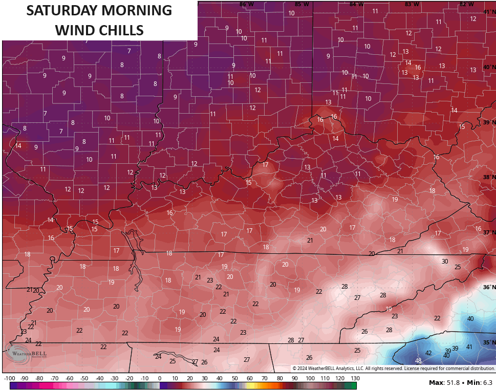
Highs on Saturday generally range from the upper 20s to low 30s with wind chills well below those numbers.
Temps look to bounce back early next week and that continues until another storm system moves in here during the second half of the week. That should unlock another round of much colder than normal temps and may also bring another winter weather threat.
I will two more updates today so check back. Have a good Thursday and take care.

I have been mainly watching festive flakes fall this winter
So I am not going to get overly excited until the event begins.
Thanks Chris. We shall see how this system plays out this time around. Hoping the forecast pans out, and those that have not had any snow on the ground this winter, will at least receive a few inches early Saturday morning.
These weather patterns we have had the past five years, I’ve not seen before. This has been the strangest El Nino year, and I’m hoping for a quiet severe weather season this spring. Not looking forward to the return of ENSO / La Nina next fall and winter. We have even less chances of snow with this phase of ENSO.
Have a great day !
Think about what you said though…..If this EL NINO is different than any you’ve ever seen… what makes you so sure that the next ENSO/ La Nina will be like every other one?
Mark, This El Nino occured in a negative Pacific Decadal Oscillation ( PDO. ) I have never seen that happen before since I’ve been studying meteorology. Is the only reason I can give for the very modest snow impact in our area of the country. El Nino’s typically form in a positive PDO like 2014 to 2015, had a huge impact with snow / cold in our area those years.
This La Nina predicted for next fall and winter will be entering in a negative PDO, which would shift the action well to the north. It can get frigid cold with very little moisture for snow here in the southeast. Just like the last one we had, but as they say ( NOAA ) ” there are no two La Nina alike ” I beg to differ on that.
I have question wonder why it’s hard to get our moisture with the cold temps 32 or under it seems like most of the time they miss each other. Or by the time they get together it’s too late for much snow at all?
Crystal, The polar jet and the subtropical jet streams never came together this winter because this El Nino was not reacting to the atmosphere like it was forecast to. I can’t believe that NOAA didn’t see this, and take it in account when making this prediction. However, NOAA wasn’t predicting much of a winter for our area anyway.