Good morning, everyone. I’m not going to lie, today’s weather has me fully on board with #TeamSpring, but #TeamSnow is trying to lure me back into the fold with a Friday blast of winter. This looks to put snow on the ground for much of the region.
A few quick thoughts:
- Light rain and light snow develop across western Kentucky Friday afternoon.
- This rolls east during the afternoon and evening with snow becoming the predominant precipitation type.
- It’s going to snow pretty good for a while Friday evening with slick roads becoming likely.
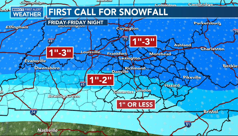
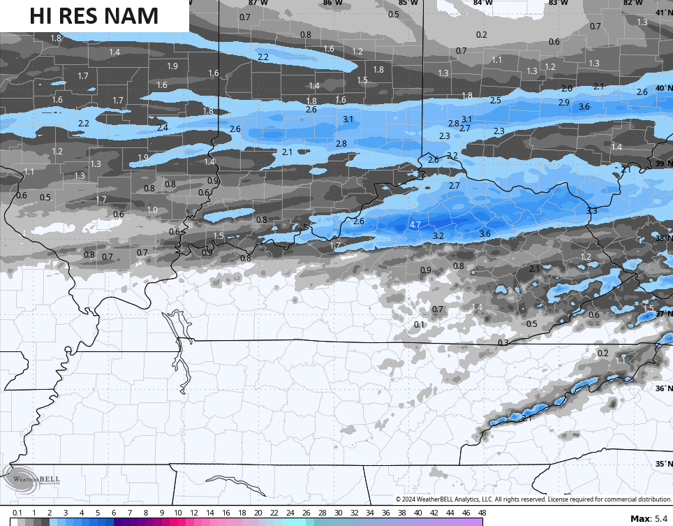
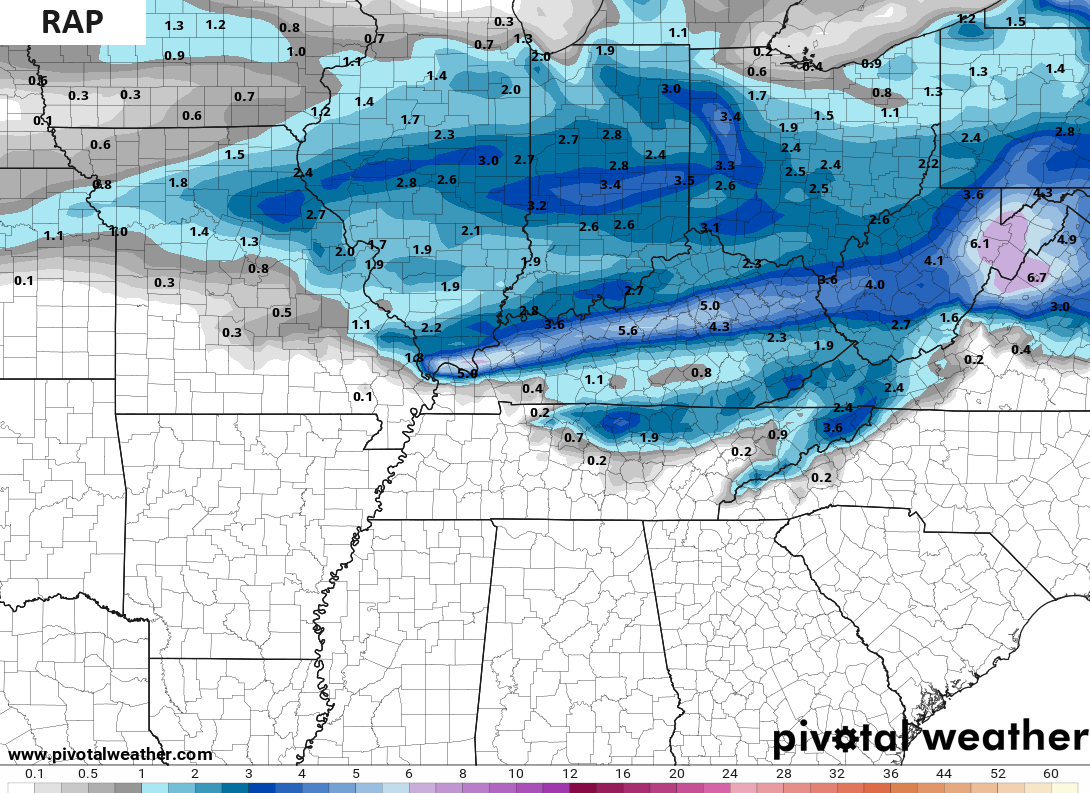
- A general 1″-3″ will be likely for many, with lower amounts in the far south because the mix hangs on much longer here.
- There’s the chance for a spot or two to wind up closer to 4″.
- Cold air crashes in behind this system with wind chills close to 10 by Saturday morning.
- Highs on Saturday won’t get above freezing for many with flurries and early morning snow showers ending.
Nothing I’ve seen has changed my mind on the light snowfall…
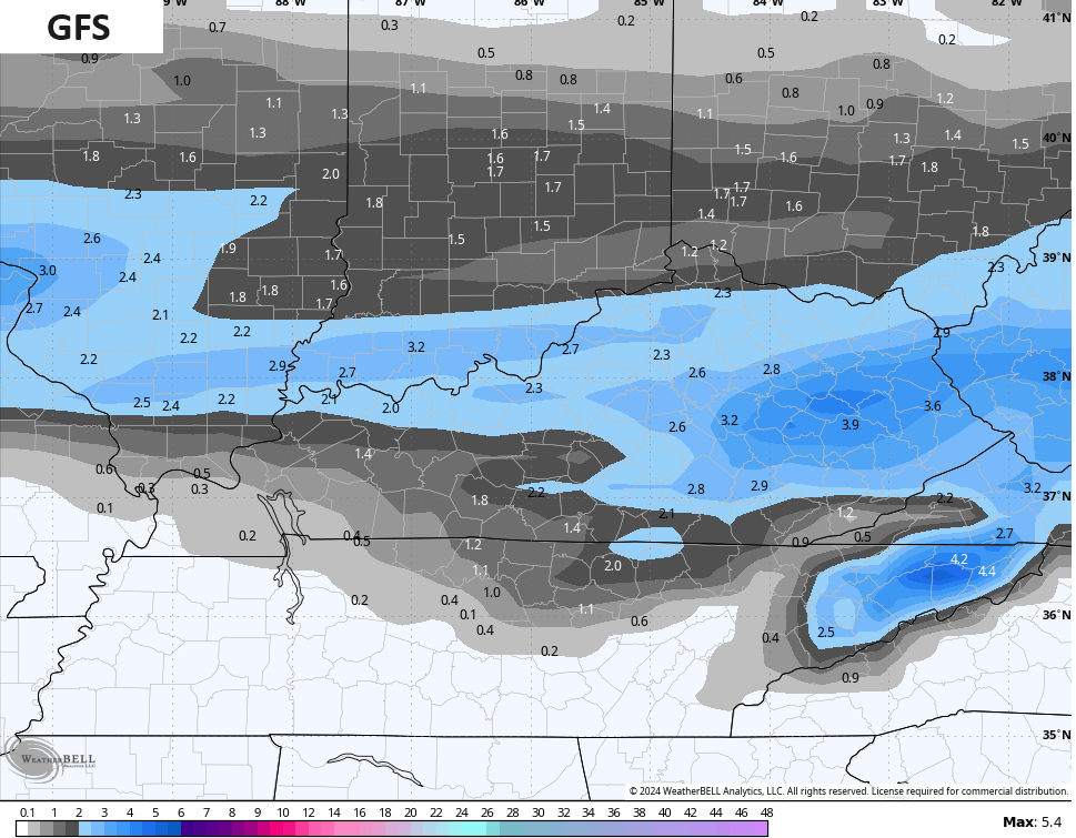
The forecast models all have the 1″-3″ swath with the usual deviations. The GFS has also had some amounts going above the 4″ mark, but the latest run settled down a bit…
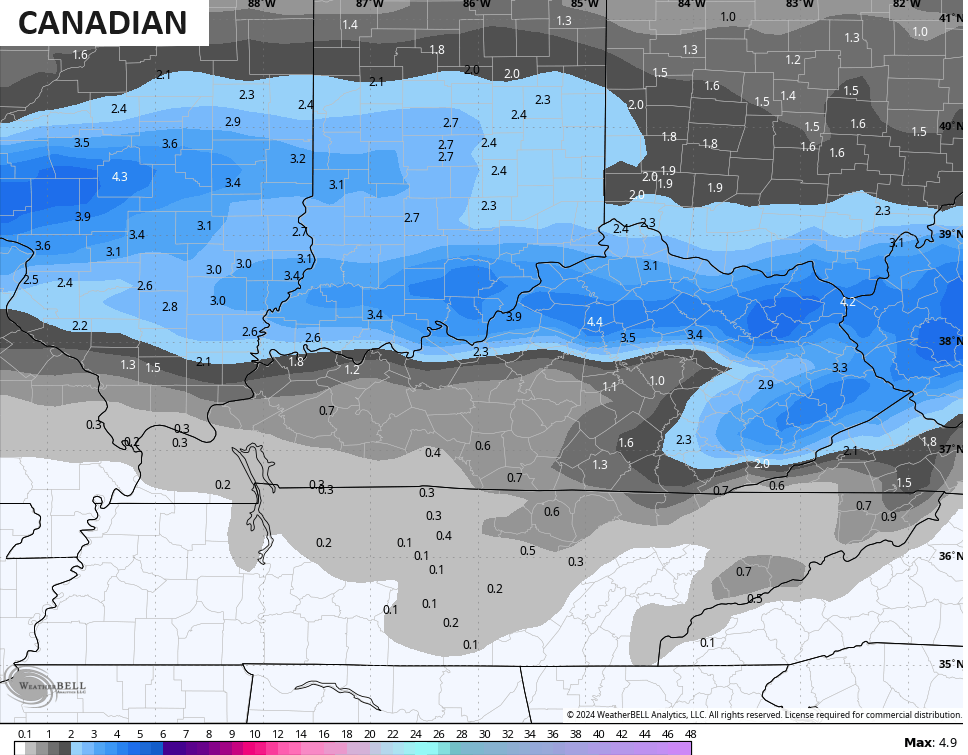
The Canadian has some 4″ amounts…
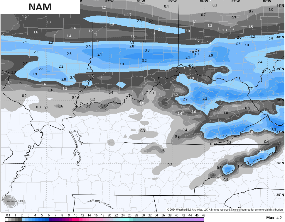
The NAM fam is a little choppy with this system…
The RAP has a narrow band of heavier snows showing up…
I will have another update or two here on KWC later today. I will also have the latest on WKYT-TV starting at 4pm. Enjoy the afternoon and take care.

Thanks Chris. An ever changing forecast. Here’s what’s predicted for Maple by the Ventusky in the way of snow accumulation for Friday:
https://www.ventusky.com/37.464;-85.502