Good evening, everyone. It’s full steam ahead toward a blast of winter weather coming in late Friday and Friday night. Not much has changed with the overall forecast with just minor adjustments to the snowfall map.
Much of the daytime on Friday is dry with some late day rain and snow developing in the west and getting into central Kentucky. The period of light snow takes over during the evening with southern Kentucky having a lower chance for accumulating snow than everyone else as the rain lingers longer there.
Here’s the Updated Call For Snowfall…
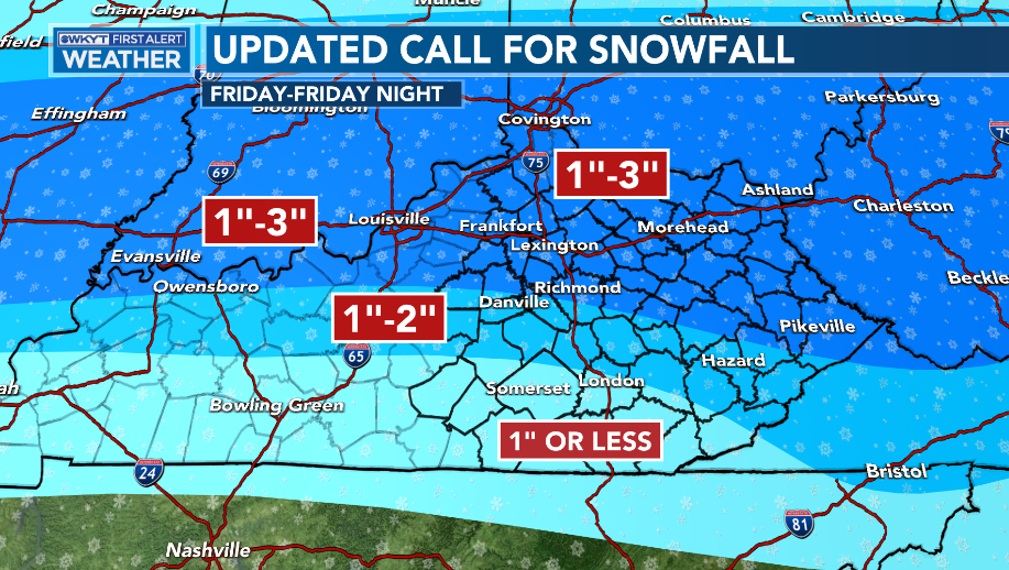
Again, just some very small changes to that since the First Call map.
It’s not a lot of snow, but it should slicken up some roads during the mid to late evening hours.
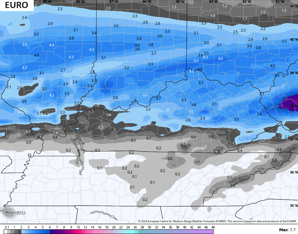
The forecast models are still in pretty good agreement with the EURO having the highest totals…
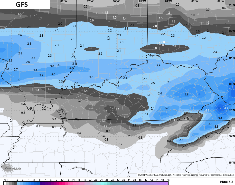
The GFS is a little more in line with what I’m thinking but may be too optimistic in the far south and southeast…
The Short Range Canadian…
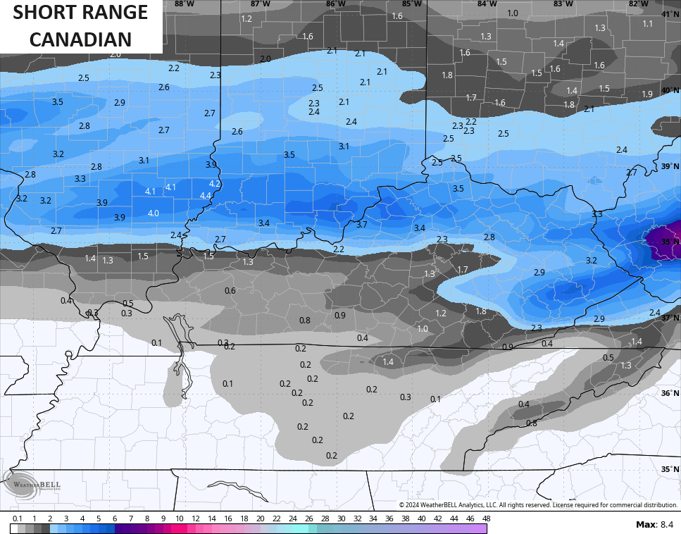
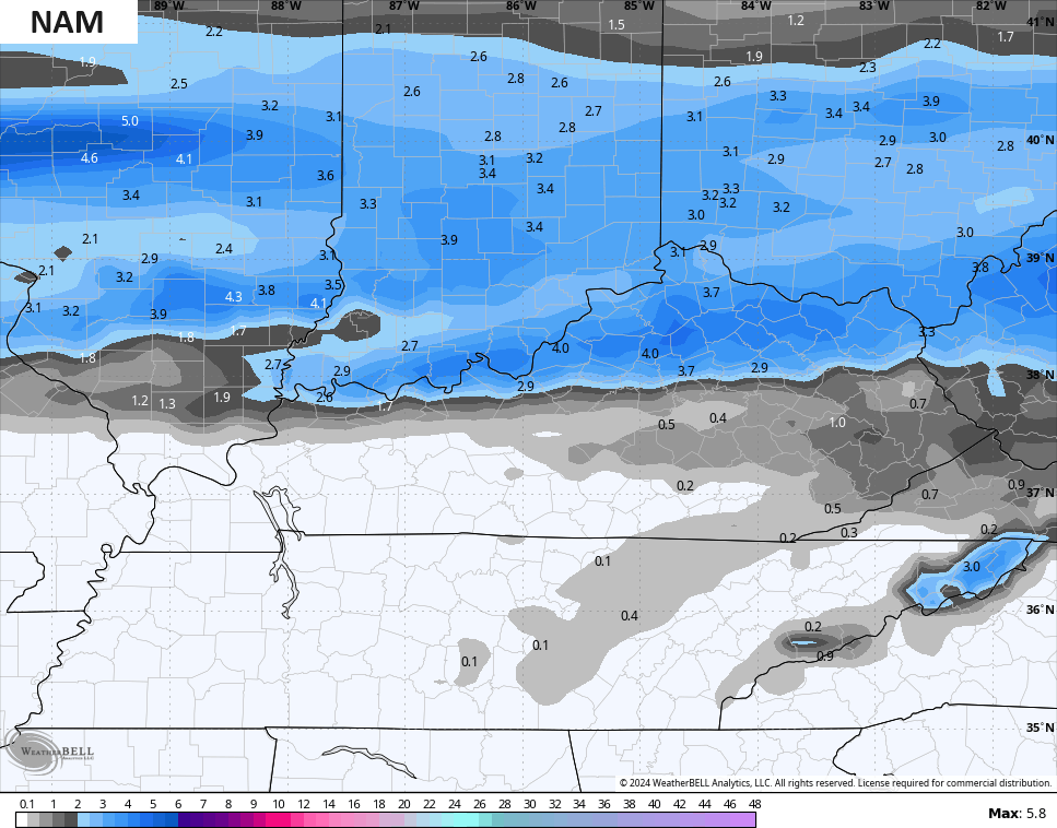
The NAM shows a super duper sharp cutoff to the accumulating snows…
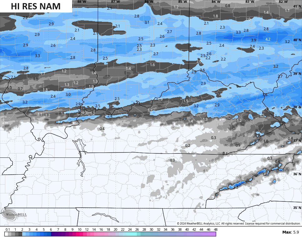
So does the Hi Res NAM…
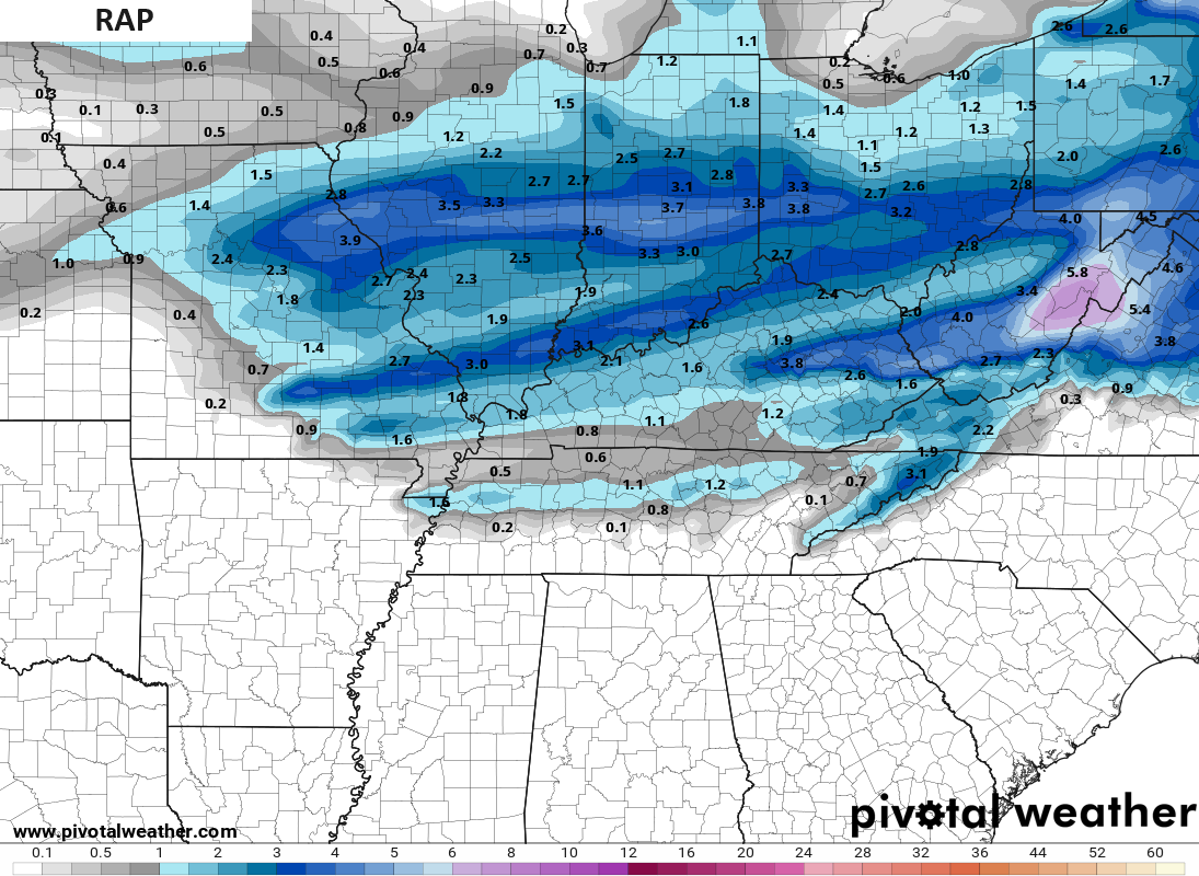
The RAP has a couple of enhanced snow streaks…
Overall, you can clearly see I’m not as snowy as the models show , but you can see how the southern parts of the state will struggle to see much sticking snow.
Frigid wind chills come in behind this with the numbers by Saturday morning down to around 10 degrees at times. Wind chills may not get out of the teens for some on Saturday. This wind chill animation goes from 7am through 7pm Saturday…
Single digit wind chills then try and show up Saturday night and Sunday morning…
I will have an updated forecast on WKYT News on the CW Lexington coming up at 10pm and on WKYT TV at 11.
Enjoy the evening and take care.
