Good evening, folks. We’re putting the wraps on a very windy and mild day across Kentucky as some thunderstorms rumble in for Thursday. That’s followed by a quick shot of winter to start the weekend before another surge of spring rolls in.
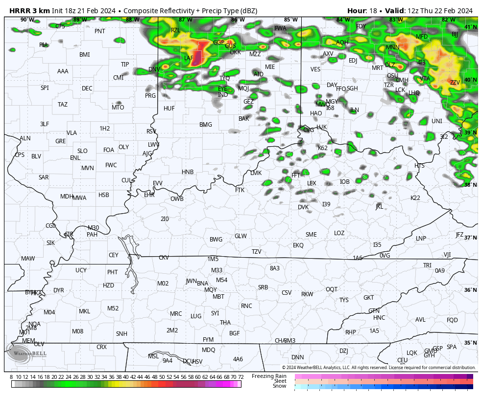
A shower or storm will be possible early Thursday before a few lines of showers and storms rumble across the state during the afternoon and evening. These show up well on the HRRR Future Radar…
Friday’s weather looks pretty good with a mix of sun and clouds and winds coming down some.
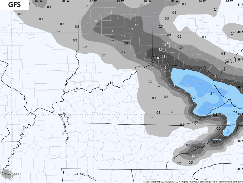
Another system drops in from the northwest with a period of light rain and light snow late Friday night into the first part of Saturday.
The GFS really likes a stripe of light snow with this…
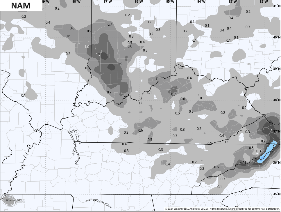
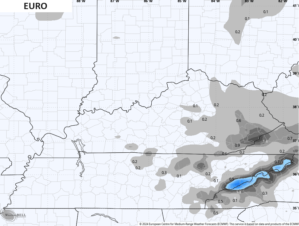
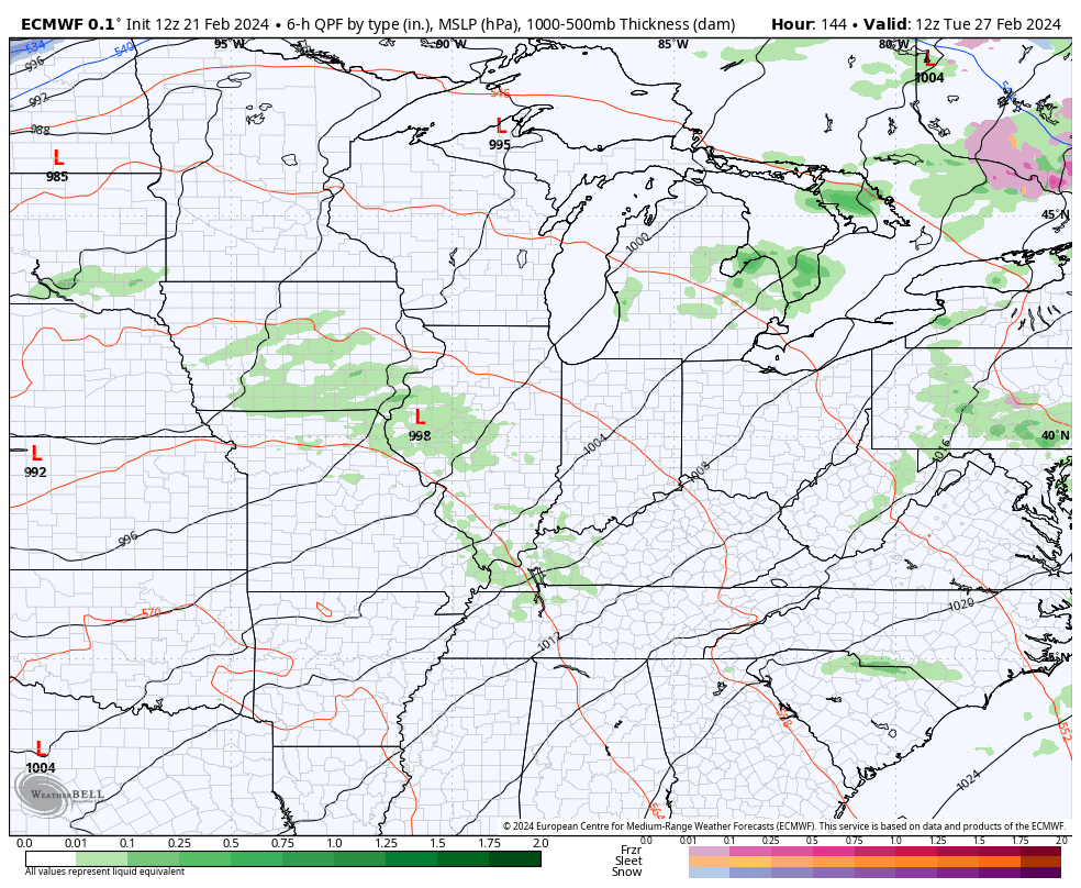
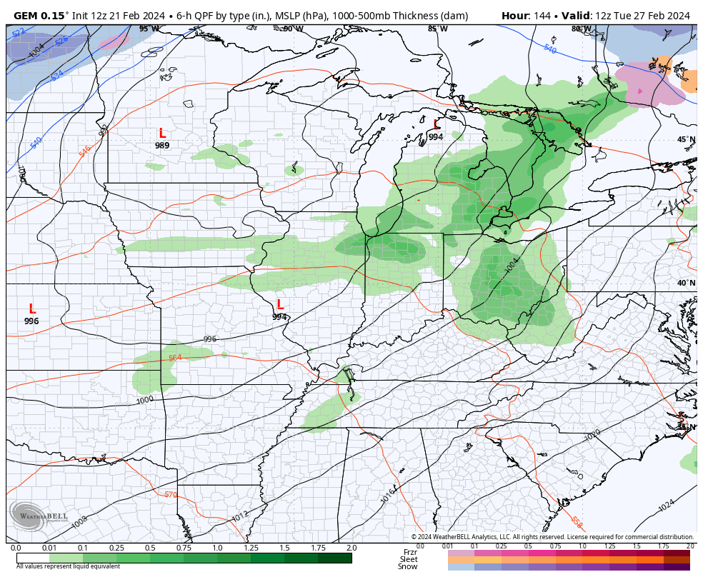
Other models aren’t as enthusiastic…
Regardless, it’s a brief taste of winter as milder winds kick right back in for Sunday. That wind boosts temps back into the 60s by Monday and those numbers take us through Wednesday ahead of a strong system that may bring strong storms into the region. Cold air and a touch of winter crashes in behind it…
EURO
CANADIAN
Enjoy the rest of the day and take care.
