Good Saturday, everybody. Some of us are getting in on a small taste of winter weather today, but the overall pattern continues to be strongly skewed toward spring. A major surge of mild temps roars in early next week, bringing the chance for strong to severe thunderstorms.
A quick-hitting area of light rain and light snow shows up today across central and eastern Kentucky. This comes as a weak low drops in from northwest to southeast and has the chance to put a touch of slush down in the north and east. If that happens, it won’t last very long as temps stay above freezing all day.
Here are your radars to follow this light system…

Temps today stay in the mid and upper 30s for the eastern half of the state with low and mid 40s in the west. Gusty winds make these numbers feel much colder, so keep that in mind.
After a frigid start to Sunday, milder winds kick in by the afternoon as temps reach the 50s with a mix of sun and clouds. There’s still the small chance for a stray shower to go up late in the day.
Southwest winds really crank early next week as highs surge deep into the 60s and may hit 70 for some. This southwesterly flow is ahead of a potent storm system coming from the Plains states toward the Great Lakes. This has a nice push of cold air coming in behind it, setting up a clash of the seasons along a cold front. This front brings rounds of showers and strong to severe storms ahead of it, and the potential for a quick-hitting band of light snow behind it as temps crash on Thursday.
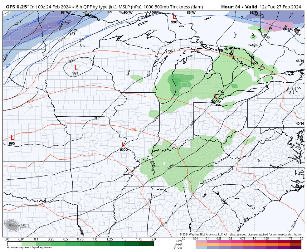
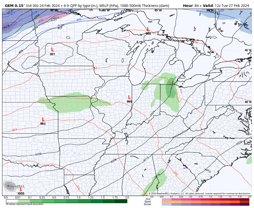
Here’s how the models are seeing it…
GFS
CANADIAN
Here’s the Severe Weather Outlook from the Storm Prediction Center for Tuesday…

Here’s the risk area for Wednesday…

I will have another update later today. Enjoy your Saturday and take care.

Thanks for the update Chris. I’m hoping these frequent late season cold spells stay moderate, and not severely cold to end the flowering season of certain ornamental plants. Not to concerned about the severe weather just yet, but I will not let my guard down until after July first.
Here’s the ENSO outlook for this spring and summer: April – June, El Nino ends and Neutral begins. June – August, Neutral ends and La Nina begins. At this time, there is a one out of four chances that La Nina will not form for next fall and winter, but there is a Sixty percent chance it will. If it does form, I’m hoping for a weak La Nina as this could bring us a better chance for snows next winter, but those are my findings on PDO readings in past years.
Very concerned about the tropical storm season ahead, so I hope we can obtain accuracy in the potential.
Enjoy your Saturday !
The jetstream forecast for Wednesday shows a very strong southwest to northeast flow setting up over Western Kentucky, at the same time as a strong cold front enters our region. This is concerning, as it will increase the chances for storm rotation, shear, and supercell development, especially in western and south central Kentucky.
Joe, I just looked at the jet stream map and your right it does show a potentially dangerous storm for Wednesday. We will have to hope that the factors that produce tornado outbreaks don’t happen. Here’s the link to the jet stream map :
https://weatherstreet.com/models/gfs-jetstream-wind-forecast.php
Chicago and much of IL will be on the alert for possible severe weather on Tuesday.
Here’s the Convective available potential energy ( CAPE ) on the Ventusky and the highest reading I can find is 300 J /kg for Wednesday. When the CAPE is above 1000, I get concerned :
https://www.ventusky.com/?p=38;-58;2&l=cape&t=20240303/2100
After high temperatures in the 60s on Wednesday and Thursday and 50s on Friday, a cold front went through the area later in the day Friday and produced a burst of snow in the evening, giving the Chicago area its largest snowfall this month. O’Hare Airport received 1.2 inches, and the NWS Forecast Office in the SW Suburbs received 0.7 inches. It was the first measurable snow here in five weeks.
It was a nice surprise to see, but the snow will melt quickly with the warm temps on the way.
Snowstorm forecast for my area of Kentucky have all been inaccurate this winter, But when severe weather is forecast in my area we get it. Also ice storm forecast are usually predictable. Just can’t receive that beautiful ‘white stuff ‘ anymore.
It’s not very often that you see the the Storm Prediction Center highlight an area of concern on their “4 to 8 Day Outlook” map, the way that our region is highlighted on Day 5. As time progresses, and we get into the 3 day, Tomorrow and current day map, those yellow shaded areas almost always end up as Slight or Enhanced Risk.
If dewpoints rise into the 60° to 65° range as expected on Wednesday, I believe the CAPE values will increase to 1500 or higher. Hopefully not!
https://www.spc.noaa.gov/products/exper/day4-8/
Thanks for sharing that information. I just hope we are warned of severe weather / tornadoes in time to save lives, but I understand that the predictability of tornadoes is next to impossible.