Good Sunday, everyone. Springtime temps are surging back into the region today and will kick into high gear over the next few days ahead of a potent storm system. This rumbles in with the chance for strong to severe storms and a quick-hitting shot of winter behind it.
Temps today hit the 50s across eastern Kentucky with the 60s into the west. Skies will be partly sunny with just the smallest chance for a shower.
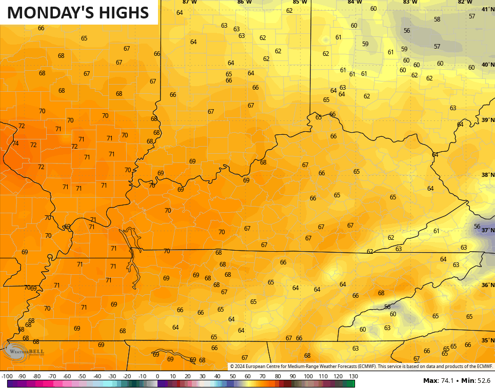
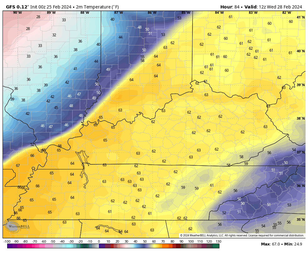
Monday finds a real deal spring feel settling in with highs deep into the 60s and some low 70s in the west…
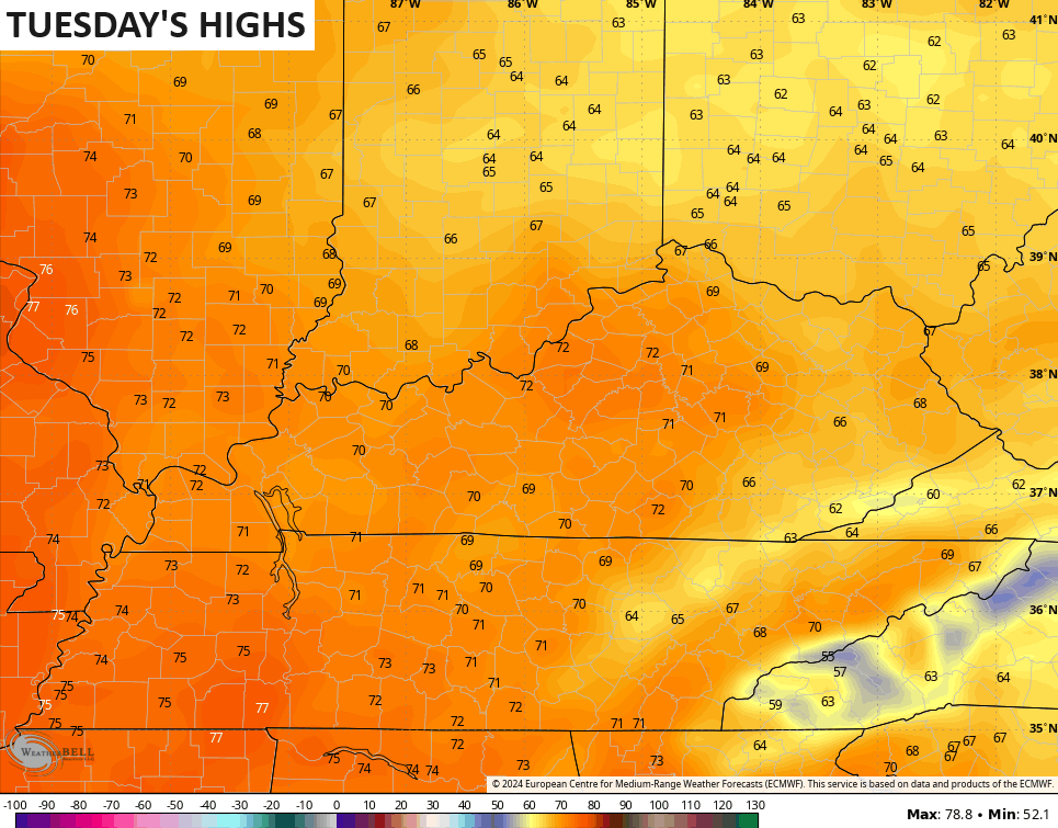
Tuesday can hit 70-75 degrees in many areas if storms aren’t terribly widespread. As is, the models are spitting out the 70s…
Gusty southwest winds will be cranking during this time and will top 30mph.
As mentioned, a few thunderstorms will likely flare up on Tuesday and those could be strong across the entire region, but the Storm Prediction Center has the best chance for severe storms in western Kentucky…

As the cold front moves in on Wednesday, the threat for severe thunderstorms will increase for the rest of the state…

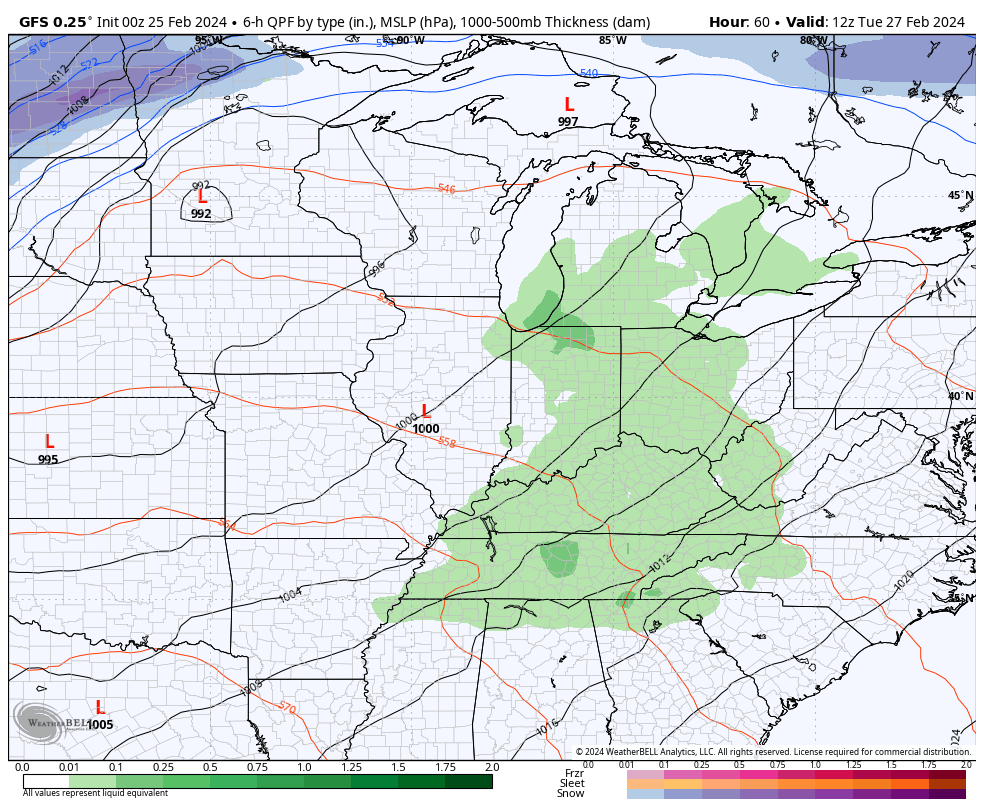
The latest GFS goes from strong storms to snow very quickly on Wednesday…
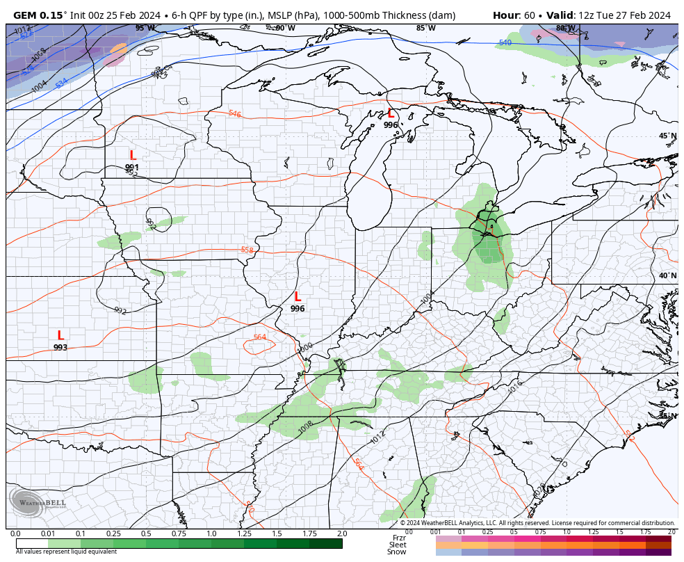
The Canadian isn’t as fast but has some wraparound snow showers…
The temp drop with behind this front is pretty amazing. This animation goes from 7am Wednesday to 7am Thursday…
The headlines of this system:
- Strong to severe storms are possible late Tuesday into Wednesday.
- Wind gusts of 40mph or higher will be possible with or without storms.
- Rainfall of 1″-2″ will be a good bet.
- Temps drop some 30 degrees in just a few hours.
- The chance for some light snow or snow showers is there behind the front.
Temps rebound quickly by Friday into next weekend with the chance for a southern system to produce some light rain. Another massive storm system looks to follow that up the following week.
I’ll have another update so check back later. Have a great Sunday and take care.

Thanks for the update Chris. When we get past Wednesday, I will be relieved from the severe weather threat for Wednesday. Not looking forward to the up and down temperatures and wind that comes in March anymore. Be glad when July gets here.
Enjoy your Sunday.
A big factor regarding the intensity of severe weather on Wednesday is the speed of the cold front. A fast moving front would make it more supercells, and the front could push through before the maximum jet stream flow sets up over western Kentucky. The only downside would be that a faster moving front increases the odds for straight-line winds. I continue to believe that this will be an above normal severe weather season.
I think it may be too, but I hope not, we need to have a great spring and summer after a very disappointing winter.