Good Monday, everyone. Very mild air continues to surge into the region today and brings showers and storms along for the ride, and some of the storms may be strong. This is ahead of a powerful cold front moving across the state with a MAJOR temp crash on Wednesday.
Let’s start with today and roll ahead.
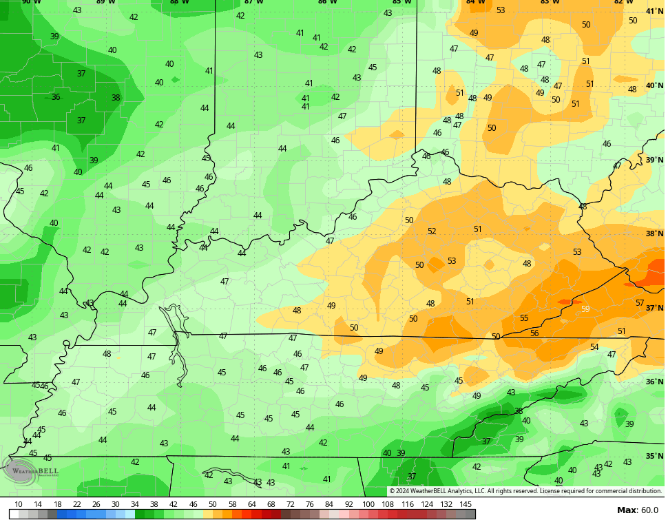
Temps surge into the 60s with a 70 possible depending on where you are. Winds will be gusty from the southwest and may hit 30-35mph at times, especially late.
Scattered showers and a few thunderstorms will be around and may increase as we head into the evening and overnight.
Here are your radars to follow any storms out there today…

Scattered showers and storms continue on Tuesday with VERY gusty winds that can top 40mph at times. Highs range from the middle 60s to lower 70s.
As the cold front approaches Tuesday night and early Wednesday, a line of showers and strong storms will develop to our west and race across the state.
The greatest risk for severe thunderstorms is to our west, but a lower end severe storms risk gets into areas of western and central Kentucky late Tuesday and Tuesday night. Here’s the Severe Weather Outlook from the Storm Prediction Center…

Here are the individual severe weather risks for this same time period…


With the faster arriving front, the severe threat on Wednesday is greatly diminished…

Wind gusts through Wednesday are way up there on many of the models with some peaking at 50mph or better…
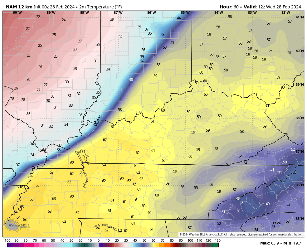
With the faster arriving front, this thing is going to do a number on your Wednesday temps. A 30 degree temp drop is likely in just a few hours once the front sweeps through. This temp animation from the NAM goes from 7am through 7pm Wednesday. Watch how fast the 30s replace the 60s…
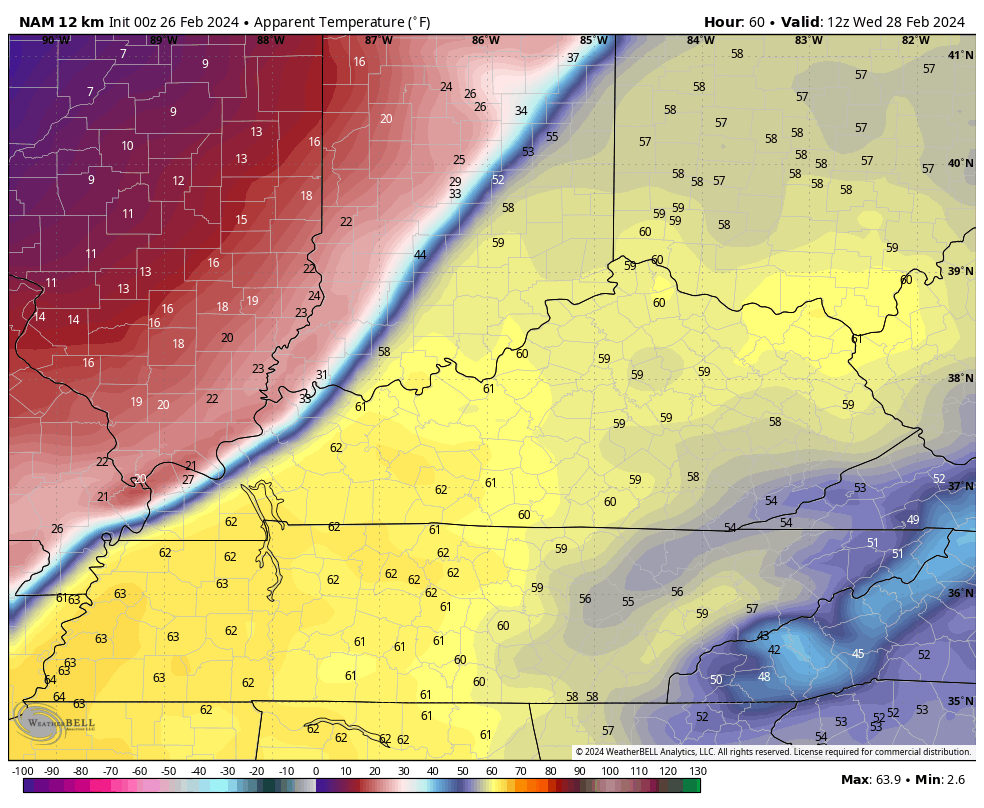
That’s pretty incredible, but the wind chill numbers are even crazier. Check out the wind chill numbers for the same time period…
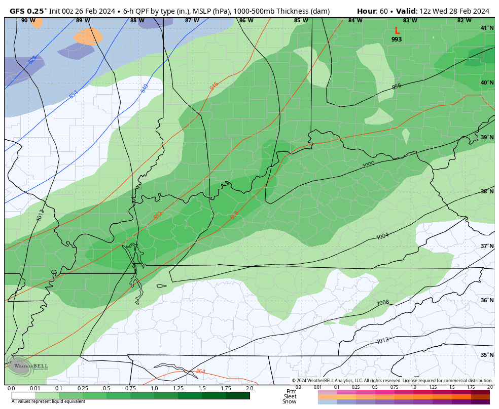
Can we get a brief period of sleet and some snow as the cold crashes in? That’s possible…
I’ll have another update later today so check back. Have a good one and take care.

Thanks Chris wow 50 mph winds are possible. Everyone baton down the hatches and hold on. The temperature drop is something else too. Our new normal.
Thanks Chris. A 30 degree drop in temperatures is very incredible. Glad the severe weather threat for Wednesday has diminished some, but I wouldn’t let my guard down. May be a tremendous amount of wind as the cold front comes through.
Enjoy your Monday everyone !
Looks like the main threat is to our north, but like Schroeder said can’t let our guard down.. .Have a Bless Day!!
Main threat Tuesday night into Wednesday will be strong winds, which could gust to 40 mph in South Central Kentucky. Meanwhile, the “Team Spring” recruitment bus has pulled into my BG neighborhood, where the current temperature is 62°F, with an expected high of 75°F!
I’m trying to understand what’s so unprecedented….we’ve always had strong fronts come through… gusty winds surging temps only for the front to come through and crash temps big time.. that’s happened lots of times since I’ve lived here.
What a bust of a winter. Bring on the sunny 70s!
I know you guys are getting tired of me going down memory lane, but I must share this one. Back in April 1975 the temperature dropped from 85 degrees down to 18 degrees in 24 hours plus we had a blizzard and a snow accumulation of 4 inches. I lost all my plants that year. This weather coming up is nothing compared to that, but it is quite a drop in temperature. Could be worse is what I’m saying.
Wow Schroeder that is a big drop.
I’m still more surprised at our wimpy snow totals. Was expecting more snow than we got, based on the “nowhere to go, but up” premise. We did get more than last winter, but still very wimpy. Looks like another streak of no big snow winters, since our three record snows, about a decade ago.
Meh
Temperatures this afternoon are already in the low 60s in the Chicago Metro Area, under sunny skies and breezy conditions. The record high for today is 64 degrees set 24 years ago, and that will easily be broken. Tomorrow, forecast highs are expected to reach the low-to-mid 70s, which would threaten the all-time high temp for Chicago in February of 75 degrees set in 1976!
Most of IL is in the slight risk area for severe weather for Tuesday and Tuesday night. It will be interesting to see if the ingredients can all mix together to produce a severe weather outbreak before the cold comes crashing in Wednesday.
Next winter if we phase into a weak La Nina we may break the snow drought ? Example : winter of 1917 – 18 was the snowiest winter to date in Illinois, Indiana and Kentucky. That year featured a strong negative AO and NAO that started in December and stayed negative for four months ( D J F M . )