Good evening, folks. A serious case of spring fever is breaking out across the region as spring surges in ahead of a potent storm system. This system blows in, literally, with high winds, strong storms and a major temp crash.
Ahead of all this comes the low-end risk for a few severe storms later this evening and tonight across parts of central and northern Kentucky…

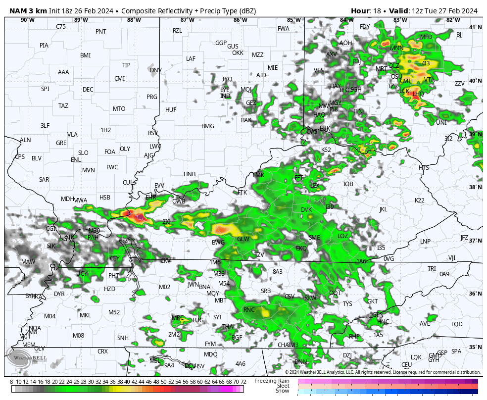
Large hail is the primary threat. Here are your radars to follow along…

A few quick headlines on the next few days:
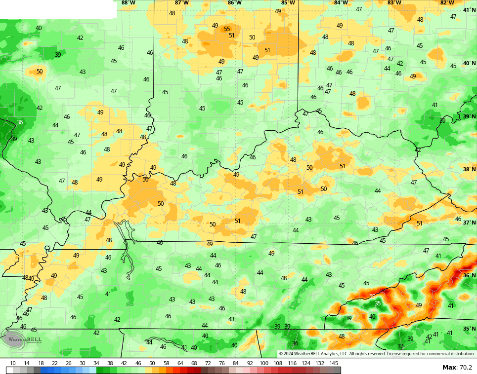
- Temps make a run toward 70 again Tuesday.
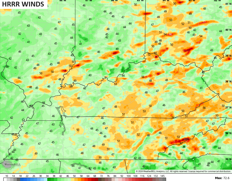
- Gusty winds will reach 40mph or greater Tuesday into early Wednesday.
- Scattered strong storms will be noted on Tuesday.
- The cold front pushes through early Wednesday with a squall line of strong storms.
- Temps start the day in the 60s and drop into the 30s a few hours later.
- There’s even the chance for a touch of sleet or snow with this temp drop.
The future radar from the Hi Res NAM shows the Tuesday scattered storms and the Wednesday squall line…
High winds are a problem over the next few days with a Wind Advisory out for most of our region. Some of the models continue to show 50mph gusts…
Here’s the Severe Weather Outlook from the Storm Prediction Center…

Here are the individual severe weather risks for this same time period…


With the faster arriving front, the severe threat on Wednesday is greatly diminished…

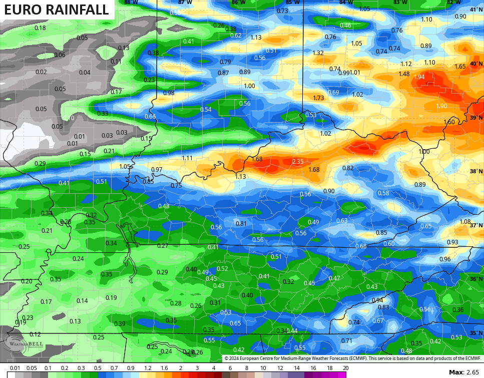
A stripe or two of 1″-2″ rains may show up across central and eastern Kentucky…
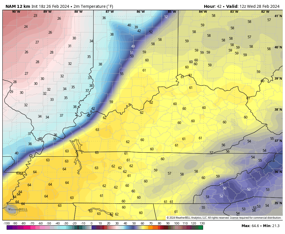
The temp crash is pretty eye opening. Watch the numbers from 7am Wednesday through 7am Thursday…
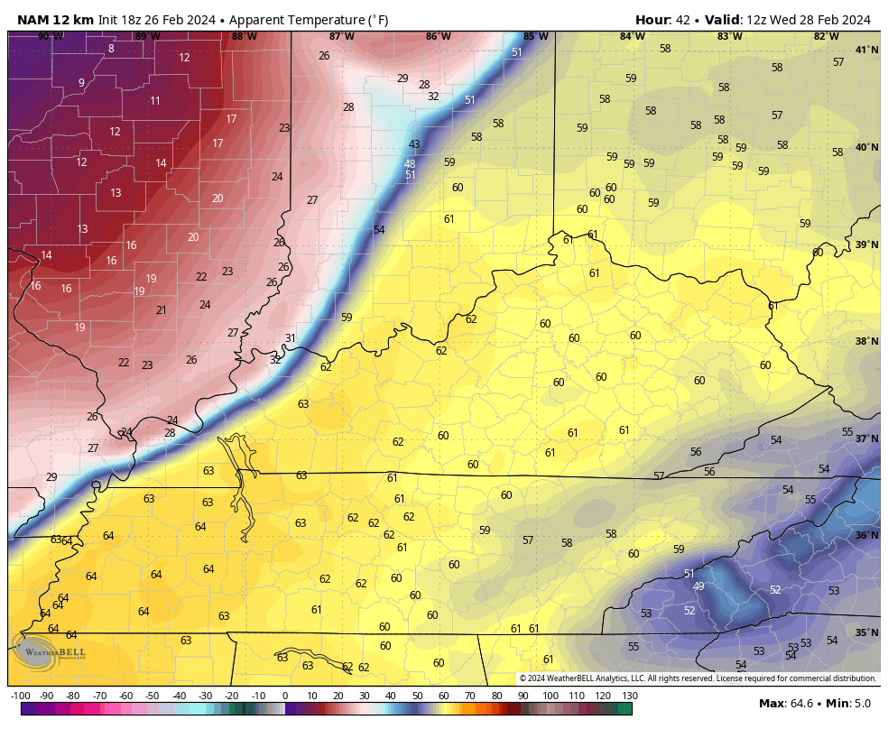
Wind chills are even more eye-opening…
Enjoy the evening and take care.

Here in Bowling Green we hit a high of 77°F, and temperatures are expected to stay in the low 60’s this evening. There is no severe weather threat for Warren County, aside from an advisory for wind gusts that could reach 40 mph.
Yeah, it is still 70 at my home in Louisville.