Good afternoon, I wanted to drop by for a quick update on the increasing threat for severe weather this afternoon through tonight as a powerful cold front sweeps into the Bluegrass state from the west.
The Storm Prediction Center has upgraded areas along the Ohio River and just south to an Enhanced Risk for severe thunderstorms…

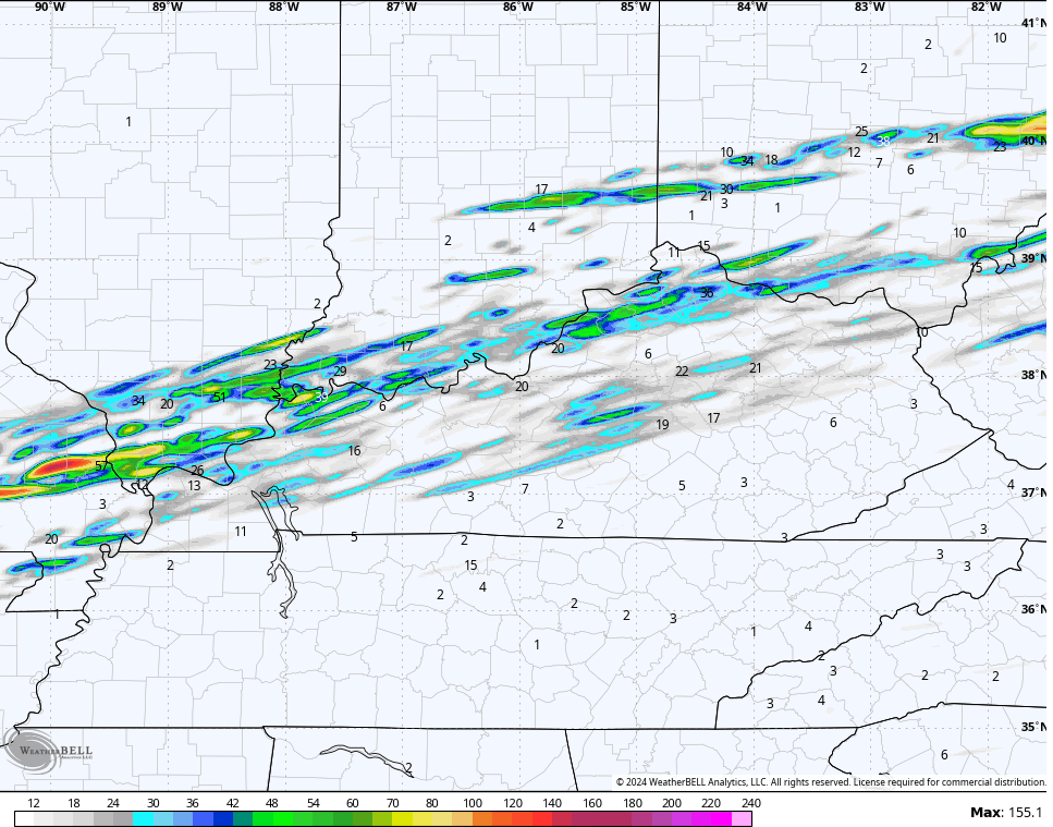
The short range models like the HRRR are really increasing the amount of shear, thus giving us an increased risk for a few tornadoes. The streaks on this map show where the HRRR expects rotating thunderstorms…
The SPC now has a hatched area for possible strong tornadoes…

Damaging winds are an issue…

Large hail is also a big player…

I will have updates later today and will have the latest on WKYT-TV starting at 4pm. H
Here are your tracking toys for the day…

Current watches

Possible Watch Areas

Have a great Tuesday and take care.

Thanks Chris, for a most important update on this upcoming severe weather. Wow, all of a sudden change for the worse. Been cloudy and showery here all morning. Hoping this will be the only severe weather event this spring, but I know it won’t. On the other side, in Minnesota their having a blizzard / snowstorm. The winter we were suppose to receive. Seems like we are just to far south anymore to be on the cold and snowy side of storms.
Enjoy this potentially busy afternoon !
The sun has peak out several times today, that just add more fuel to the fire when the storms developed in our area later tonight or wee hours in the morning here in western ,ky. Don’t like this set up at all especially it’s going to happen while were asleep.
Take care and be safe Winter Lover !
You too Schroeder!;
All of Northern IL is in the Enhanced Risk area, including the Chicago Metro Area, with a Tornado Watch in effect until 10 PM CST.
Several Severe T-Storm Warnings have already been issued for parts of North-Central IL, and even a Tornado Warning in Western IL. The storms continue to increase in coverage and intensity as they move towards the NE.