Good evening, folks. Strong to severe storms are still expected to fire up overnight into the early morning hours of Wednesday. This action is along and ahead of a potent cold front racing eastward across the state.
The greatest threat for severe weather is after midnight for many areas. Areas from Covington to Paducah have the earliest impact with those in the east and southeast getting the storms by the middle of the morning, likely in weakened fashion.
The Storm Prediction Center keeps areas along the Ohio River and just south in the Enhanced Risk for severe thunderstorms…

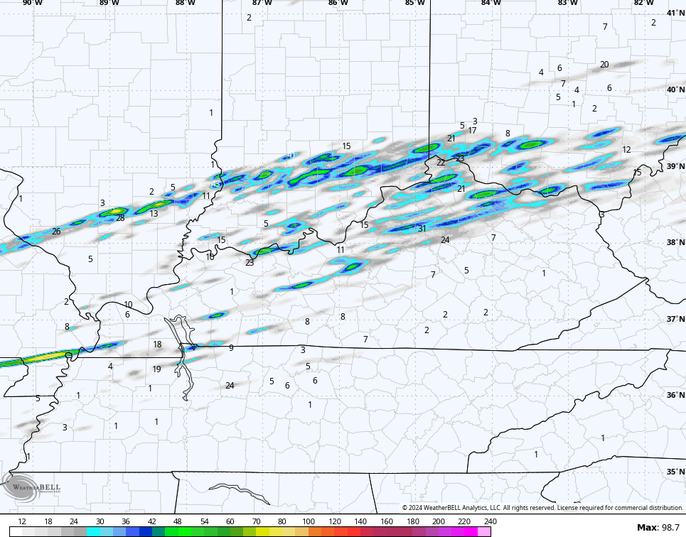
The latest HRRR continues to see streaks of rotating thunderstorms racing from southwest to northeast…
The SPC keeps the hatched area for possible strong tornadoes…

Damaging winds are a big issue…

Large hail is also a big player…

I will have the latest on WKYT News starting at 10pm on the CW Lexington and on WKYT at 11. As always, I have your tracking tools to follow the severe storms threat…

Current watches

Possible Watch Areas

Enjoy the evening and take care.

I have a question. If the Louisville area is in the best chance for Tornados to develop, why hasn’t the NWS put out a Tornado watch? I don’t live there but I have family that does, so I’m curious as to why.
Patty – you should call them now and ask them. Let them know you are not happy. They are supposed to be serving us.
Numerous Tornado Warnings have been issued this evening for the Western Suburbs of Chicago, with several confirmed sightings. Where I am in the SW Suburbs, it’s currently lightning and thundering with Severe T-Storm Warnings and Tornado Warnings out to the west.
This is amazing for any time of the year, let alone February!