Good Thursday, everyone. On this bonus day of February, we are dealing with a seasonable brand of chill to put the wraps on the month. Day one of March looks rather ugly, but it’s on the leading edge of another spring surge.
Today starts with temps in the 20s before recovering into the 45-50 degree range for most this afternoon. Clouds will begin to stream in from the southwest as a system pushes toward us, bringing some chilly showers for the first day of March on Friday…
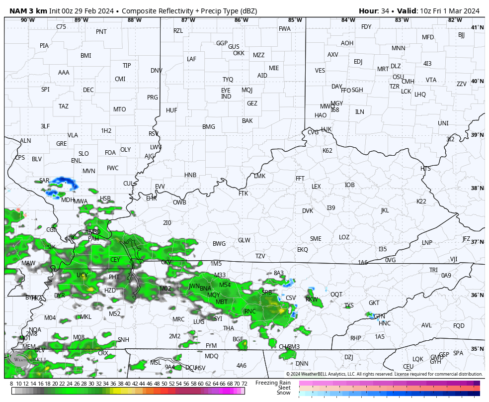
Highs Friday may struggle to get out of the 40s.
Saturday is a slow starter with clouds and a small shower chance early on. Temps spike into the 50s during the afternoon as some sun tries to show up.
This kicks off a very mild period pushing in Sunday into early next week, at least. The setup features a big blast of winter into the western half of the country, with a springtime ridge of mild temps in the east…
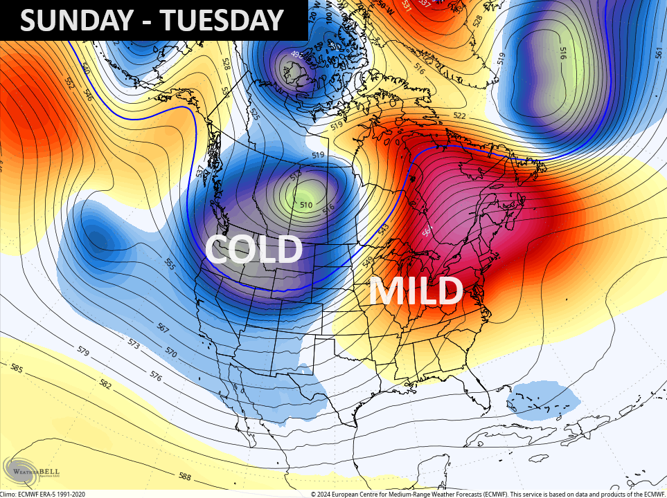
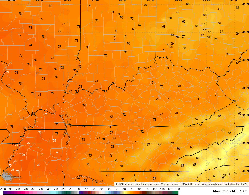
Highs during this time can reach the low 70s for a day or two…
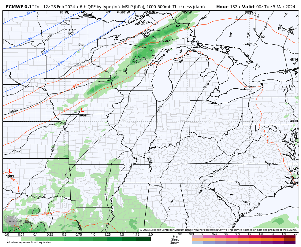
This initial surge of spring is ahead of a series of systems set to impact our region from Tuesday through late next week. This setup can bring more rounds of storms and heavy rains our way…
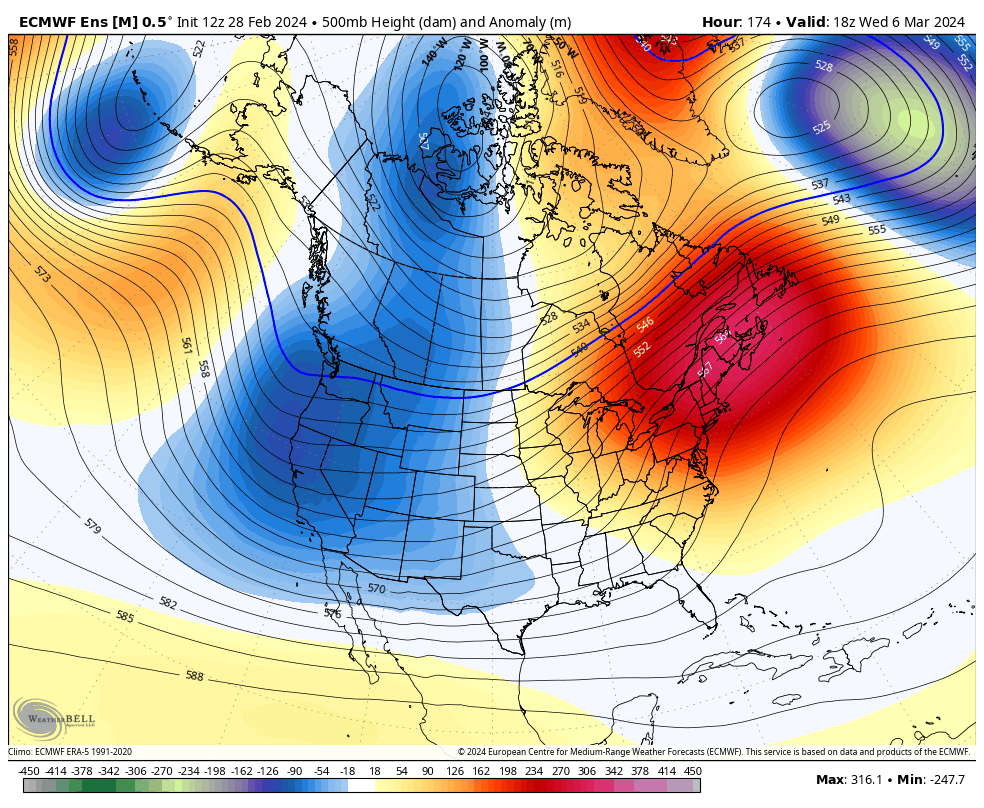
The Ensembles just won’t give up on the idea that the troughing in the west starts to get kicked farther east. Now, they’ve been showing this happening for weeks, but they have yet to fully verify, obviously.
Still, the EURO Ensembles paint an active looking week two of March…
March is likely a very busy month that can bring periods of extreme weather to much of the country. Ugh.
I’ll drop by for another update later today. Until then, have a good one and take care.

It seems like I have been looking at the same exact Ensemble since January.
Maybe a new way of forecasting is to take what the ensembles show and reverse it?
I say meet in the middle.
22° F this morning in Richmond, a 40-degree difference in 24 hours.
Thanks for the update Chris. Currently, it’s 23 degrees here in Maple. Quite a shock to this old system of mine. I think there should be an investigation in why the weather models fail so often.
Enjoy your day everyone !
Something is telling me that ole man winter is going give us a surprise snowstorm sometime this month.
Agreed
Temperatures at O’Hare Airport ranged from a high of 74 degrees on Tuesday to a low of 20 degrees on Wednesday, a 54-degree difference in a two-day time frame. Pretty amazing.
There were 10 confirmed tornadoes in the Chicago NWS County Warning Area on Tuesday evening, which were rated EF-0 or EF-1. The NWS is continuing to survey the damage.
Illinois had the most tornadoes in the nation last year, and is off to a quick start this year.
The CFS continues to remain mild for the month of March as a whole – a lot driven by the first two weeks of the month averaging out much warmer than normal!
Keep in mind though that normal last frost/freeze dates don’t happen for a while, and the April forecast will likely be more important in nailing down those risks.
Why dont you start your own site????
Hey Dash, I’m still waiting for your end of February cold prediction to come through. What happened? I want forecasts, not fantasy!