Good Monday, folks. The first full week of March is off and running on a very mild note as temps hit the 70s in many areas. These late April temps are kicking off a very active setup that brings rounds of showers and thunderstorms across the state this week.
As mentioned, temps out there today reach the 70-75 degree mark in most areas with a mix of sun and clouds. There’s a small chance for a shower or thunderstorm to go up, but the threat for scattered showers and storms will increase on Tuesday.
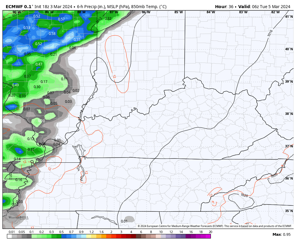
That’s when a cold front moves in, allowing a wave of low pressure to develop along it for Wednesday. This brings cooler winds and a few more showers and rumbles of thunder to the region, especially across the eastern half of the state.
The EURO shows this well…
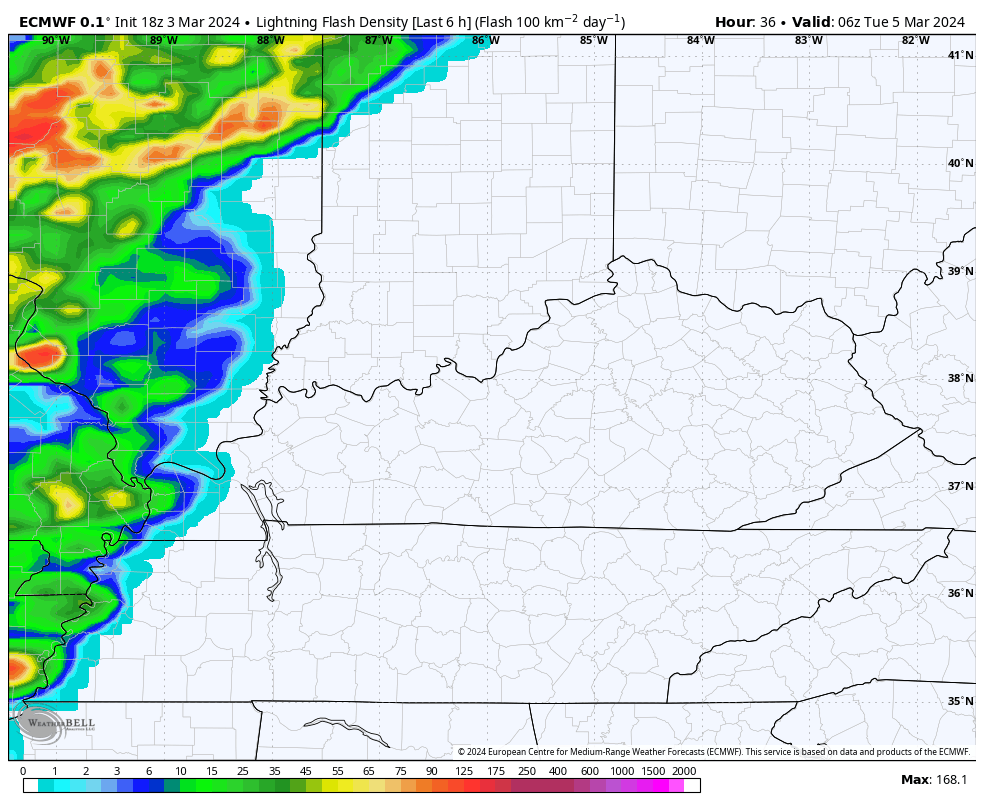
Check out the lightning forecast from this same run…
Temps on Wednesday come down with highs ranging from the mid 50s to mid 60s depending on where you are.
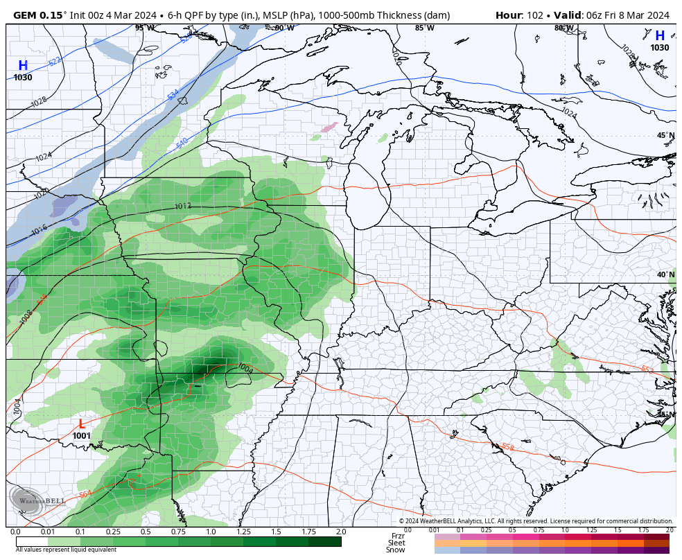
Thursday is a fairly nice day as we await the arrival of a potent storm system Friday and Saturday. This pushes in with showers and thunderstorms ahead of it with a nice temp drop behind it on Sunday. There’s even the chance for a touch of winter weather to show up…
There should be a bounce back in temps after that system swings through, but that’s likely ahead of another deep trough sweeping into the east. The Ensembles have a pretty good signature on this setup…
GFS
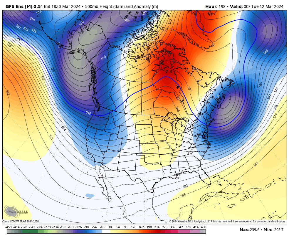
EURO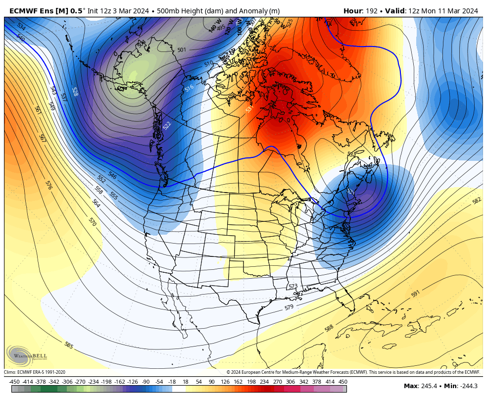
Big ridges to deep troughs this time of year can make for interesting weather. Severe storms to a little bit of winter?
I’ll have another update later today. I leave you with your radars to track any isolated shower or storm that goes up…

Make it a magnificent Monday and take care.

Thanks Chris. Great day to work outside and get things done for spring’s arrival. I’m hoping we won’t have many more cold / frosty morning to contend with, but you never know.
I dug up some facts on this winter, and way it turned out by looking at the recordings of the Pacific Decadal Oscillation for ( DJ F ) The PDO for December was – 1.67, January was – 1.56 and February – 1.33. The question I have is how could we have an El Nino winter with these negative figures. The El Nino winters in past years were always positive, and La Nina winters were always negative. I can’t find any year going back to the 1800’s where the El Nino winters had a negative PDO. What gives ???
Enjoy the nice spring weather !
Here’s the summary of the winter 2023 – 24 :
https://www.weather.gov/lmk/winter_23-24_summary
The Eastern/Central US looks to be 2 things this week: Wet and Warm
️Much above normal temps will continue…
Multiple rounds of rain will cause for heavy rainfall, especially the SE US/East Coast
The temps won’t be above normal this weekend.
We can always use more rain in the spring and going into summer’s growing season. Just don’t want the severe stuff.