Good evening, everyone. We are wrapping up an incredibly warm day across Kentucky with the increasing threat for thunderstorms to rumble into the region over the next few days. This kicks off a very busy pattern with another big system this weekend.
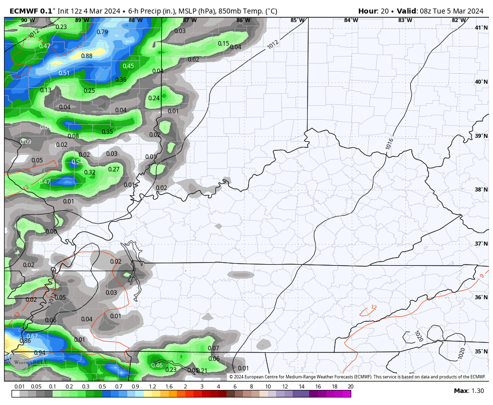
Rounds of showers and storms pick up the pace late tonight and early Tuesday from the southwest to the northeast. This won’t be constant but the storms can put down hit and run heavy rains.
This action is along a cold front working in from the west. This slows down on Tuesday with a wave of low pressure developing along the boundary and moving across the region Tuesday night and Wednesday. The end result is more showers and some thunder…
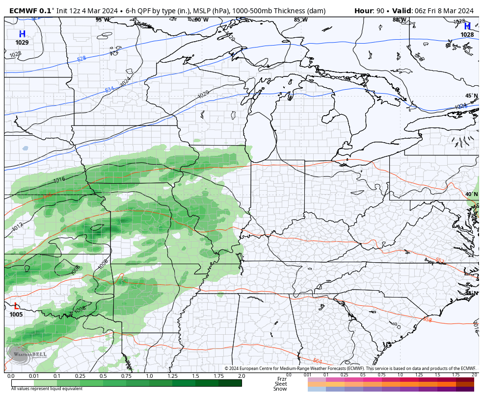
We catch a break on Thursday before a more potent system moves in with rain and thunderstorms Friday and Saturday. Colder air comes in behind this for Sunday with the chance for a rain or snow shower for some…
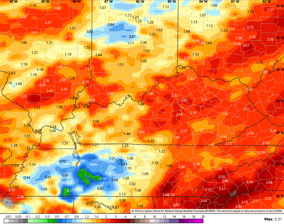
Rainfall totals through the weekend should average 1″-3″ for most of the Commonwealth…
There’s the chance for an isolated shower or storm going up this evening and your radars are on duty to follow anything that’s out there…

Have a great evening and take care.

today being the clean freak that I am cleaned my house all morning. I pulled the screen door open and turned the window fan on to draw fresh air across the house while I cleaned…I was so uncomfortable.. It felt so humid even though the temp wasn’t that warm really…… anyway…after mopping I noticed it was taking forever for the floors the dry… the humidity inside was 78% (no wonder)…I have no shame in closing everything up and turning on the AC to get the humidity down.
Mark do you do windows lol ?? It’s definitely getting spring cleaning time. I am with you about the AC. Bring it on.