Good Tuesday to one and all. We have a cold front dropping into the Bluegrass state and it’s bringing scattered showers and storms along for the ride. This is the opening act to a much bigger system arriving for the weekend.
Let us start with today and roll forward.
Scattered showers and storms increase from southwest to northeast as the day wears on. Here are your radars to follow along…

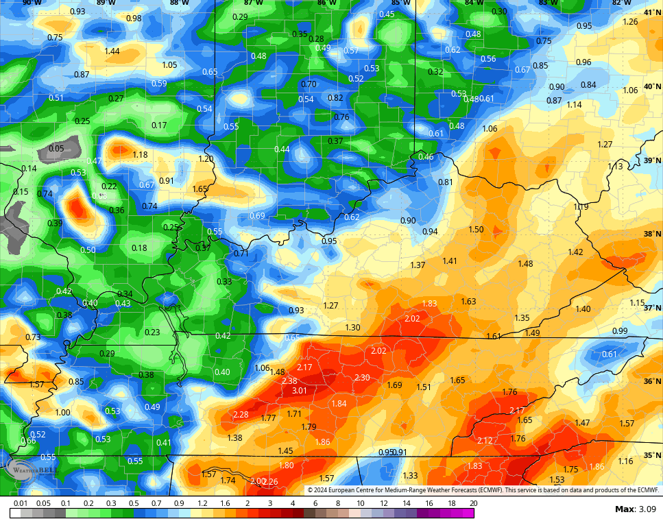
Low pressure develops along the front and lifts into the Smokies tonight and Wednesday. That keeps rounds of rain going, mainly in the central and east, through the first half of Wednesday. The EURO is the most aggressive with this system, spitting out more than 1″ of rain through tomorrow…
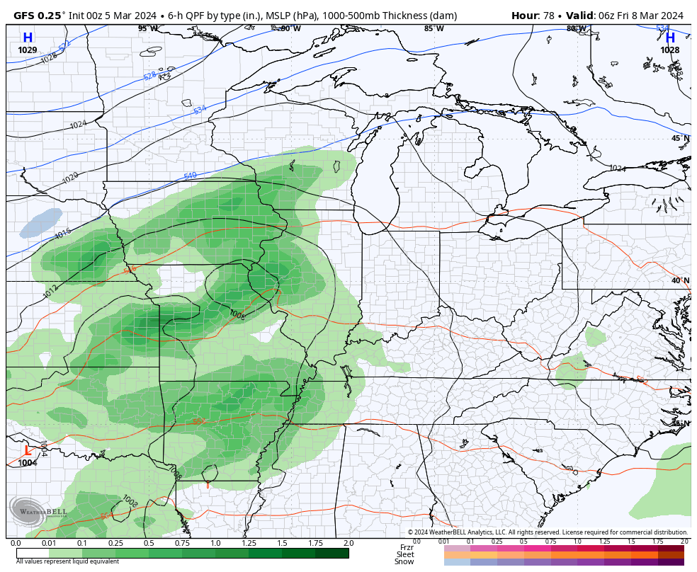
Better weather moves in for Thursday before we track another potent system moving in for the weekend. This brings an increase in showers and some thunderstorms for Friday with widespread rain likely for Saturday as low pressure moves through the area. Colder winds blow behind this into Sunday with a small chance for a lingering rain or snow shower…
Temps are below normal for Sunday and Monday before they quickly bounce back to above normal for much of the rest of the week. That ridge is ahead of what looks like a massive trough set to build in across the eastern half of the country by the following weekend and into early the next week…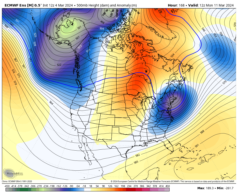

I’ll have another update later today. Have a terrific Tuesday and take care.

I’m surprised by nothing in the weather world anymore… I feel like Murphy’s law has to bring us a cold spring because of how warm it’s been…but it’s 2024….no one knows.
Mark, this weather pattern has pague us for years. I pinned it down to the solar cycle #25. Until this solar cycle changes we will continue this current weather pattern. May last for several years. Just one of my theories.
Schroder, there were talking about how this solar cycle would effect us as how cold it would get, but the opposite has happen.
I noticed this when we have more solar flares, and an increase in sunspot activity, and a brilliant display of aurora borealis both in the fall and spring the winter turns out mild.