Good Wednesday, friends. It’s another damp day across Kentucky as low pressure number one spins just to our south. Low pressure number two is on the way by Friday and Saturday, bringing more in the way of wet weather. Moral of the story… Get used to it.
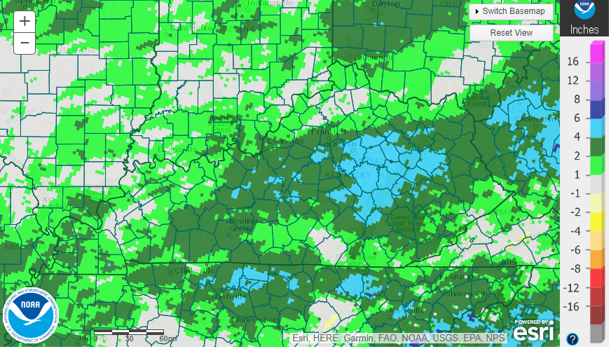
Temps today are in the 50s as our low works just to our southeast. That puts us on the northwest side of a spiraling band of rain with the greatest concentration across central and eastern Kentucky. This is where we are dealing with a lot of ugly weather today before the rain tapers off from the northwest into the evening.
Your Kentucky radars are getting a workout this week…

Today’s rain is adding to what has been a very wet start to the year. We are running well above normal on rainfall over the past 60 days…
We catch a mainly dry day for Thursday but clouds are slow to break with temps that can make a run at 60 with enough sun.
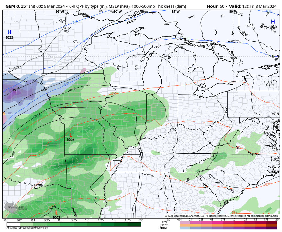
The next storm system then works into the region Friday and Saturday bringing more rain and a few thunderstorms into the region. Gusty winds will also be an issue as much colder air blows in behind this departing storm on Sunday…
The chilly northwest wind then settles in through early Monday before temps rebound very quickly by the middle and end of next week.
This warmer than normal surge looks to get wiped out by a significant shot of cold into the country next weekend into early the following week. The EURO Ensembles are ugly…
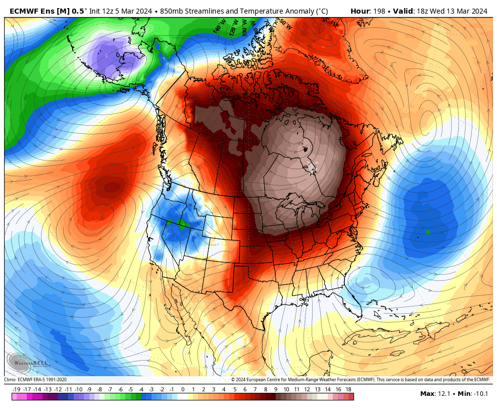
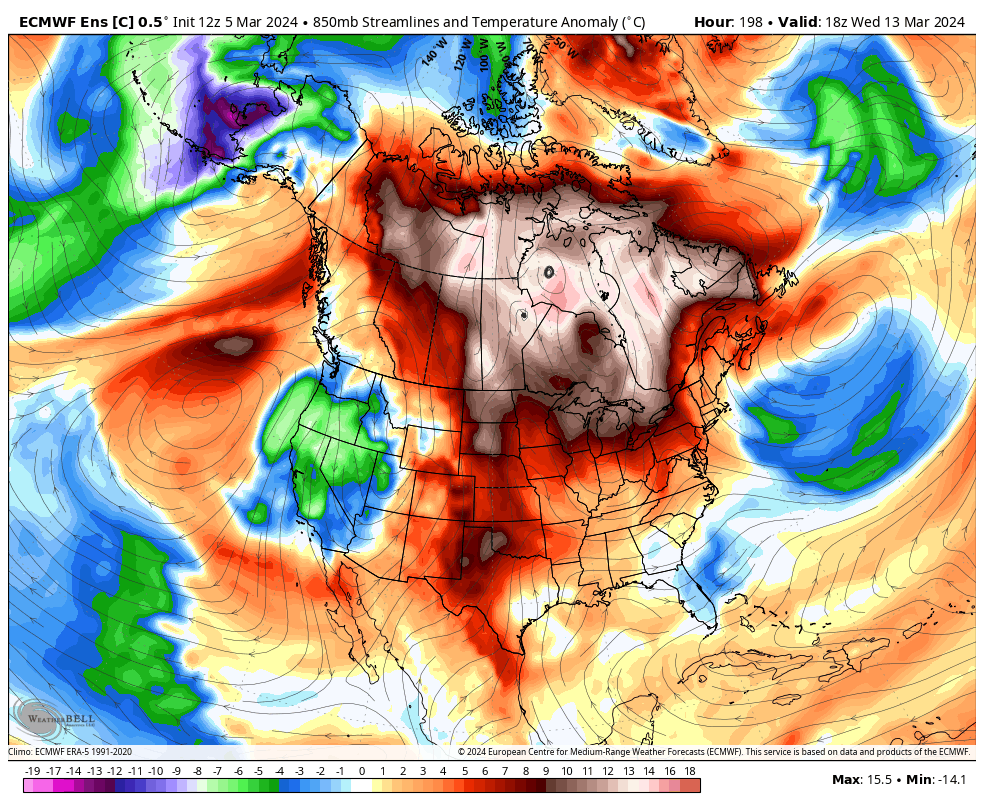
So is the control run of the Euro Ensembles…
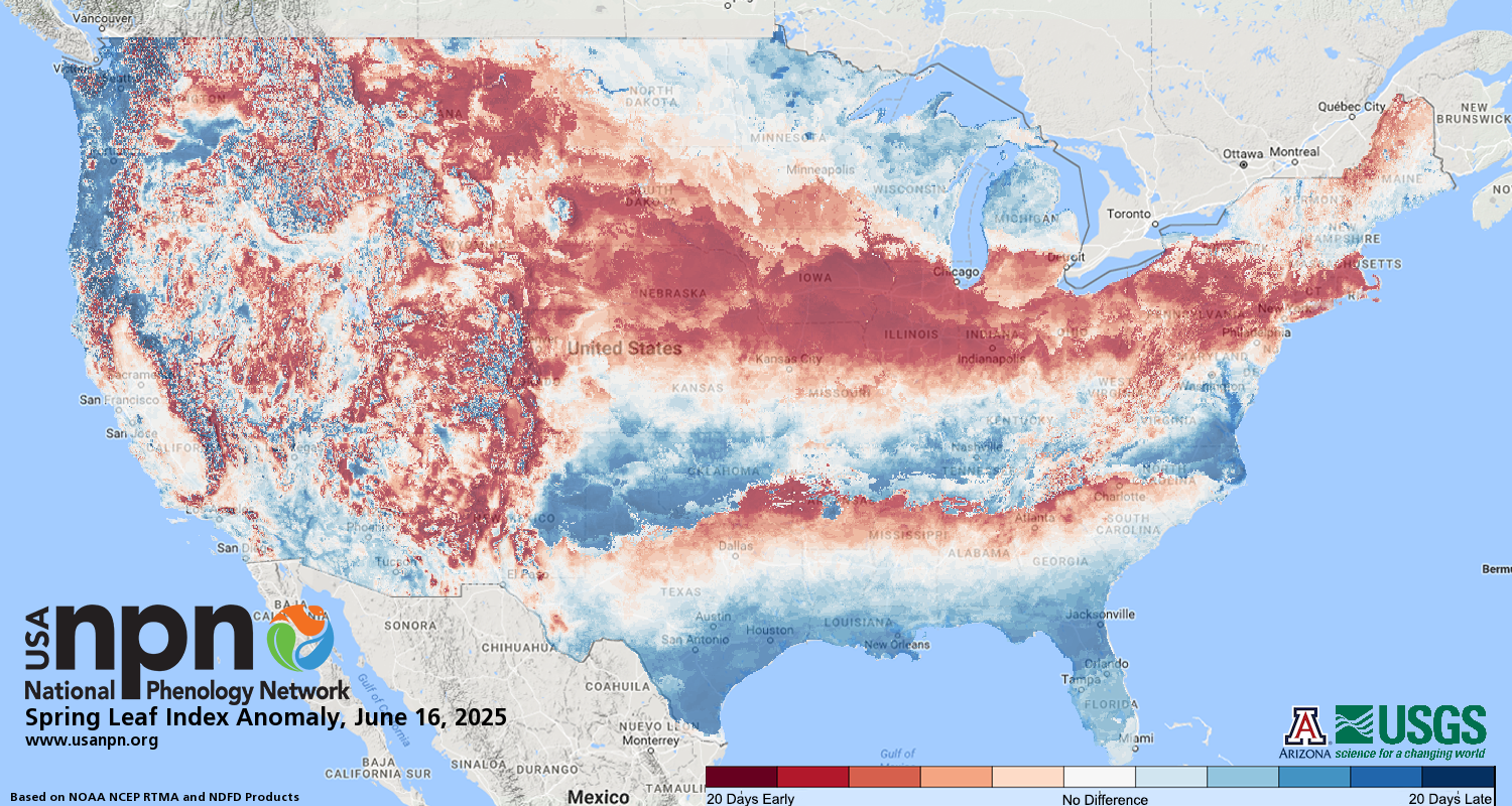
A cold shot like that is expected this time of year, but we already have things in bloom so that could cause some harm. As a matter of fact, we are 2-3 weeks ahead of schedule in much of our region…
I will have another update later today. Make it a good one and take care.

We need sunshine.
Thanks Chris. I like the sunshine too, but we need the night temperatures in the mid forties to low fifties to slow plants from reacting to the warm daytime temperatures. Glad we are starting to see rains coming out of the south rather than the drier northwest. Yesterday, we recorded 0.46 ” of rain, so we are great going into the planting season. The ensembles showing a return to colder weather is a tradition that happens every spring. Nothing we can do about that.
Have a great day everyone !
When there’s no tropical activity we almost never have problems with systems coming through pretty frequently…
I am starting to see some trees blooming.
I noticed that as well, as we turn our clock forward this weekend means longer daylight hours. So ready for spring since the snow never show up again at my neck of woods. Were in a 3-4 years of snow drought.
Red Maple just started blooming here. My allergies are kicking in big time, but I don’t take any medication to relieve it because I had a doctor MD as a customer at the nursery a long time ago, and he told me to be thankful for the allergies ” you won’t get cancer, ” So for then on, I’ve learn to live with the allergies. Back to the spring trees, I always go by this observation, when the Beech trees and Oaks lose their old brown leaves from last fall, frost and freezes are usually over, but I can’t count on this observation anymore.
Over the past few years, the long range ensembles have been inconsistent at best, and flat out wrong at worst. The near term models have also been affected, but to a lesser degree. When I think about the freezes we experienced last Spring, I’m hoping that the ensembles inconsistencies remain consistent.
There really needs to be an investigation into all of the weather ensembles.
There are a couple of reasons why chances are good that we will see more tropical activity this year. One is the absence of El Nino, which has a tendency to force Atlantic hurricanes to either fall apart due to shear or deflect them to the north, then northeast. The other is that February ocean water temperatures in the equatorial Atlantic, where storms spawn, were the same as what the normally are in July!
I wouldn’t call this an ” El Nino winter, ” more like ENSO / La Nina or ENSO / neutral. I think a little of both, but that would be impossible.
It will be an active Atlantic Tropical storm season because the Pacific is still negative and the Atlantic is still positive. If and when these two ever reverse, we will have more normal temperatures / precipitation patterns.
Had rain all morning not heavy but a steady rain. I hope something gives for next winter and we have some good snow but we will see.
This Fall and Winter’s El Nino fell far short of normal, but one area where it did show its strength was in how tropical winds shifted to a strong easterly flow. This caused Atlantic hurricanes to weaken as they approached the Caribbean, and also tended to push these storms to the north and then northeast.
This year will be far different, as an easterly flow takes over, and we will likely see an uptick in the number of hurricanes, since during February, ocean water temperatures in the equatorial Atlantic where these storms spawn were at levels normally seen in July!
I meant to say that El Nino produces a west to east flow, while ENSO Neutral > La Nina is east to west.
Wow Joe I bet we will see strong hurricanes this year. When do you think the ocean will start cooling? Is that the million dollar question?
We had about 0.71 ” of a steady light rain in the past 48 hours. Very welcome type rain. The kind that soaks in instead of running off.
Keep hoping Crystal on that snowy winter later this year and next year. I will be surprised if we have another winter like we had this year. The Pacific has to change sometime.