Good Thursday, folks. It’s a better weather day out there but it’s not going to win any beauty pageants. Clouds will be tough to break before another storm system rolls back in for Friday and Saturday. That brings more rain and storms to kick off the upcoming weekend.
Highs today are mainly in the 50s with some morning drizzle and fog giving way to mostly cloudy skies. Some afternoon peaks of sun will be possible, especially in the south and west.
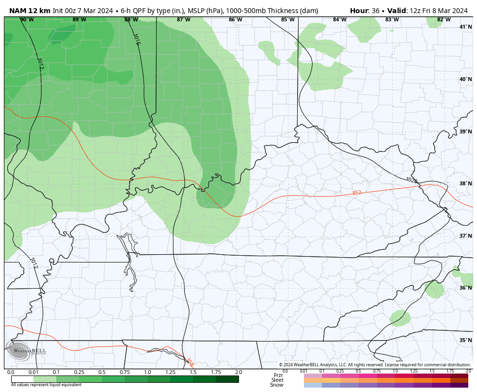
A few showers and storms increase from west to east Thursday night and Friday, but it’s not all day stuff. Temps hit 60-65 for many. Low pressure then rolls across the region into Saturday with more widespread rain and some thunderstorms. As the low passes by, colder air filters in from the northwest late Saturday into Sunday.
If the low passes just to our west, there’s a small window for a few strong storms across central and eastern Kentucky. That’s what the NAM is showing…
Temps are seasonably chilly for Sunday, but that doesn’t last very long.
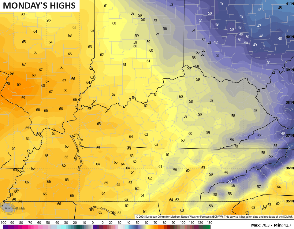
Temps respond very quickly as we head into early next week. Check out the 60s surging back into the state for Monday.,.
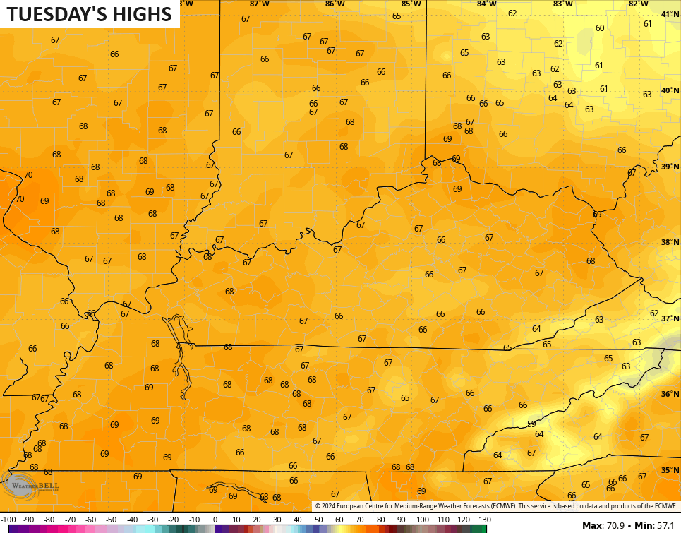
Mid and upper 60s then take up residence by Tuesday…
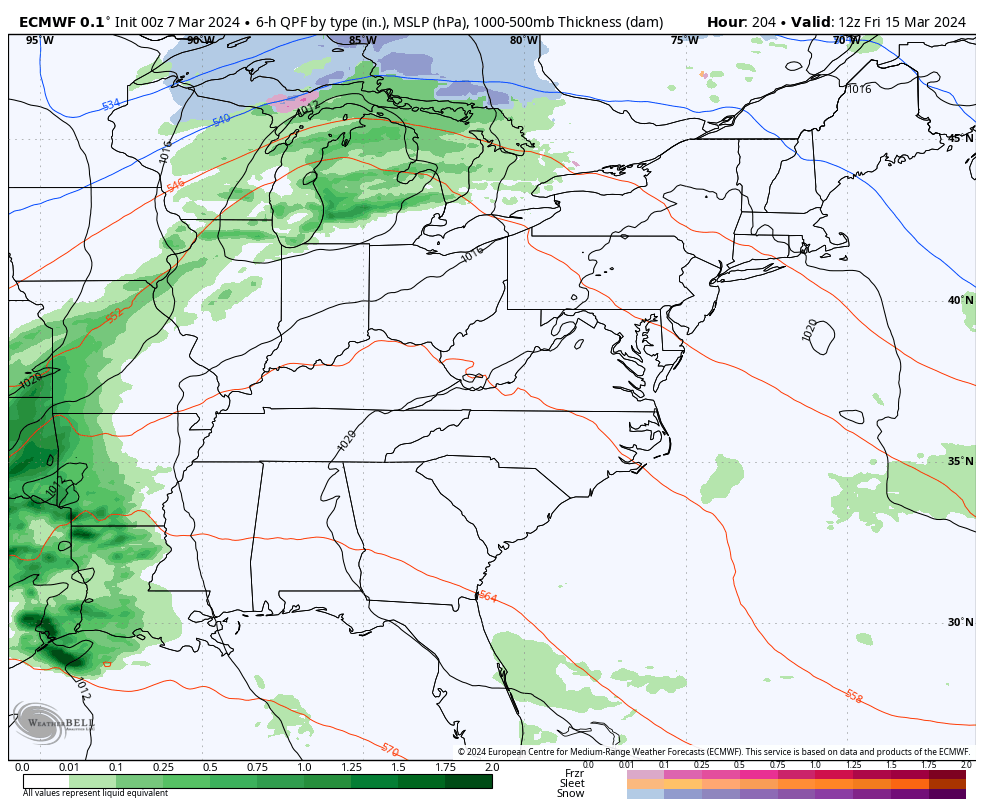
From there, 70 degree highs will be possible for the middle and end of the week before another big storm system crashes in from the west. This looks to bring more rain and storms followed by a much colder pattern by next weekend…
That’s likely a cold pattern settling in for an extended run and it’s one that can bring a some winter with it.
As I mentioned, this year is off to a very wet start with well above normal rainfall across Kentucky. I expect this trend to continue into the spring with frequent rounds of rain and thunderstorms.
The Euro Weeklies Control Run shows MUCH above normal rainfall for much of the eastern half of the country through April 20th…
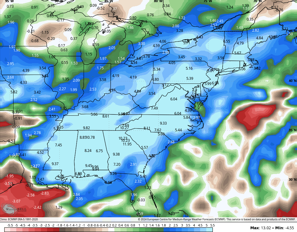
One has to assume this is the start of an active spring severe weather season. That’s something we haven’t seen in a while.
Another update comes your way later today. Have a good one and take care.

I’ll believe any long-term model or ensemble when it actually happens.
Me too Jeff !
Thanks for the update Chris. Frequent light rain / showers, but with a couple of sunshine days in between is what I prefer. I agree, we can only expect that this spring will feature bouts of severe weather. More so than last year’s spring. Coming out of a half a*ss El Nino and moving towards ENSO / neutral we could have a very warm and dry summer and fall. Really concerned about an active tropical storm season in the Caribbean, Atlantic, and Gulf.
It won’t be that long, we will be discussing fall and winter 2024 – 25. Can’t wait for all the fall and winter forecast and the first ‘ chilly alert. ‘
Have a great day everyone !
Not that I believe the enembles… especially when they showed feb turning bitterly cold only for it to be the exact opposite….
but would anyone really be surprised if March/April turned cold? Isn’t that the way it usually works? One extreme to the other
No that wouldn’t surprise me at all Mark.
Looking increasingly likely that a period of cooler weather will arrive the last third of March.
Not expecting this to be a pattern that produces notable cold/snow but it will be a reminder that it is indeed still March.
Another very warm March overall and Super Niño, 2016, also had a cooler stretch late March – Early April.
Dash, I hope the cooler pattern in mid month happens, as this will slow plants blooming and growing too early. The very strong El Nino in 2015 – 16 gave our area lots of cold and snow because the PDO was positive and the AO, NAO and the EPO were all negative for most of the winter.
Thanks, Chris