Good evening, everyone. Our next system is rolling toward the region and it’s set to bring more in the way of showers and storms to close the week and begin the weekend. THis system also has a brief blast of cold coming in behind it before we spring it up again next week.
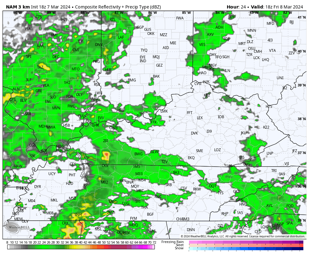
Scattered showers are pushing into the west this evening and this action will increase overnight into Friday. Here are your radars to follow the western Kentucky drops…

This looks fairly scattered until Friday night and Saturday when low pressure moves into the region. As the colder air sweeps in Saturday night, there’s a small chance for a few snow showers and flurries in the east.
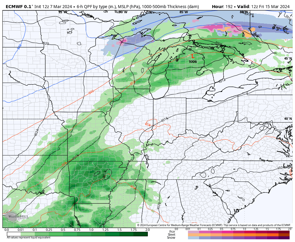
The future radar from the Hi Res NAM goes from 1pm Friday through 1am Sunday and shows all of the above…
We still need to be on guard for a few strong storms across the eastern half of the state on Saturday.
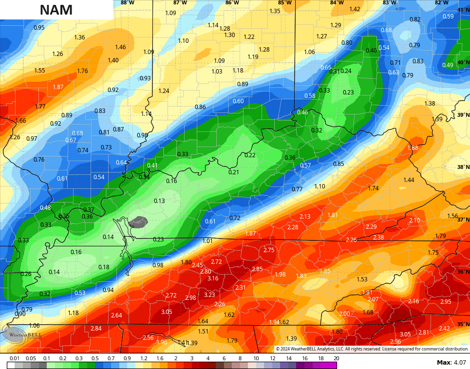
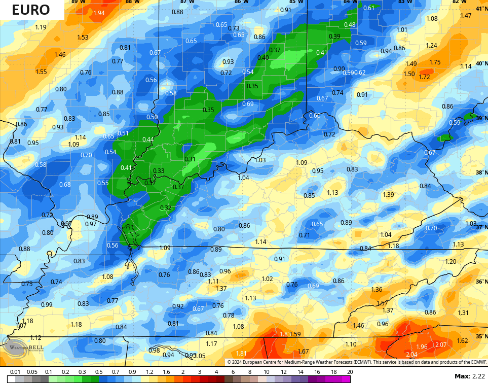
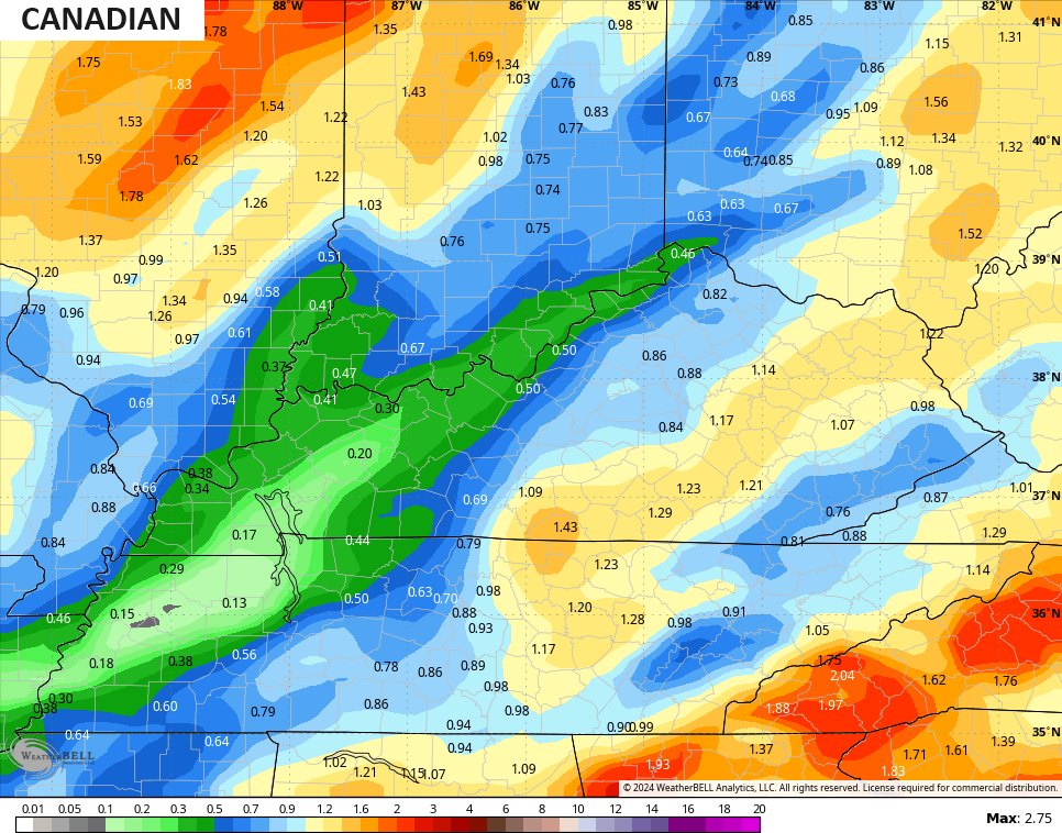
Rainfall numbers of 1″+ will show up for some areas with the greatest potential in central and eastern Kentucky. Here are a few of the model forecasts…
That cold shot is one and done for Sunday with milder air kicking in by Monday. MUCH above normal temps then take control again by the middle of next week…
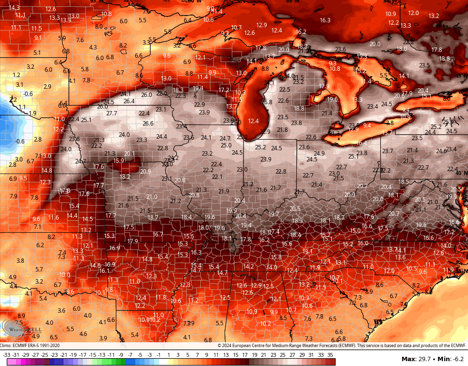
Highs make another run at 70 degrees during this time.
That’s ahead of a pattern change diving in by next weekend. Another storm system brings showers and storms into the region with a big dip in the jet stream behind it…
That may wind up becoming a pretty healthy cold snap through the middle of the month. Ugh.
Enjoy the evening and take care.
