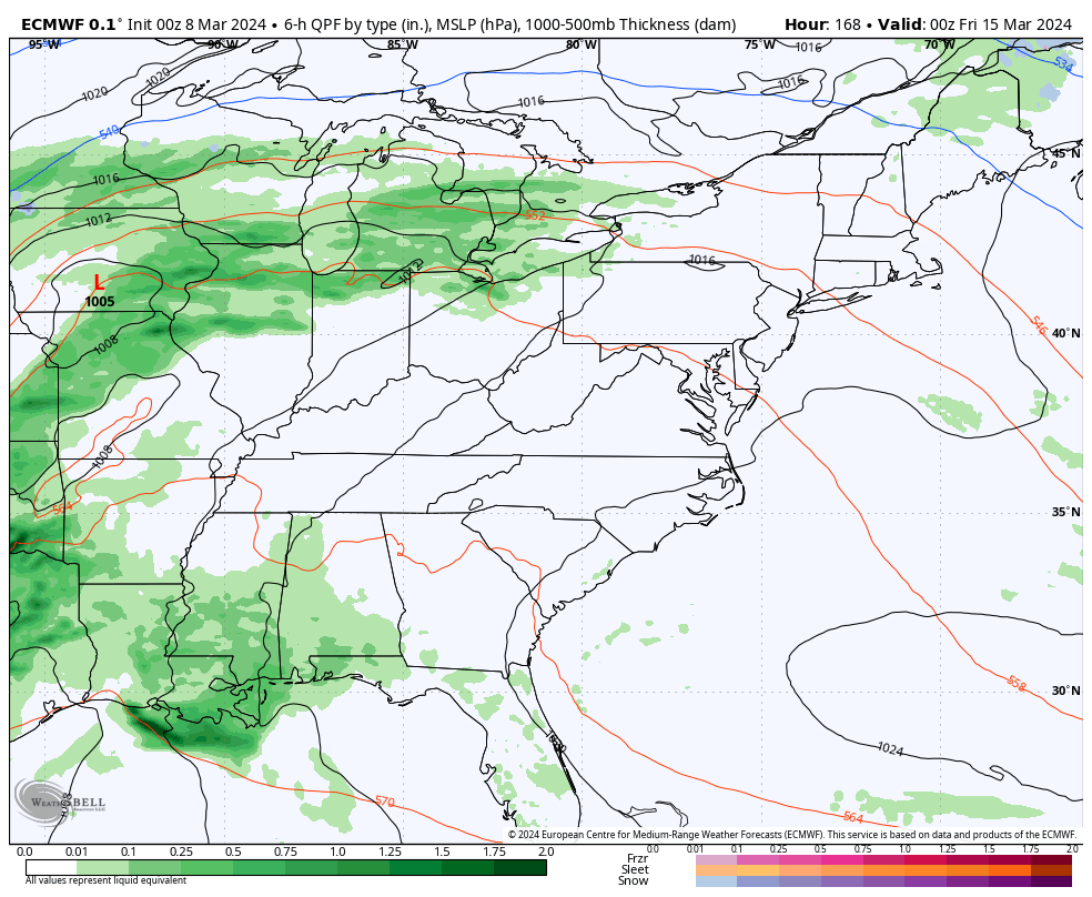
Good Friday, folks. Showers and storms are back in the Bluegrass State as another storm system rumbles in from the southwest. This system also unlocks a one and done cold shot to end the weekend with more spring temps to follow.
Scattered showers and storms are out there today as milder winds kick in. Any shower or storm today can put down hit and run heavy rains as temps surge back into the 60-65 degree range for many. Here are your radars to follow today’s scattered stuff…

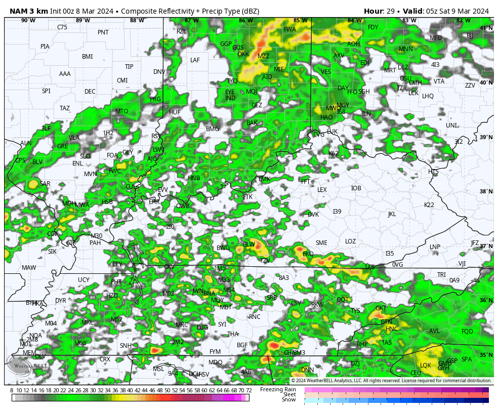
Showers and storms increase tonight and Saturday as low pressure arrives. This brings more widespread showers and storms with even the chance for a few strong storms across the east. Cold air crashes in from the northwest behind the low starting late Saturday. This may even spit out a rain or snow shower in the east Saturday night and early Sunday.
Here’s the Future Radar from the Hi Res NAM…
Highs stay in the 40s for many on Sunday as skies become partly to mostly sunny.
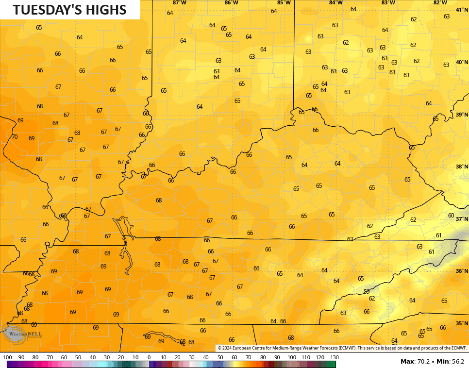
Milder winds then roll in for Monday with the 60s in the west and 50s in the east. Those numbers jump deep into the 60s on Tuesday…
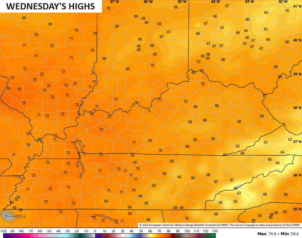
Upper 60s and low 70s show up for Wednesday…
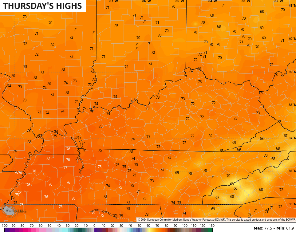
Those numbers may hit 70-75 across the board for Thursday…
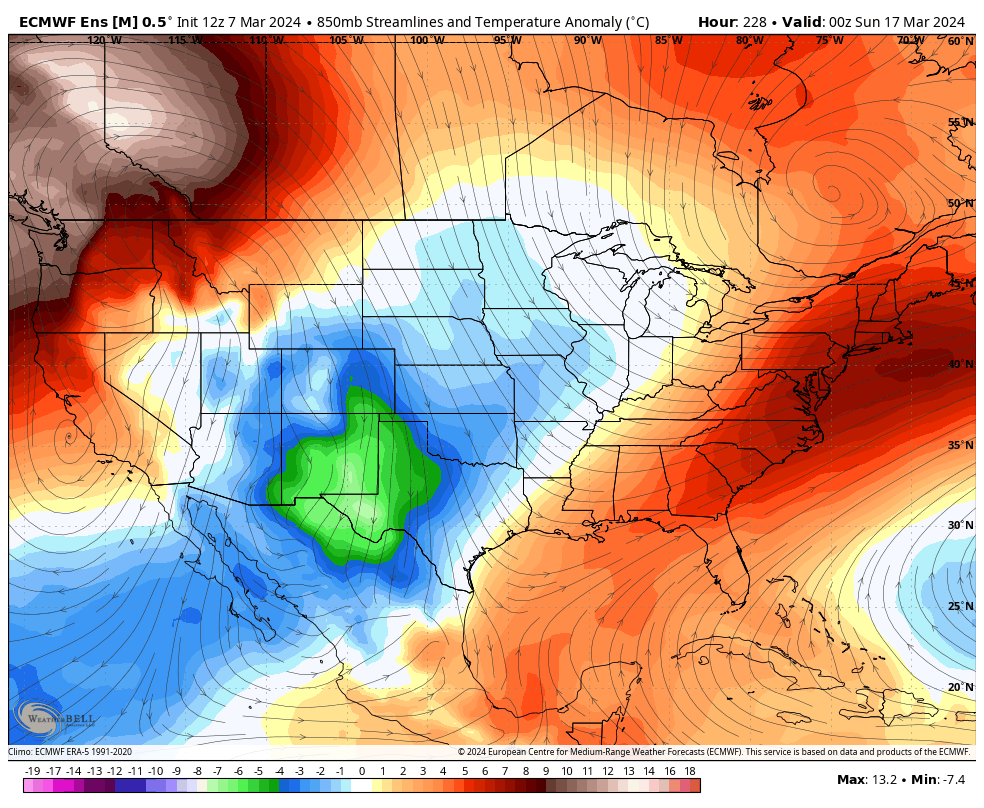
Another potent storm system moves in here by late week into the start of next weekend. That brings showers and storms ahead of it and much colder air behind it…
This likely kicks off a much colder than normal pattern that goes into the following week. Watch this cold blast show some staying power on the EURO Ensembles…
Again… No thank you!
I will throw you another update later today. Have a fantastic Friday and take care.

Not believing the ensembles. Sorry.
Me either Jeff.
Thanks Chris. Looks like the rain to my northwest may miss my county or breakup due to the strong ridge to the southeast. We had a good soaking rain the other day, so we are in great shape going into the spring planting season. Just don’t want to see a trend in the precipitation pattern, like we had earlier this winter.
I would be surprised if the next cold period has much staying power in our part of the country, as the days are increasingly longer and trending warmer.
Have a great day everyone !
The Euro Ensembles keep trying to advertise a deep freeze invasion of Arctic cold…again. They were wrong in January, they were wrong in February, and here’s hoping their second half of March forecast is also wrong. I want no part of a repeat of last Spring’s killing hard freeze!
I looked up the extended on the Ventusky, and it showed much colder air starting on the 18th of March, but I couldn’t tell how long it would last. Temperatures down to 23 degrees, which would kill off the blooms on certain plants. Hope it’s more of the BS we got this winter from the ensembles, or maybe there will be moisture with it resulting in a big March snowstorm. Who knows these days of anything could happen.
I’m ready for spring, but I’ll take a long overdue March snowstorm.
Yeah, that would be interesting to have an unexpected snowstorm this time of the year. I’ve seen many in my days back in the early 1960’s.
One of the strongest storms of the century and a rare true blizzard for eastern Kentucky, brought 6 to 30 inches of snow to eastern and southeastern Kentucky from March 12-14, 1993. Maybe Chris can dig into the WKYT archives and share some footage.
A 6 to 12 inch snowfall is what we use to receive in March around the sectional basketball time. Almost had to cancel the games because the roads were clogged with snow.