Good Saturday to one and all. We have low pressure working through the region today and it’s bringing some big changes. Rain and some thunder usher in much colder air and even the chance for a few flakes later tonight and early Sunday. Beyond that, spring surges back in.
Showers and storms are rather common this morning for much of the region with locally heavy rains for many. This action becomes more scattered from northwest to southeast this afternoon and evening.
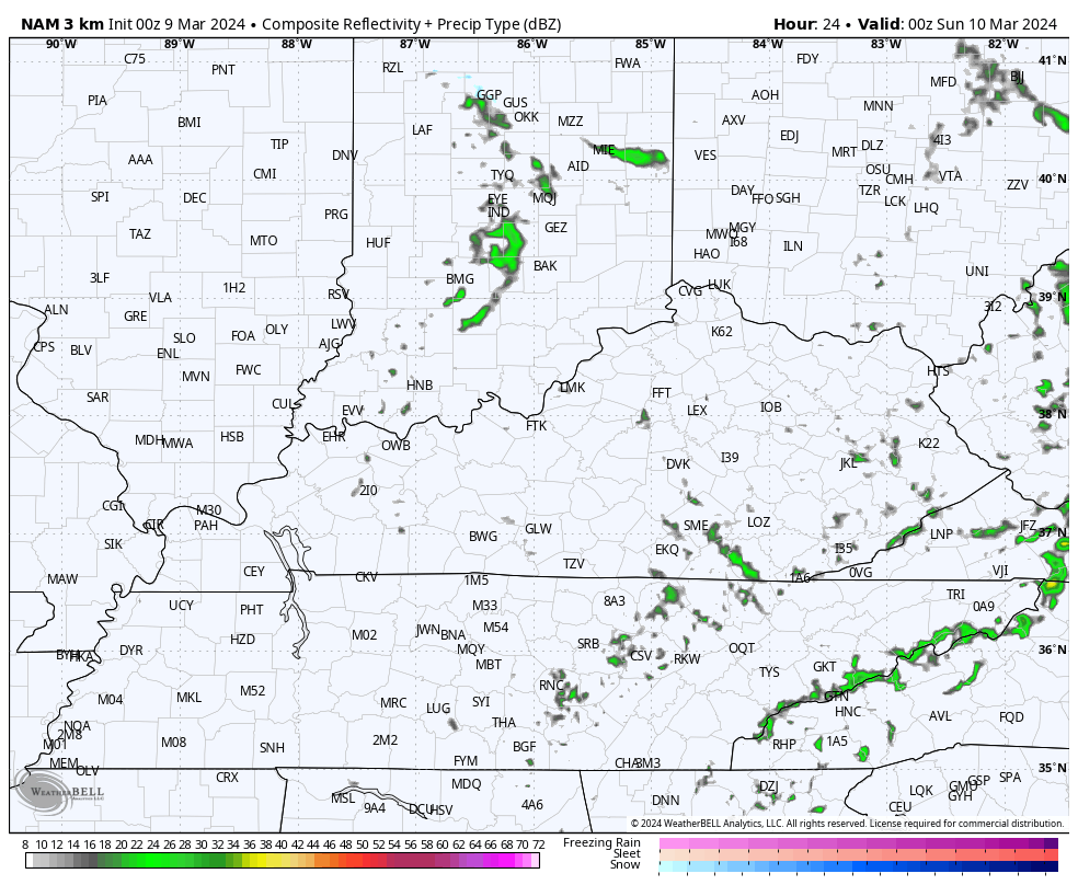
Here are your radars to track all the rain out there early today…

Cold winds then kick in as temps drop through the 40s this afternoon. Temps overnight into early Sunday morning hit the upper 20s to low 30s with gusty northwest winds making it feel much colder.
There’s even the chance for a few flakes to show up, especially in the north and east. The Hi Res NAM future radar shows this well…
Highs Sunday are in the 40s across central and eastern Kentucky with the 50s in the west. Temps then surge into the mid and upper 50s central and eastern Kentucky and low to mid 60s in the west for Monday.
Highs on Tuesday hit the 60s for the entire region and we push 70 by Wednesday. Thursday looks to be the warmest day with highs deep into the 70s…
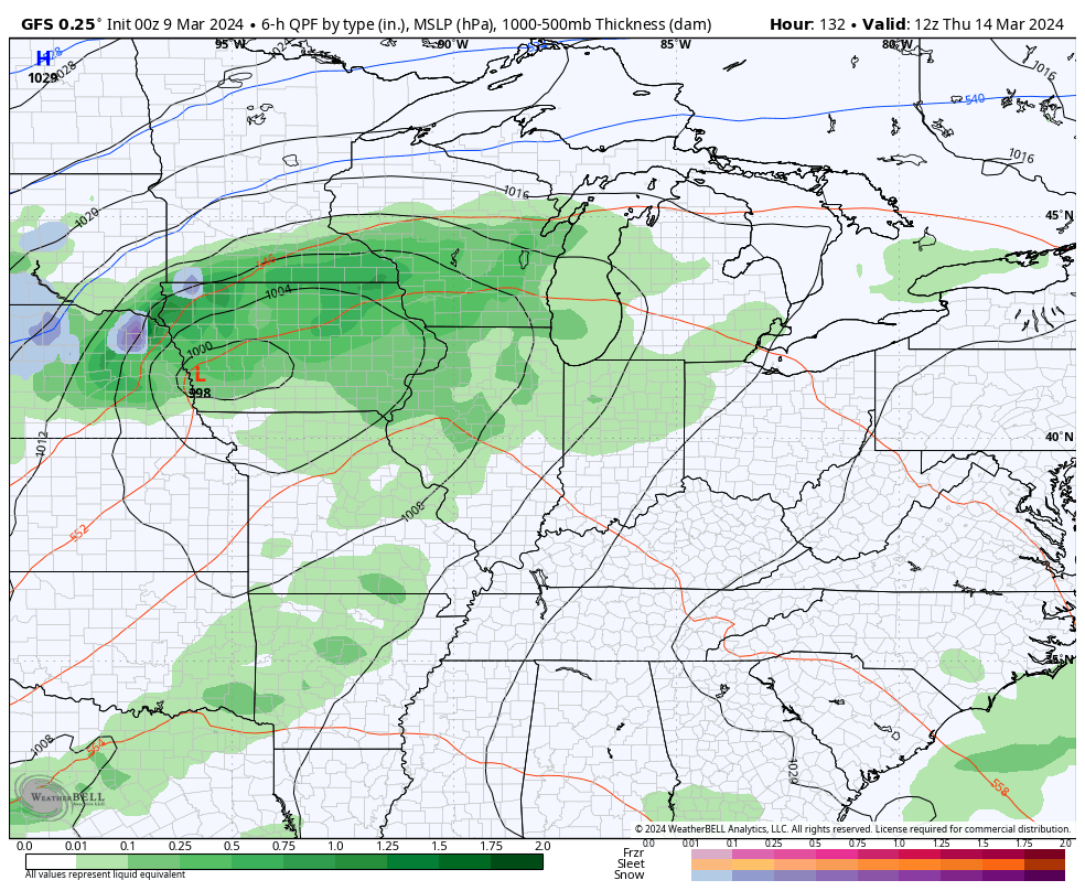
That’s followed by a storm system pressing in here from the southwest by Friday. How strong this system is remains to be seen as the model trend isn’t quite as cold with the air coming in behind it…
That’s would fit the trend of the past month, wouldn’t it?
I’ll see you back here with another update later today. Make it a good one and take care.

Thanks Chris. March, so far has been a lamb, but all that could change, Yesterday’s slow light rain event amounted to over a half inch. More than I expected. I like the cooler / cold mornings, which help in keeping plants dormant longer until spring temperatures are here for good. It’s sad that trees in full bloom now will have their flowers wipe out by the predicted freeze tomorrow morning. This happens every year we have a mild, uneventful winter.
Have a great Saturday !
March 12th – 14th 1993 blizzard was most likely triggered by the ‘ volcanic winter ‘ that occured that year. Here’s the link :
https://en.wikipedia.org/wiki/1993_Storm_of_the_Century
In April will we see again an entire month of blue ball (Ensemble) false flag runs?
Just take the ensembles as a guild, and as the worse case scenario. Scientist / climatologist really need a new way to make accurate long range predictions, or no one will take it seriously. I think the technology is there, but it’s well into the future.
funny….this weekend storm was supposed to be the stronger of the two storms this week for us… but we ended up getting more rain from the first one.