Good Sunday, everyone. It’s a brief cold shot kicking in across the state today, but even this isn’t too bad. Once into the new week, much milder winds kick in with another serious surge of spring temps returning to the Commonwealth.
Temps today start in the upper 20s to low 30s and only reach the 40s across central and eastern Kentucky. This is on a strong northwesterly wind flow that may also spit out an early morning rain or snow shower in the north and east.
Most of the area misses out on this, but your radars are on duty to follow along…

Temps start cold on Monday with mid and upper 20s for many. Those mild winds kick in by the afternoon with temps hitting the 50s for central and eastern Kentucky with the 60s in the west.
The 60s overtake the rest of the state Tuesday and may flirt with 70 on Wednesday. The 70s then flex on us by Thursday…

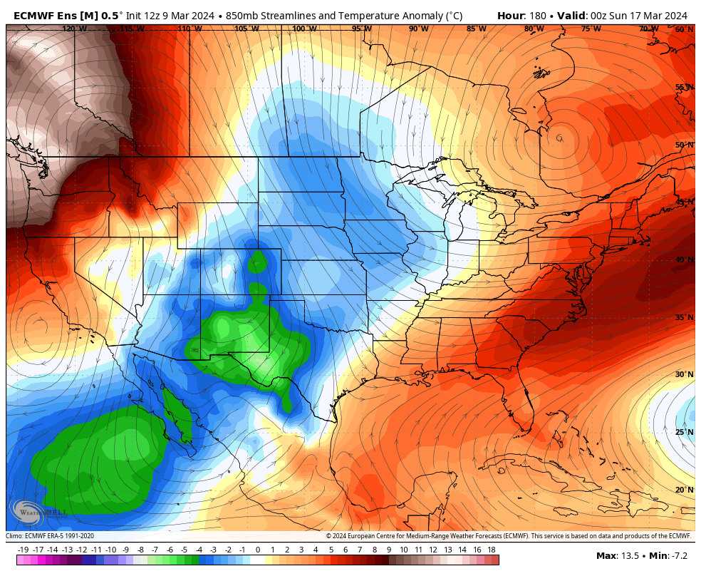
This is ahead of what appears to be a fairly significant pattern change as winter tries to flex one last time. How this flex transpires is a work in progress, though.
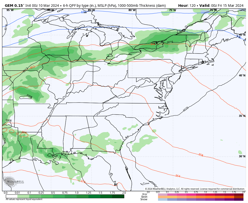
One storm system moves in here by Friday with showers and some thunderstorms. Does the cold crash in behind this or wait for another system to fully unlock it later next weekend and early the following week? The GFS thinks the latter…
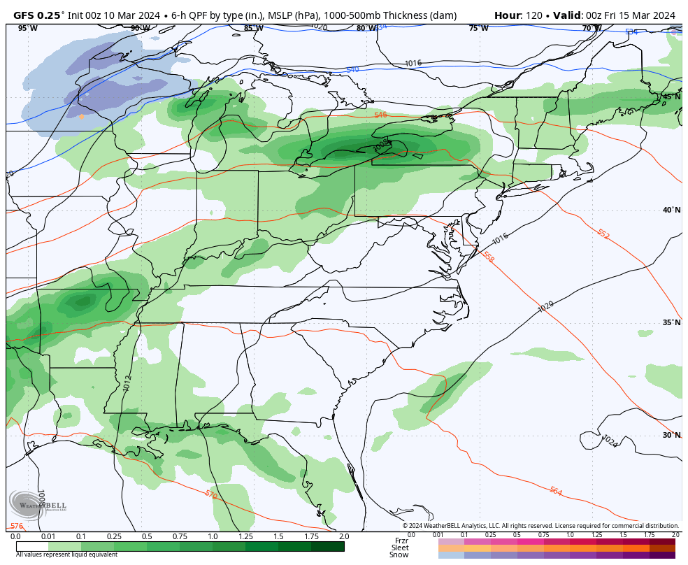
The Canadian goes about it in a slightly different way…
Regardless, very cold temps for the second half of March will likely come calling. Look at these temp departures…
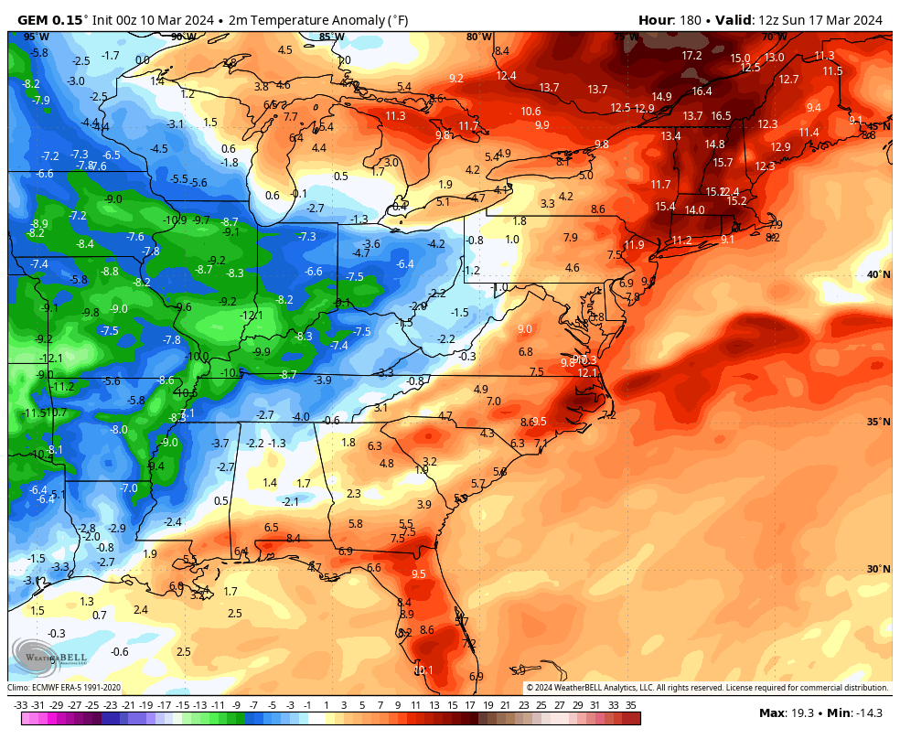
Barney colors this time of year are never a good thing, folks.
The EURO Ensembles continue to show this as the beginning of prolonged stretch with a fairly deep trough across the eastern half of the country…
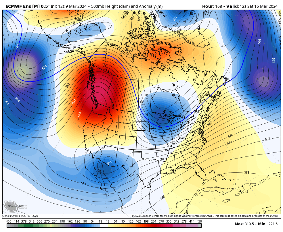
The look on that continues to be below normal for temps…
I’ll have another update later today. Make it a good one and take care.

If the 2nd half of march is cold I wouldn’t be surprised at all… Nor would I be surprised if the ensembles are totally wrong.
The ensembles are not to be trusted.
As Chris previously reported, we’re about two weeks ahead on the spring cycle of budding, flowering, & growing. If we get what the models portray, some plants are going to take a whuppin’. Bad bongos.
Every time we have a mild winter you can count on a spring freeze. When we use to have 4 months of winter weather we had a great fruit harvest in the late summer and fall. When I had my nursery this didn’t happen as often as it does now. We need to have a positive Pacific to change this pattern, but it doesn’t seem this will happen for many years now.
Thanks for the update Chris. No comment on the weather, but I do have a complaint. When we have the time change I turn into a ‘ grumpy old man. ‘ I wish we could stay on the same time all the time ! It’s about politics and money and I’m getting sick and tired of it.
Putting the above aside, Everyone enjoy your Sunday.
The first time it was used was in WW1.
Ironically the old Germany-Austrian Empire was the 1st to implement it. Other European empires & countries followed suit.
Many retailers think it’s better to have the extra daylight in the summer rather than the winter.
Myself I would prefer the extra daylight in the winter.
I have been looking at the same Ensemble since mid December.
The Ensembles were respectable in 2023.
This year not so much.