Good Monday, everybody. Much milder winds are slowly kicking in out there today as our another case of spring fever takes hold of Kentucky. Enjoy it because Old Man Winter has another flex or two coming next week. Ugh.
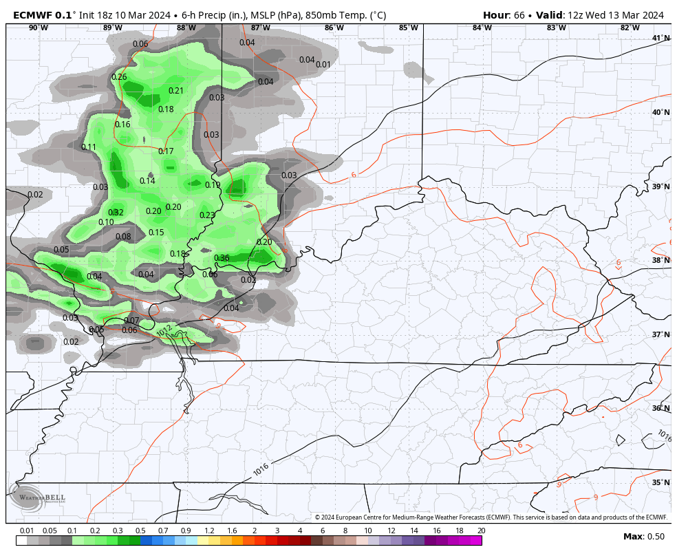
Temps today recover into the 50s for central and eastern Kentucky with the 60s in the west. Those 60s then surge eastward for Tuesday as even milder winds start to kick in. This may touch off a scattered shower or thunderstorm by Wednesday…
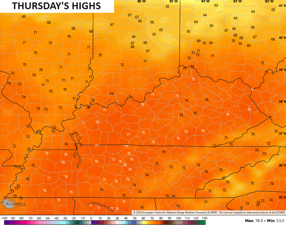
Temps behind this likely reach the 70s by Thursday…
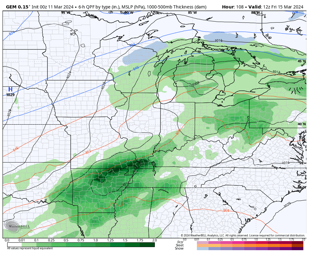
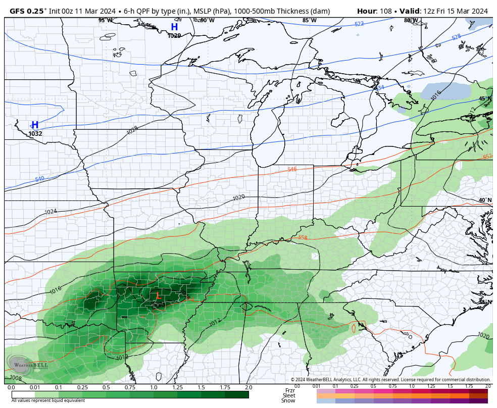
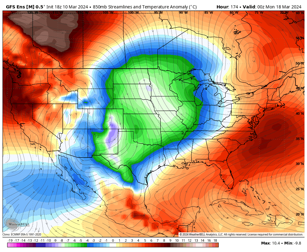
This is ahead of a storm system set to bring showers and some thunder Thursday night and Friday. That will be followed up by another storm system that has a chance to bring some winter weather behind it as temps crash.
Here’s the progression from the Canadian Model…
And the GFS…
This is something the various ensembles have been showing for a while now. I’ve been sharing the EURO Ensembles of late, but the GFS Ensembles are also on board with this prolonged cold snap potential with deep troughs digging in…
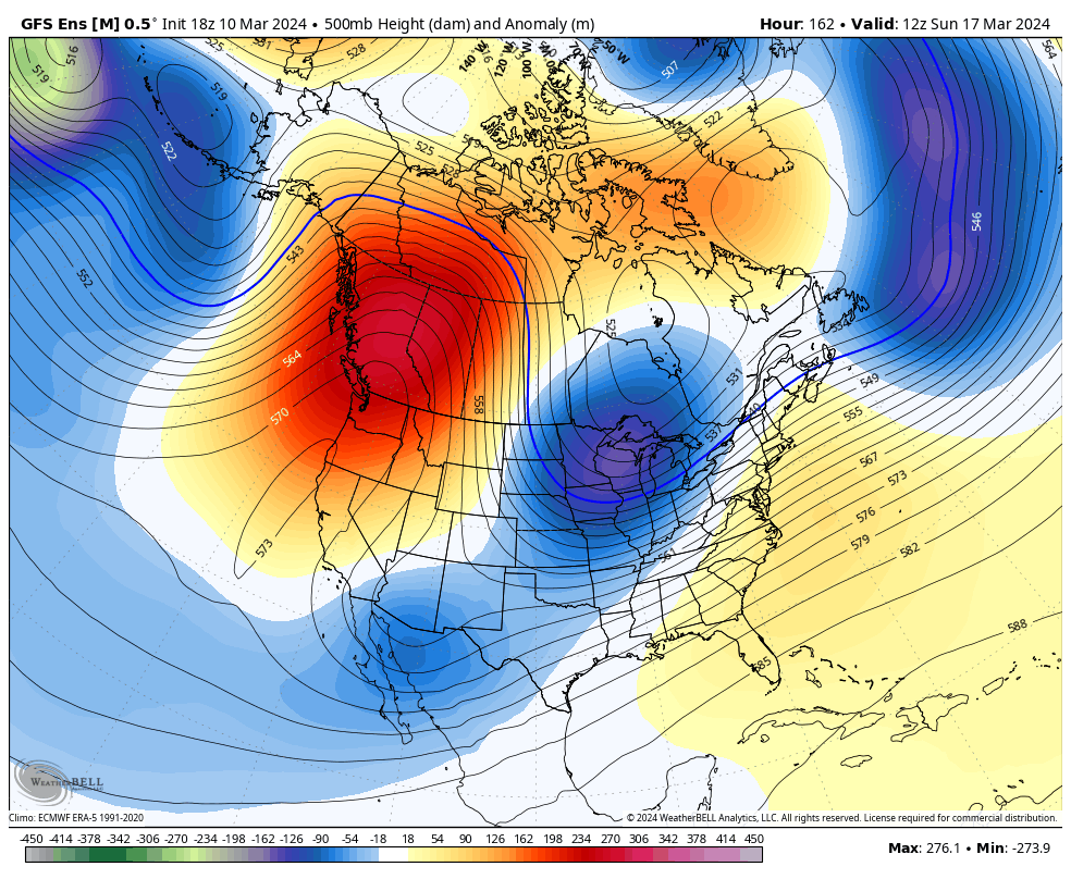
Check out the below normal temperatures…
I’ll throw you another update later today. Make it a good one and take care.

If it does snow it looks to be east of I-75 again.
Thanks Chris. Enjoy the pleasant spring temperatures this week. Worry about next week’s weather when It comes. Something tells me It won’t be that bad.
Have a great day !
The ensembles will be wrong.
I skip over the ensembles after what happened this winter.
Was 28 degrees when I got up, and then dropped to 27. Went outside for an armload of firewood – it’s definitely chilly. Even “crispy.” There go the blossoms on the saucer magnolias. Should be a good week for early spring cleanup chores.
That’s sad when blossom freeze on any plant. The whole concept of spring is the beauty of flowers and growth. The reproductive cycles of plants being destroyed is an act of the devil.
The temperature drop to 23 degrees here in Maple. Lots of frost over entire field in front of my house. Only trees beginning to bloom is the Red Maple. We are behind in the growing season compared to the towns and cities along the Ohio River.
It was cold this morning the wind still is. I just read this has been the warmest winter on record in 130 years hottest February globally ever. It won’t let me copy a link but it’s on news nation if you want to read it. We just keep heating up. I wish we would get out of this pattern or cycle or whatever you call it. I would love to go back to winter in the 70s well at least I have my memories.
I found out that global warming of the earth is not happening. This cycle we have been in for years is caused by the solar cycle we are in. When that changes we will return to our normal precipitation / temperature pattern.