Good Wednesday to one and all. Spring fever continues to run rampant across the state as temps continue to rise. This comes ahead of a late week storm system and a much bigger change coming for early next week. That one brings back colder weather.
Today features 65-70 degrees in most areas with a slight chance for a shower or thunderstorm. That small threat continues into tonight and Thursday with highs reaching deep into the 70s for Thursday on a strong southwest wind.
Showers and storms will then increase Thursday night and Friday as low pressure rolls through the region. Watch how the NAM handles this…
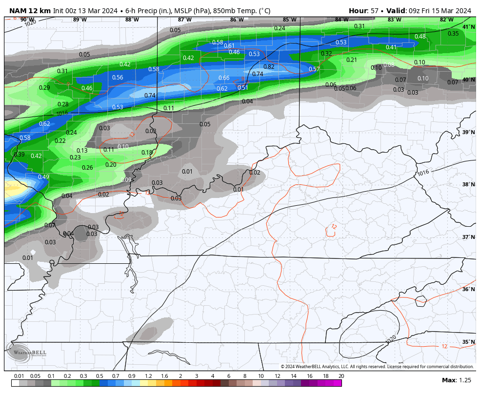
That would be some pretty stout storms that can put down a lot of rain in a short amount of time.
The Severe Weather Outlook from the Storm Prediction Center for Thursday shows western Kentucky in the low end threat…

I can’t rule out a strong storm or two around here on Friday. Here’s what the Friday Severe Weather Outlook shows…

Saturday looks good with a mix of sun and clouds and temps in the upper 50s to low 60s.
Another cold front then drops in here on Saturday with limited moisture. This may only spit out a stray shower ahead of it, but the cold behind it takes center stage. This blast of cold coming from Sunday night through Tuesday may even be accompanied by a few snowflakes.
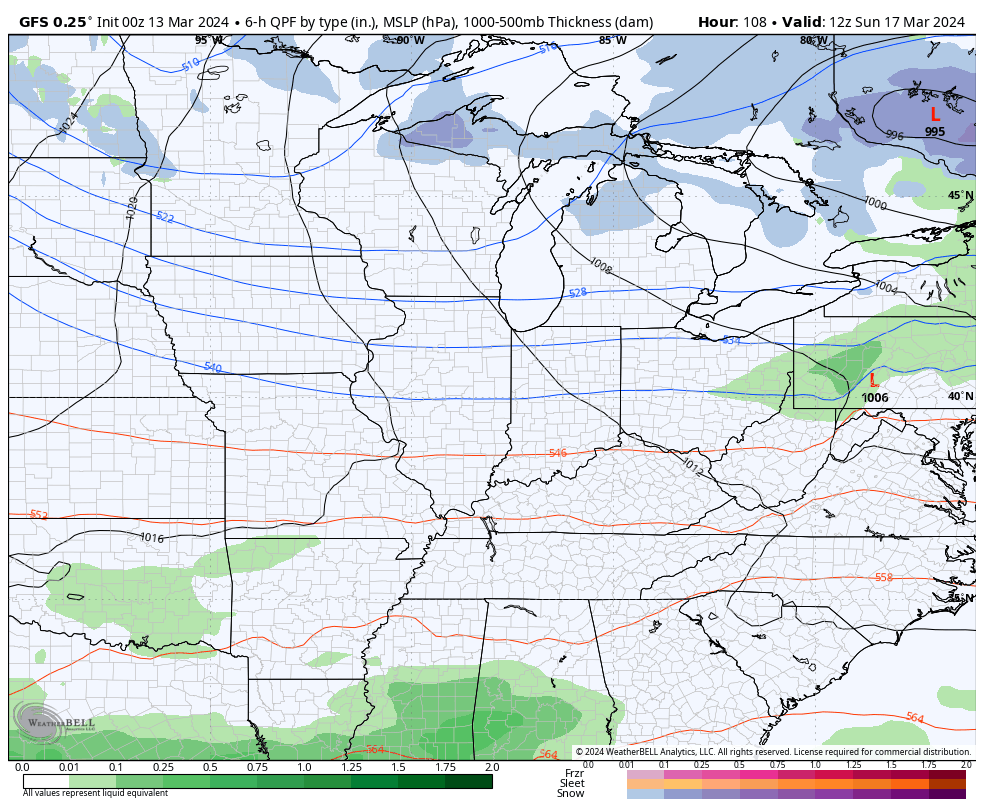
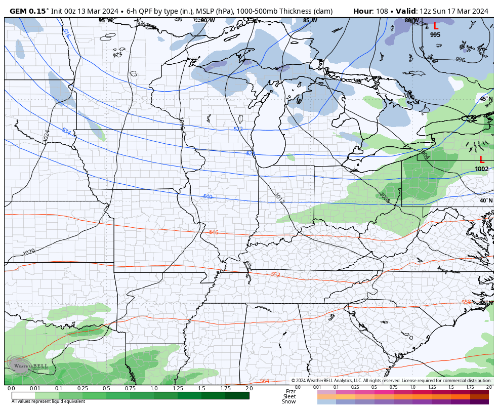
Flakes show up on both the GFS and Canadian Models…
GFS
CANADIAN
Lows reach deep into the 20s with wind chills that can briefly drop into the teens by Tuesday morning.
Temps rebound quickly for the rest of the week before we get another cold shot by the following weekend or week.
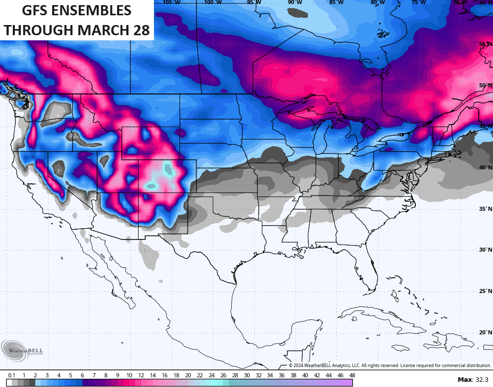
To illustrate the cold potential, the ensembles see the chance for flakes pretty far south over the next two weeks…
I’ll have another update coming later today so check back. Until then, I have your Kentucky radars up and running to follow any shower or storm action that goes up.

Enjoy the day and take care.

Not biting on the flakes.
Not biting on any thing shown any more.
Thanks for the update Chris. Have a great day !