Good evening, folks. It’s feeling the part of May across Kentucky through Thursday and that may be complete with a few strong to severe storms. This is ahead of a big pattern change that brings the chance for a touch of winter weather in here early next week.
Highs on Thursday reach the mid and upper 70s on a strong southwest wind. There’s the chance for some showers and storms trying to fire up during the late afternoon and evening, especially in the west and north.
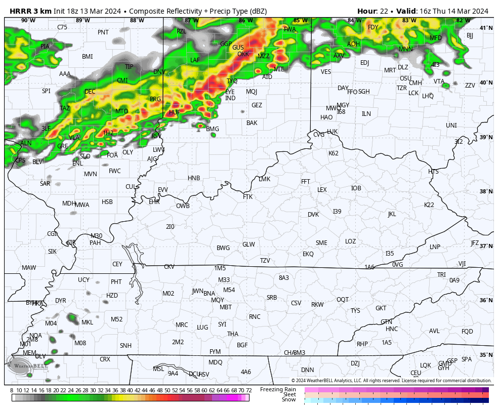
The HRRR is showing some late afternoon storms hitting the north…
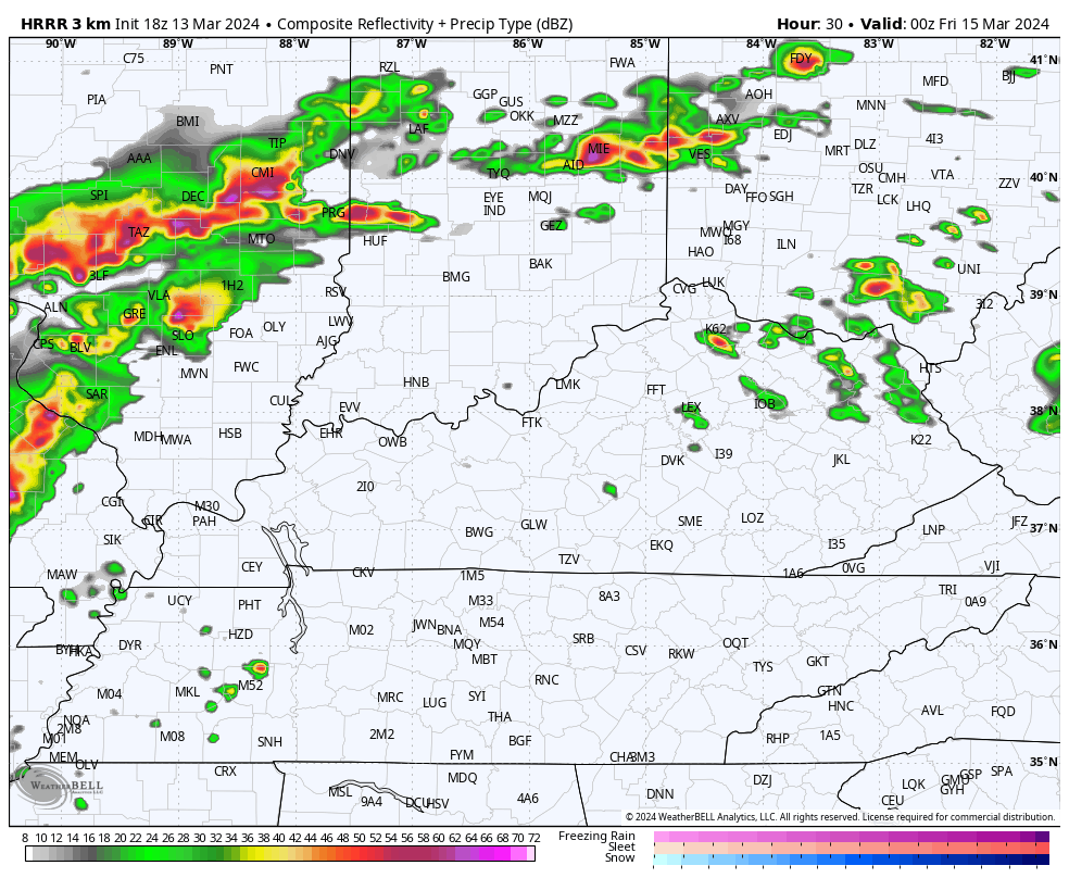
From there, rounds of showers and storms then rumble across the state Thursday night and early Friday. Here’s the future radar from the HRRR…
The Storm Prediction Center continues to edge the Thursday severe threat a bit farther east with the Marginal to Slight Risk areas into western and central Kentucky…

That risk may very well get pushed a bit farther east later tonight or Thursday.
Here are the individual severe weather risks for this same time period…


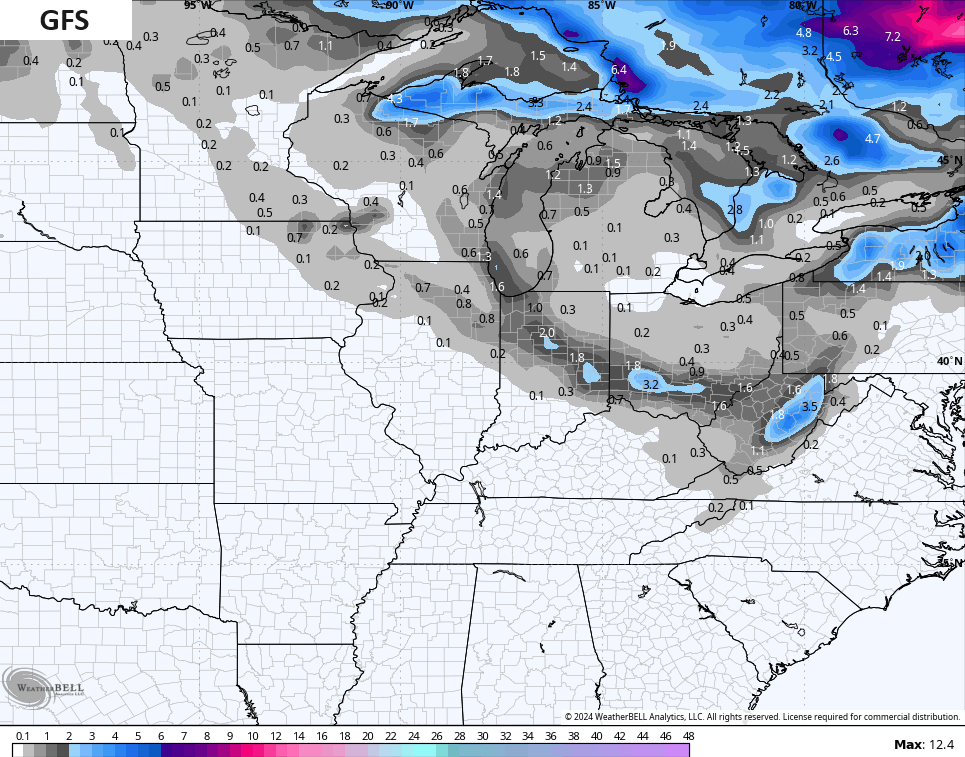
A major blast of cold air comes in from late this weekend and early next week. This is when the models are trying to bring some flakes into our region. A few models even have a clipper dropping in with a band of light snow.
Here’s the GFS…
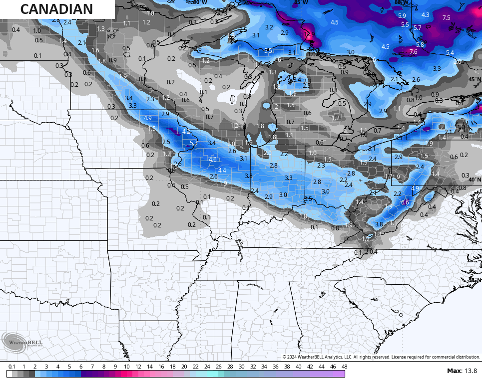
The Canadian is the strongest with the clipper…
The EURO is the weakest…
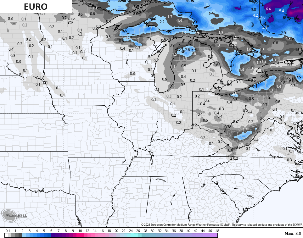
Either way, those models do bring the chance for some flakes into parts of Kentucky. NOOOOO!!!!!
Here are your radars to follow the showers and storms to our west…

Enjoy the evening and take care.
