Good evening, everyone. It’s a very active setup taking shape tonight as rounds of strong to severe storms target the region. This is along and ahead of the first of two cold fronts working into the region from the west over the next several days.
Wanna see something crazy? Check out this video from earlier today as a tornado crossed out of Indiana into Kentucky…
Absolutely insane video of a tornado crossing the Ohio River into Kentucky earlier today.
Video is from Jenny Craghead on Facebook. #kywx pic.twitter.com/6dRclNsCcH
— Chris Bailey️️ (@Kentuckyweather) March 14, 2024
WOW!
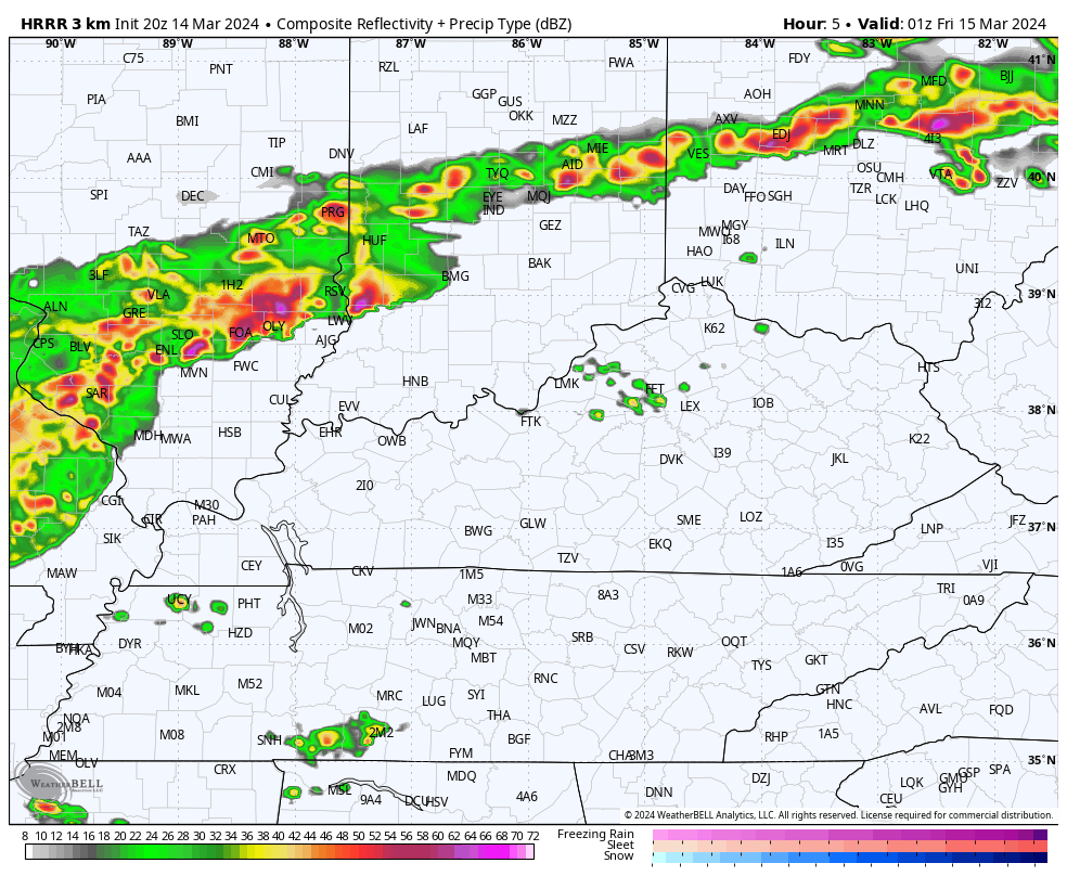
Severe storms are likely to roll across the state from late this evening into the wee hours of Friday morning. The future radar from the HRRR shows this well…
Damaging winds, large hail and a few tornadoes are possible as the storms push through.
Here’s the latest Severe Weather Outlook from the Storm Prediction Center…

The individual threats from the Storm Prediction Center for this same time period…


I will have the latest on WKYT News on the CW tonight at 10 and on WKYT-TV at 11pm. Of course, I’ll be on air as needed into the overnight.
Here are your severe storms tracking tools to keep you company…

Current watches

Possible Watch Areas

Enjoy the evening and take care.
