Good Friday, folks. Rounds of strong to severe storms rumble across the region before the sun comes up with scattered showers and storms for the rest of the day. Better weather blows in behind this for the weekend before a major cold blast moves in early next week.
As mentioned, the severe storms threat is over before the sun comes up. Those pesky showers and rumbles of thunder then remain through much of the day with the greatest concentration across central and eastern Kentucky.
Here are your radars for the early morning severe weather and for the scattered stuff later in the day…

Temps today are in the 60s with a gusty wind along and ahead of a cold front pushing through.
Saturday’s weather is pretty nice with low and mid 60s with a mix of sun and clouds.
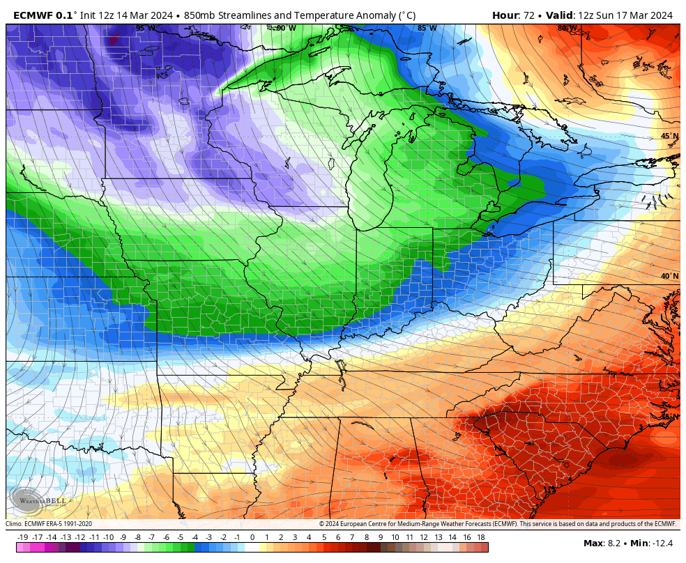
The next cold front has very little moisture with it, but it means serious business in terms of cold air coming in behind it. This shot is loaded with barney colors, representing well below normal temps…
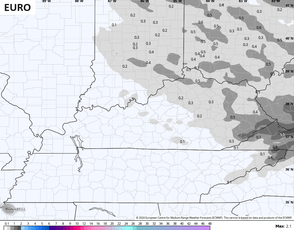
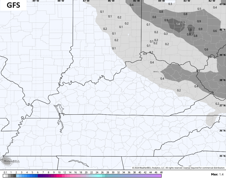
That strong northwest flow on Monday may spit out some snow flurries or snow showers across areas of northern and eastern Kentucky, especially. The EURO and GFS are seeing this potential…
Temps on Monday range from the upper
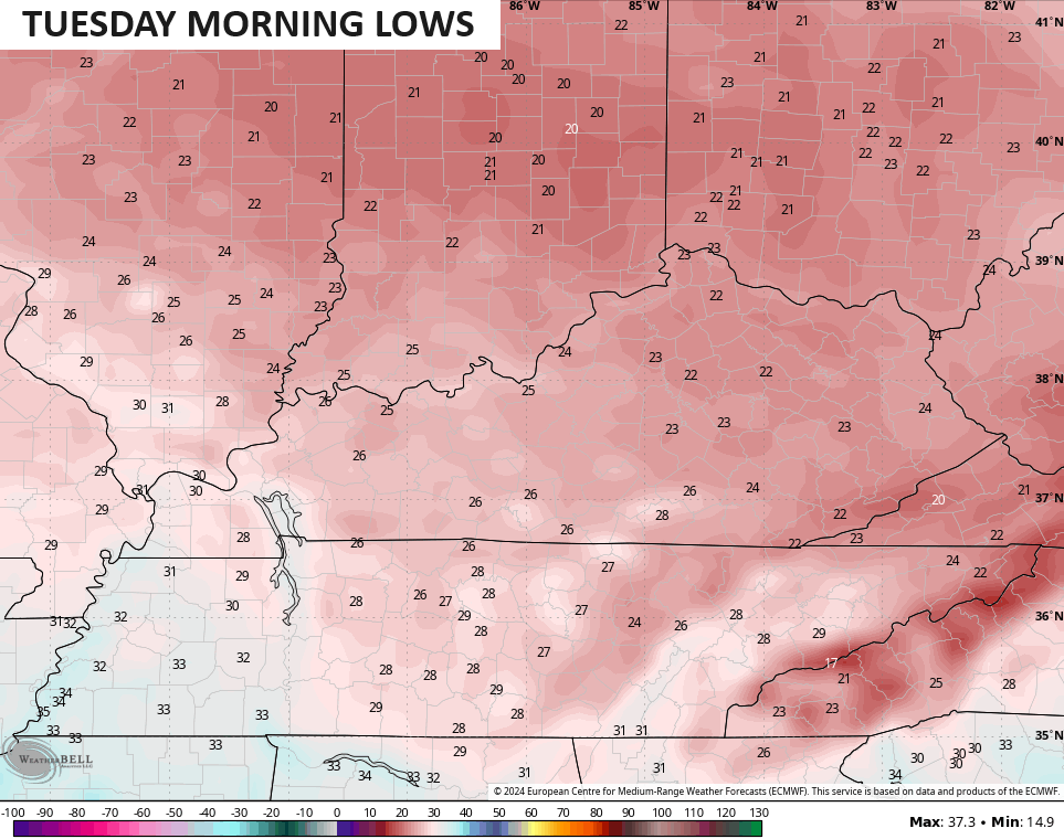
Temps will stay below normal through the middle of the week before bouncing back by the end of the week. This is likely part of a pattern that features additional wild temp swings through the rest of the month. That can mean more severe storms threats and some additional chances for snowflakes.
I’ll have another update later today so check back. Make it a great Friday and take care.

The remaining cool shots and potential flakes are nothing to worry over. In and out very quick.
Unable to post more than a couple of words.
I wondered why everyone was being so quiet.