Good Saturday, everybody. It’s a much better weather day taking shape but a big blast of cold air is on the way. This arrives Sunday night and Monday, kicking off a pattern that may throw a few more cold shots at us before March is over.
Let us begin with today and roll forward. Highs today are generally in the 60s with a mix of sun and clouds. Overall, this is a really nice day and likely to be the best we see for a while.
Sunday finds our cold front dropping in with gusty winds and temps starting to come down. This front doesn’t have any moisture to work with, but it sure has the cold crashing in behind it…
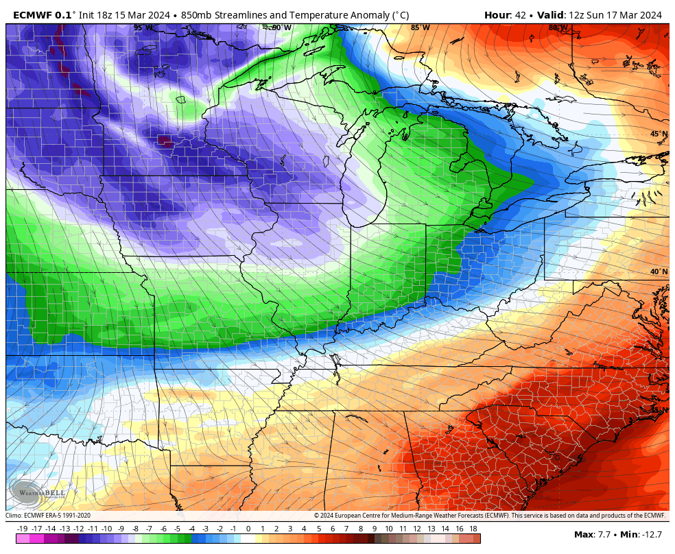
There’s even the chance for a few flakes to show up in the north and east on Monday as highs reach the upper 30s to low 40s following a morning in the 20s.
Tuesday morning will find lows closing in on 20 degrees and wind chills in the teens…
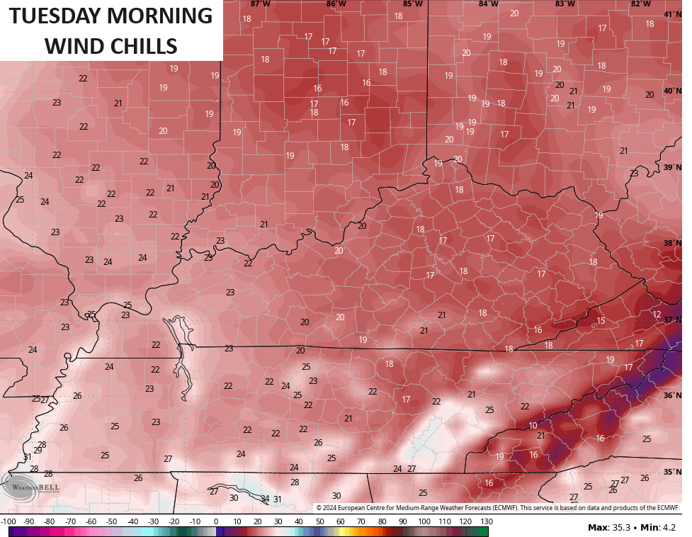
Back to back mornings deep into the 20s will cause some issues to all the tender plants and vegetation blooming some 3 weeks ahead of schedule.
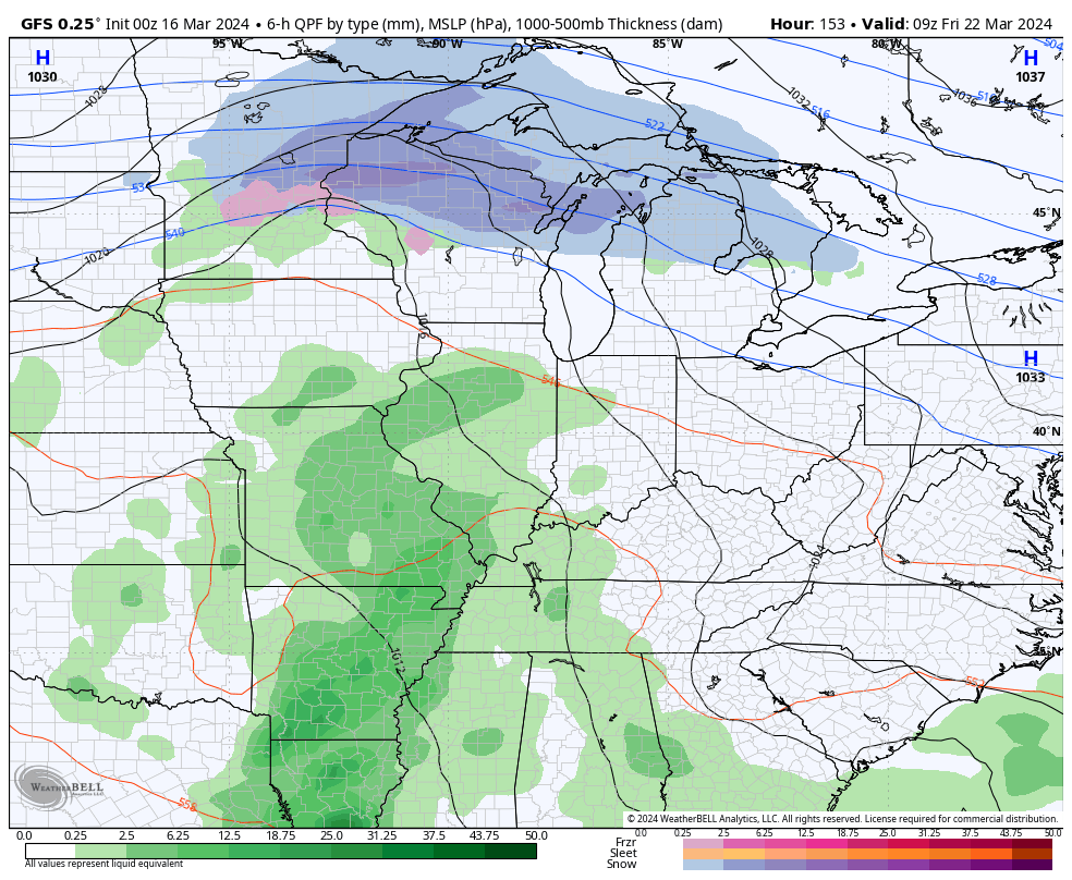
Temps moderate back toward the 50s for the middle and end of next week as our pattern starts to get very active once again. One system works in here by late Thursday and Friday with another one behind it late next weekend or early the following week. That one could unlock another shot of cold.
Here’s the GFS with these two systems…
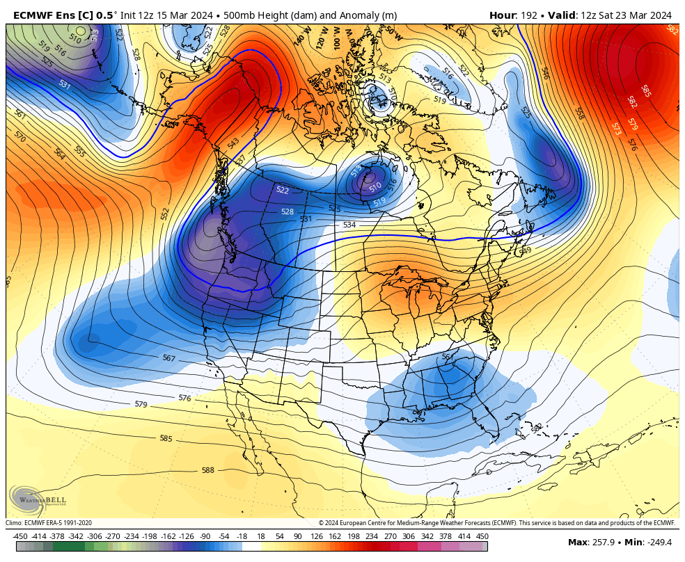
This is part of the overall pattern featuring big troughs sweeping through the eastern half of the country for the last half of March. Those show up well on the EURO Ensembles…
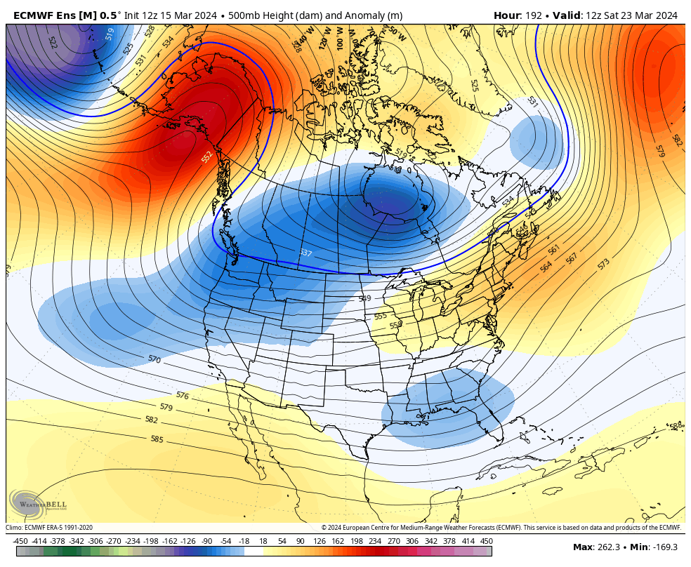
The Control Run of the EURO Ensembles is even uglier…
True spring is still a ways away, folks.
Enjoy your Saturday and take care.

Honestly… I don’t mind… we have a lot more months of HOT/warm weather than we do cold.
Ensembles aren’t reliable.
The further into the future these models look, the more our warming climate makes them inaccurate. When you amplify chaos, the results are invariably chaotic.