Good Monday, everyone. It’s a whole new weather pattern we’re dealing with out there today as winter throws a little punch our way. Very cold temps and a few snowflakes are kicking off a week that’s colder than normal. This setup leads us into another active pattern starting late this week and going through next week.
Temps today range from the upper 30s to low 40s for highs as a strong northwest wind makes it feel even colder. This same northwest wind can spit out a few snowflakes from time to time with the best chance being in the north and east.
The HRRR future radar is likely overdone, but it even shows a few snow showers trying to roll through this afternoon and evening…
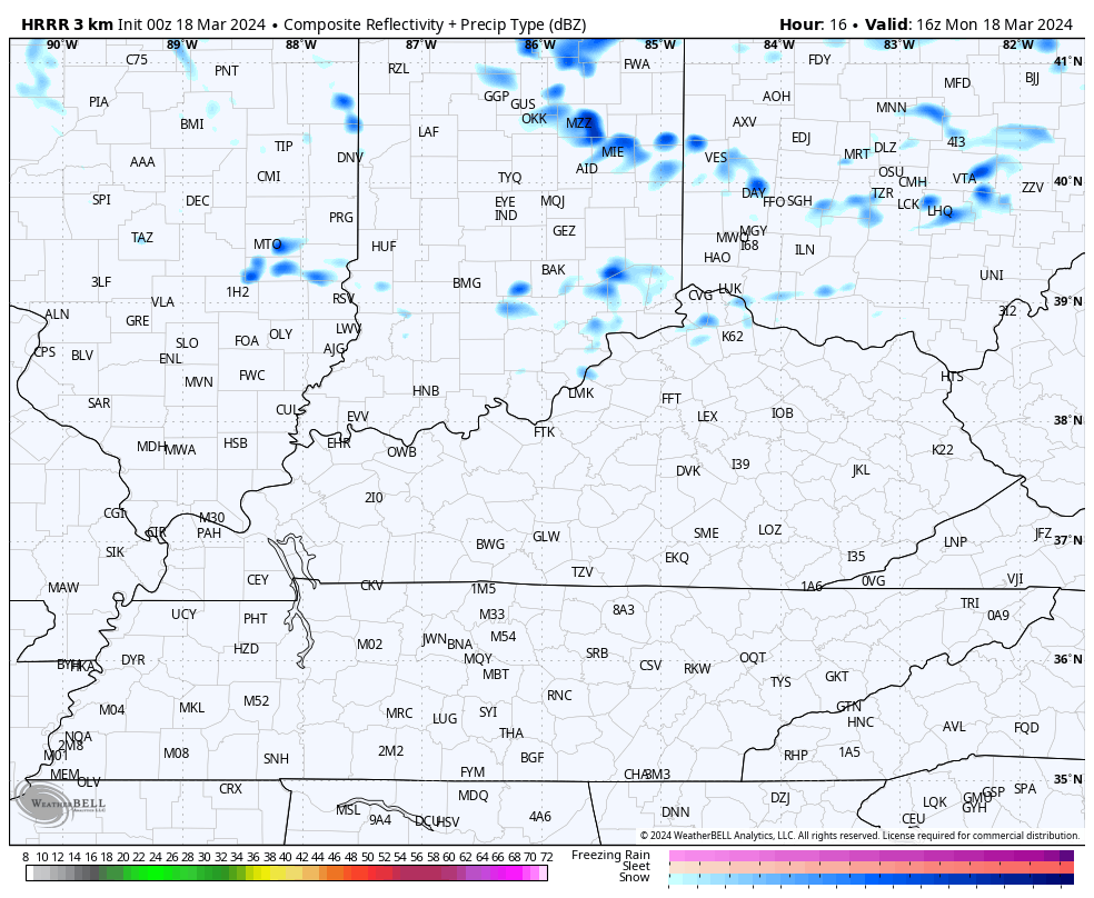
Your regional radars are on duty to help walk you through the flakes…

Temps tonight drop deep into the 20s with
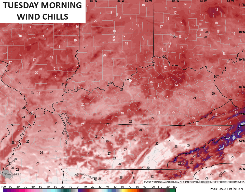
Temps rebound into the upper 40s to mid 50s on Tuesday with temps ranging from the mid 50s to low 60s for Wednesday. Both days look to feature a mix of sun and clouds.
From here, the pattern gets very active with one system coming at us from late Thursday into the start of the upcoming weekend. The evoultion of this remains a work in progress, but it’s likely to bring chilly temps back in here right behind it…
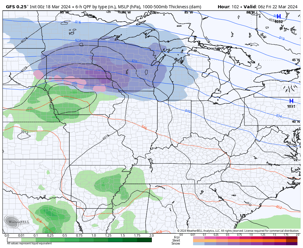
The pattern for late this weekend and early next week features a stronger storm likely developing in the Plains. This system has spring air in front of it and wintertime air behind it, meaning it’s likely a severe weather maker from the Plains states and east, potentially including Kentucky.
The models go about things differently with the GFS bringing a series of lows through here…
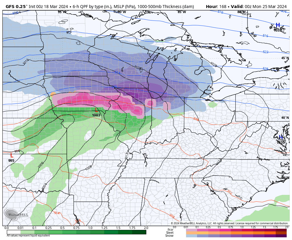
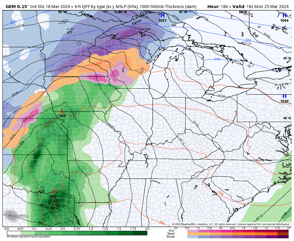
The Canadian Model has the one monster Plains storm…
I may drop by for another update later today. Make it a great Monday and take care.

Come on warm weather.
One thing that seems certain to me is that the increased rate of evaporation due to warmer than normal Gulf of Mexico water temperatures has led to an uptick in dewpoint levels in the Gulf States. Also, the strengthening ENSO-Neutral condition and the continuing split flow jet stream will lead to an increased flow of warm, moist unstable air from the south.
These factors indicate to me that we can expect to see above normal severe weather in the northern Tennessee and southern Ohio Valleys during the late March through early May time frame.
If all this results in a hot, but not too dry Summer, I’m all for it, Joe.
It is cold out I mean cold. Some people have seen a few flurries near me. Wonder how long this will last?