Good Tuesday, everyone. Today is a bit better than the true winter weather we had on Monday, but the forecast still can’t find the true start to spring. We have a lot of ups and downs in the temperature pattern and this will likely lead to additional issues in the next few weeks.
Temps today start in the 20s and finish in the upper 40s to middle 50s with a mix of sun and clouds.
Another cold front then moves in from the north late Wednesday. This front has no moisture with it, but it does usher in another blast of cold air. This knocks the lows back into the 20s for many by Thursday morning…
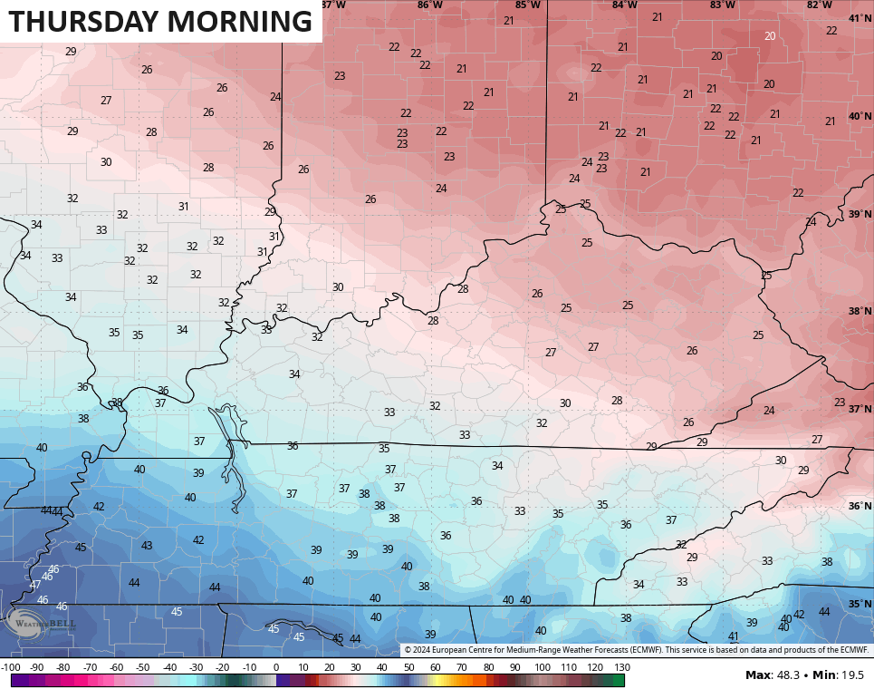
Wind chills will be in the upper teens again.
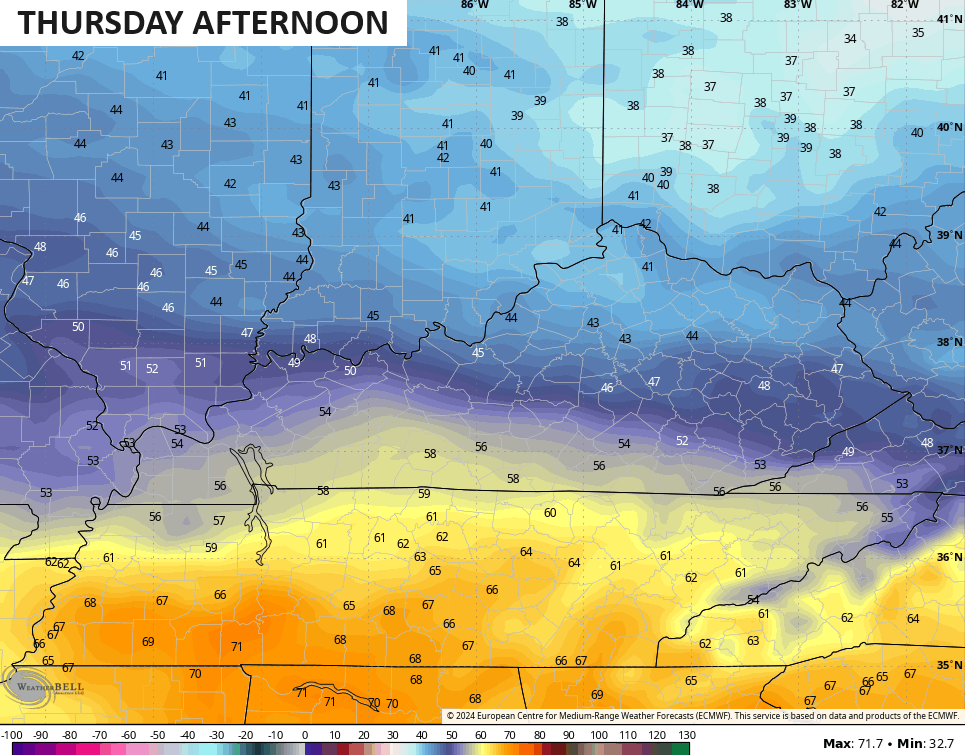
This boundary hangs around the state through Thursday with much colder air across the northern half of Kentucky. Highs in the low 40s will be noted in these areas with the far south pushing 60…
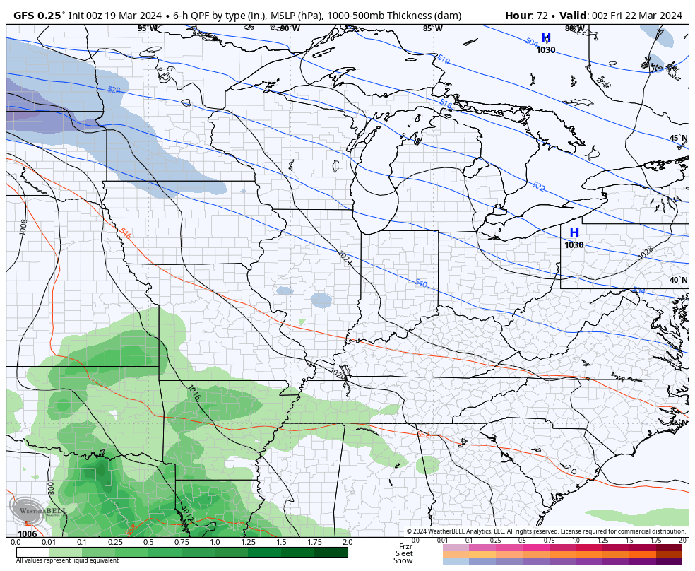
The next system moves in on Friday with a few showers coming along for the ride…
Better weather returns behind this for the weekend with skies becoming partly sunny.
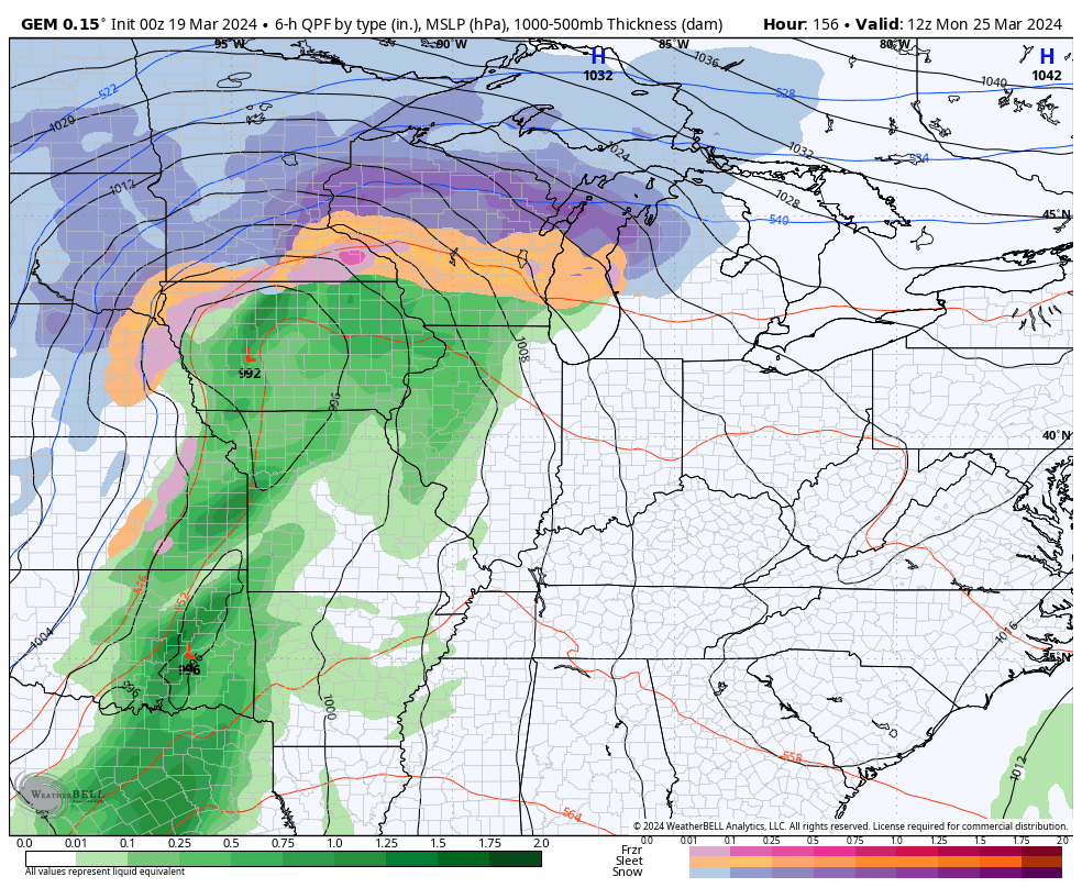
Low pressure then develops across the Plains by early next week and it has a spring surge in front of it with another blast of winter behind it. This could bring some big storms into the region ahead of it.
Here’s the GFS with this setup…
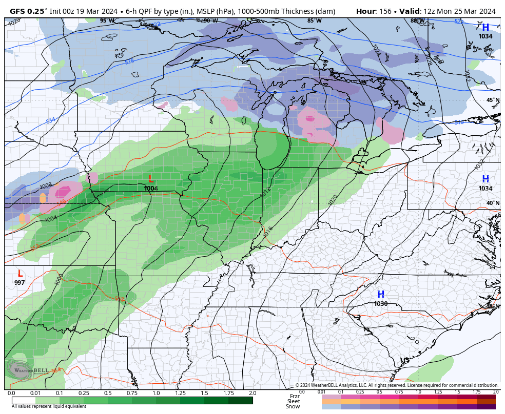
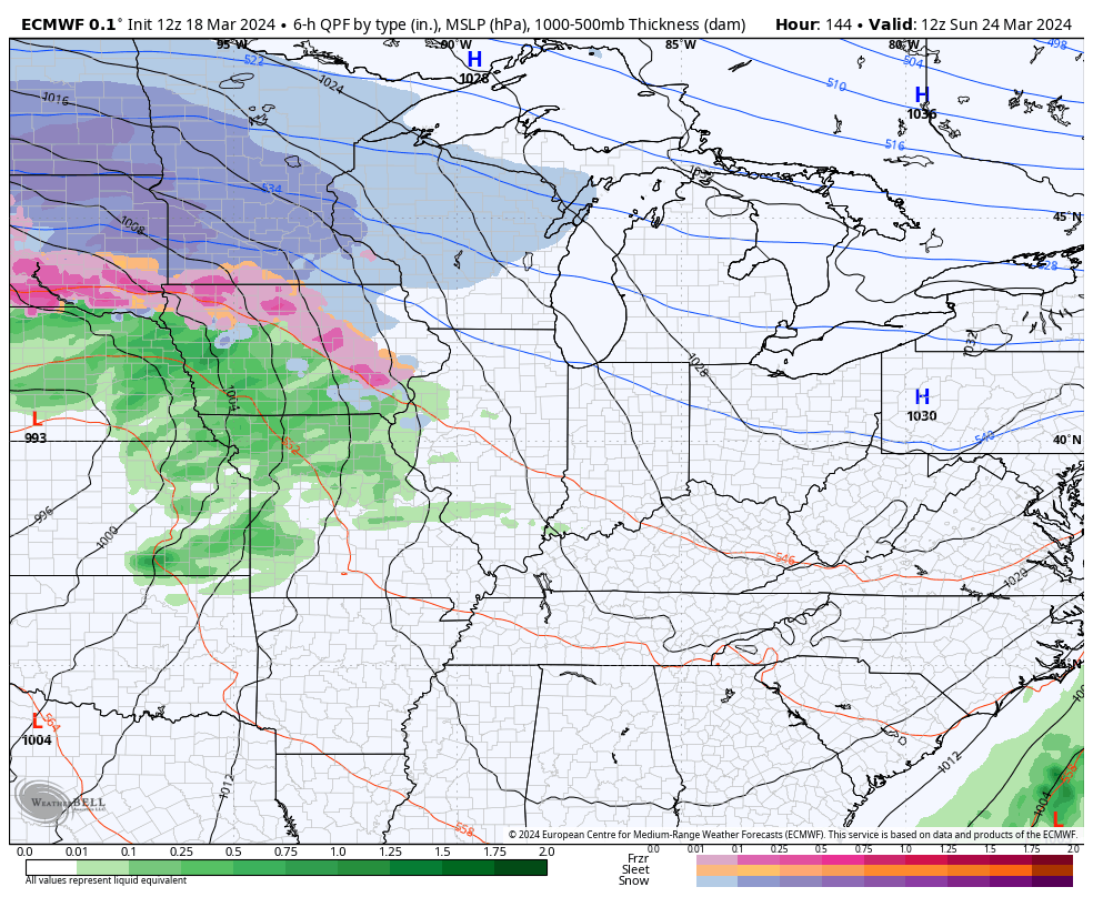
The EURO and the Canadian have that system and then follow it up with more of a southern storm track that could have some winter on the backside of it.
CANADIAN
EURO
If we look longer down the road we find the EURO Weeklies FINALLY showing a better pattern taking over once we head into April. The 30 Day Height Anomaly Map shows a milder setup…
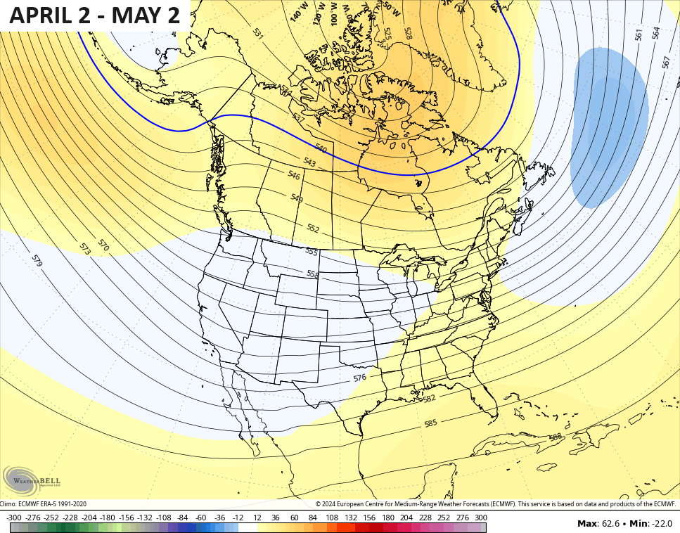
That setup is also one that has the look of a frequent severe weather maker for our part of the world.
Make it a terrific Tuesday and take care.

Interesting bits of data. Scroll down to “soil moisture.” Correlates to what’s happening in Fayette and Clark counties.
https://www.weather.gov/media/lmk/Hydro/SpringFloodOutlook2024_3_LMK.pdf
Let’s hope April is warm.
Warm, moist air to the south, cold dry air to our north, and a serious dip in the jet stream forecasted next Tuesday the 26th puts Kentucky in the battle ground. Historically in South Central Kentucky, when we’ve seen wide temperature swings in March, then late March, April and early May frequently experience increased severe storm activity.
https://weatherstreet.com/models/gfs-jetstream-wind-forecast.php11
Sorry, bad link in previous post:
https://weatherstreet.com/models/gfs-jetstream-wind-forecast.php