Good Friday to one and all. A few showers are rolling into the region today as another cold front works in from the northwest. This boundary knocks the temps back down for the weekend before a bigger system arrives early next week.
Today’s showers are very scattered and not everyone sees them. The action increases a big this evening into the overnight, mainly across the eastern half of the state. Here are your radars to follow along…

Temps today range from the mid 50s to mid 60s depending on where you are.
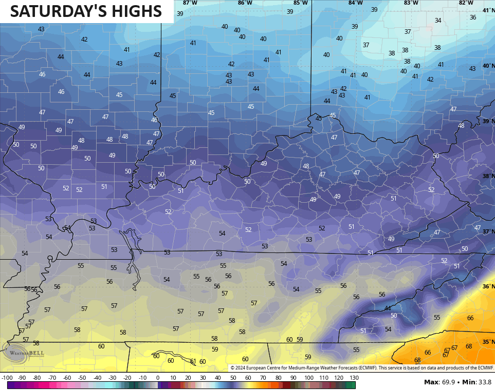
A few showers linger into the start of Saturday with slow-clearing from the northwest through the day. A northwest wind keeps temps pretty chilly through the day and the trend is for many of us to stay in the 40s…
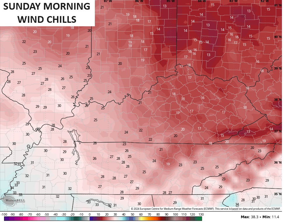
Lows by Sunday morning are back into the 20s with gusty winds making it feel MUCH colder. Wind chill temps to start Sunday will be in the mid and upper teens for central and eastern Kentucky…
The rest of Sunday looks good with temps rising into the 50s with a mix of sun and clouds.
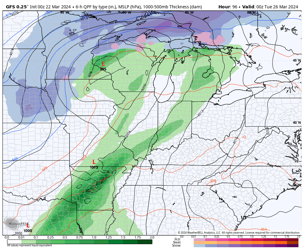
Monday continues to look like the best day with temps hitting 65-70 on a gusty southwest wind. This wind is ahead of low pressure working through the Plains, en route to the Great Lakes. This drags a cold front across the state with the chance for a wave of low pressure along it. The end result will be gusty showers and some thunderstorms…
Chillier winds move back in here behind that for the middle of next week with the active pattern continuing. That also means we keep the back and forth temps going.
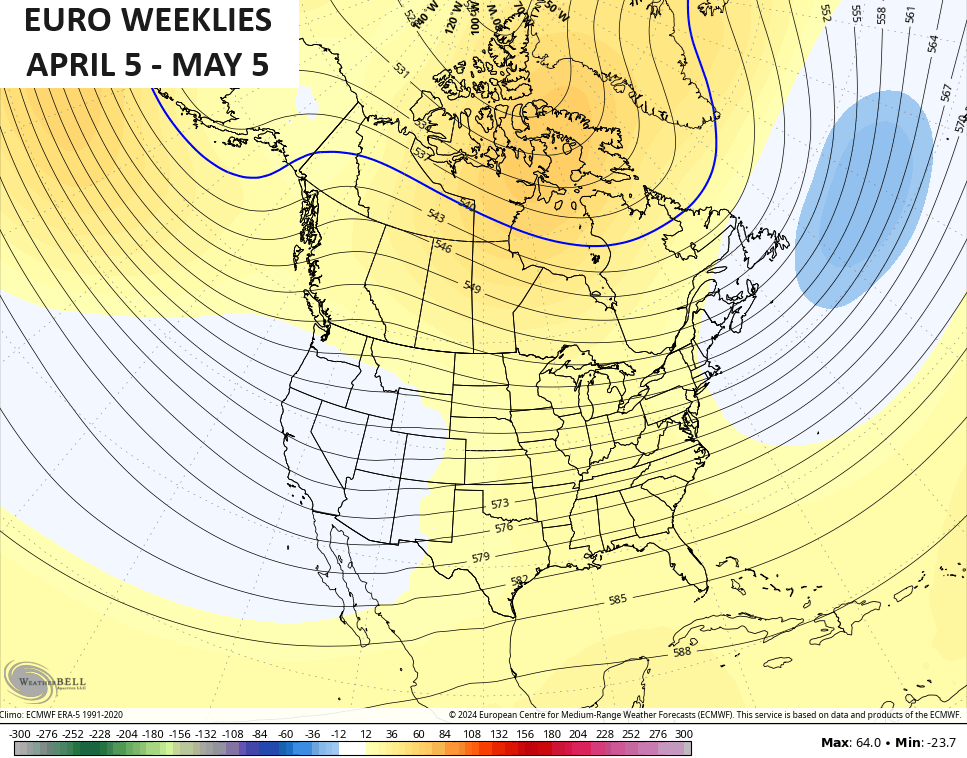
The EURO WEEKLIES continue to slowly come around to a much milder look as we get into April. The latest 30 day 500mb height anomalies chart from April 5 through May 5 shows much more ridging into the eastern half of the country…
True spring!!!!
Enjoy your Friday and take care.

Those weeklies would be nice if they verified.
Thanks Chris. Looks like we are going to get our split, zonal flow back. Hoping it doesn’t cut off our chances of receiving some good soaking rains in the coming days ?
Have a fantastic Friday everyone !
Spring outlook ( A M J )
https://www.weather.gov/media/lmk/climate/2024_Ohio_Basin_Spring_Hazard_Outlook.pdf
I have as much faith in the Ensembles as I do in UK basketball.
Same here, March madness isn’t the same as it used to be. Cal has ruin the fun of it.
I only went to my high school basketball games sometimes in the snow.