Good Saturday to one and all. Chilly winds and stubborn clouds dominate much of our day as we get set to kick off another busy pattern. This starts with a storm system moving our way by Monday night and Tuesday. This brings showers and storms back into the bluegrass.
Speaking of, a few lingering showers will be noted out there early today across the eastern half of the state. Here are your radars to follow the early day action…

Clouds slowly break from west to east today as temps struggle to get out of the 40s for most of central and eastern Kentucky. The west is best with temps in the 50s and more sun.
Sunday starts frigid with lows in the 20s and wind chills in the teens. This cold start to the thermometer will get better as the day wears on. Highs reach the 50s for much of the state with some 60s in the west.
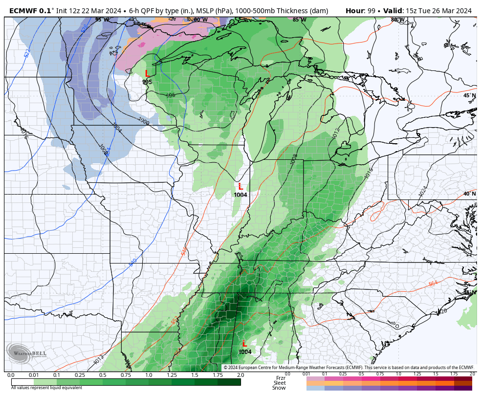
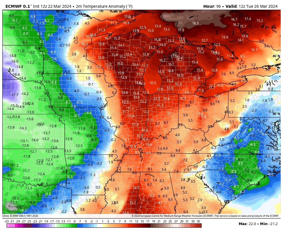
Southwest winds gust up on Monday with temps 65-70 for many. This is ahead of a cold front set to move in here for Tuesday. As the front moves in, low pressure develops along the front and moves through here. That brings fairly widespread showers and some thunderstorms…
The above normal temps ahead of this front get wiped out pretty quickly with another blast of cold behind it for the middle of the week…
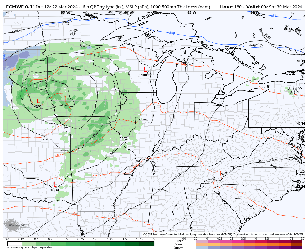
Temps rebound after that as a couple more systems bowl our way from the west, starting next weekend into early the following week…
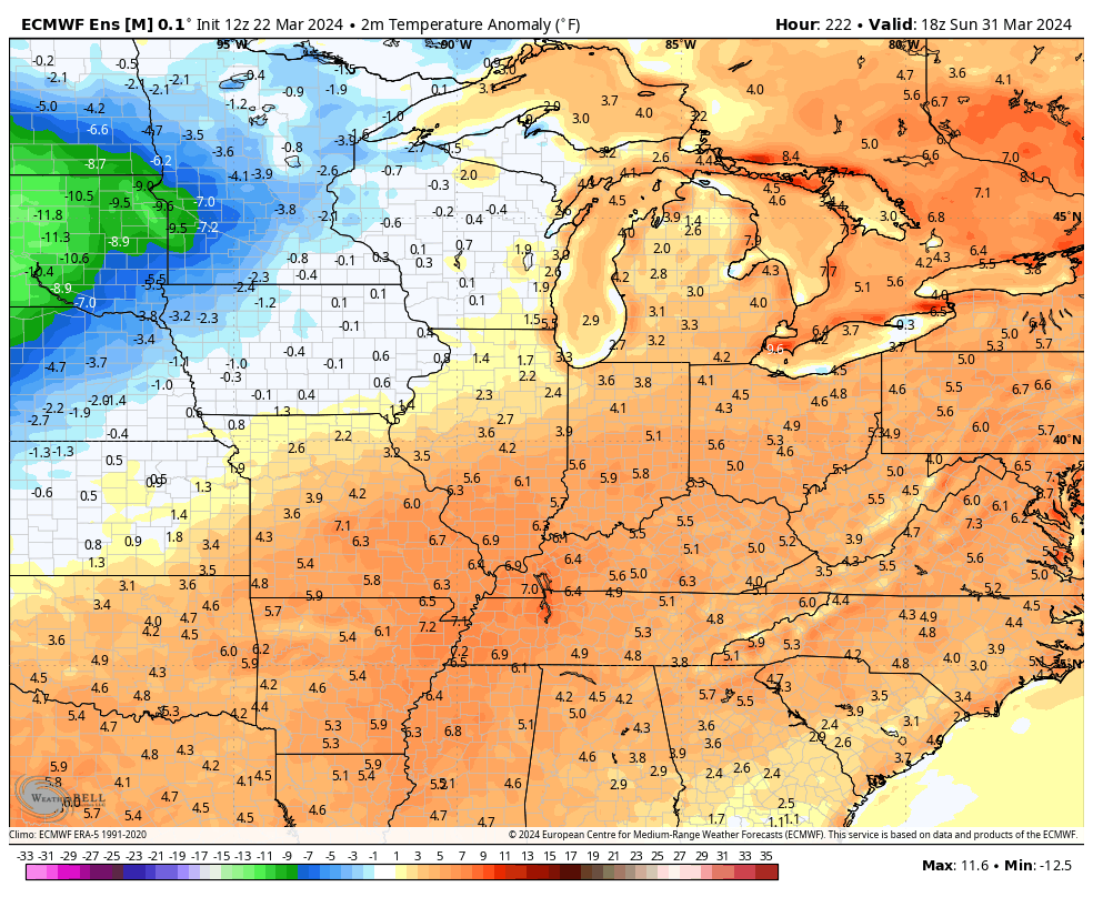
That type of a flow likely means above normal temps for the close of March and the start of April. However, another below normal pattern may kick in during the first week of the new month. That’s exactly what the EURO ENSEMBLES are showing…
Awwwww, springtime in Kentucky! Nothing like back and forth temps.
Enjoy the day and take care.

Funny how the Euro weeklies were showing above normal for April now this. This is any long range model is never to be trusted.
Thanks Chris. Yesterday, I viewed the snowstorm on the storm chaser’s site. The snow line has definitely moved way north over the past several years. I kind of wonder if our area will ever have those late snow storms like we had in the distance past. Don’t really care for the spring weather we have here in Kentucky now days. Already, blooming trees and shrubs had their flowers destroyed by the hard freeze. Sad for the garden centers and plant collectors, but this is what we get when we don’t have winter weather and sustain cold during the winter months. The rains predicted for Tuesday will most likely be light events and not widespread. I hope and pray that the severe weather ( tornadoes ) are not going to happen and the cool dry weather stays for the remainder of the spring months.
My Sister sent me this youtube video on the April 8th solar eclipse. It’s biblical prophecies as to what may happen after the eclipse occurs. Warning very scary ! Here’s the link :
https://www.youtube.com/watch?v=3_mcNX99VaU
.08” of rain yesterday and none since midnight. Holding out hope for the Tuesday/Wednesday system. Have four good-sized burn piles, ready to go, but it’s not gonna happen until conditions improve.
We only received 0.01″ of rain. Thinking about watering the one plant I have left tomorrow when it gets warmer. I no longer have any confidence on any weather forecast these days.
It’s so tempting to go out and plant.
But I know it would be a big mistake.
I always transplanted my Azalea liners after June 1st, but that was when I was living in Indiana. I think it would be safe to plant after May 15th in Louisville. No one really knows in this climate we are in these times.