Good Sunday to one and all. Better weather is blowing into the region today as we get set for another potent storm system and cold front to move through early in the new week. This brings some big-time winds to go along with showers and storms and another temp crash.
Let’s begin with today and roll forward.
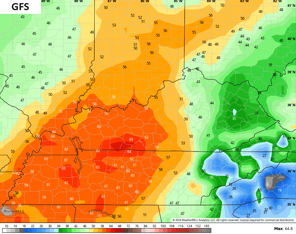
Temps this morning are frigid with 20s for most of the state. Gusty winds give us a wind chill in the teens to start the day. Temps recover very well this afternoon as sunny skies help boost temps into the 60s for the west and south. Highs across the rest of the state hit the 50s.
Low pressure is working out of the Plains toward the Great Lakes Monday into Tuesday. This is bringing a major snowstorm from much of the northern Plains into the upper Midwest…
This same system drags a cold front across Kentucky on Tuesday. This front may have a wave of low pressure developing along it that would enhance the showers and rumbles of thunder in our region…
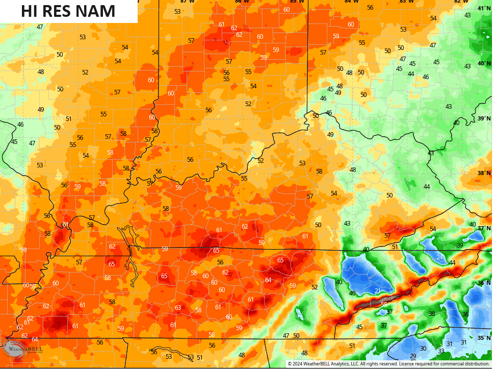
Ahead of all this comes a serious blast of southwest winds from late Monday into Monday night. Some of the models are going crazy with the gusts across the western half of the state and are spitting out 60mph+ gusts.
The NAM fam is leading the charge…
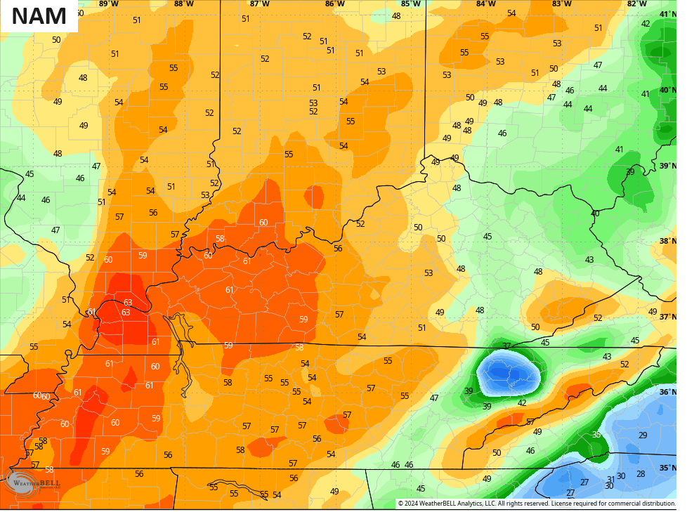
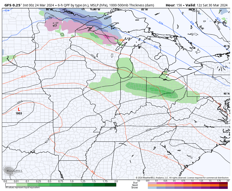
The GFS agrees…
Wow!
Chilly winds blow in behind this for Wednesday and Thursday before the numbers bounce right back up later in the week and weekend. That whole temp climb may come with a series of systems working through here with colder air pressing back in from the north…
The longer range look on the EURO Ensembles continues to show blocking across Greenland which helps deep troughs swing across the country thgrough the first few days of April…
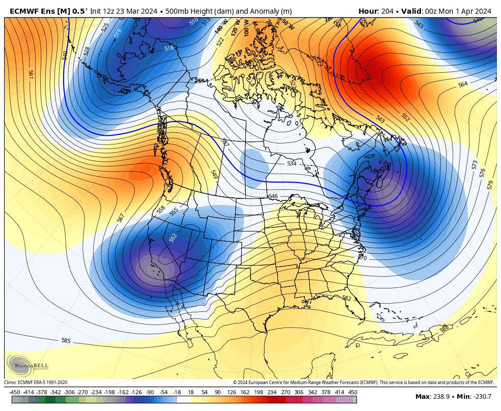
The Control Run of the EURO ENSEMBLES is even uglier…

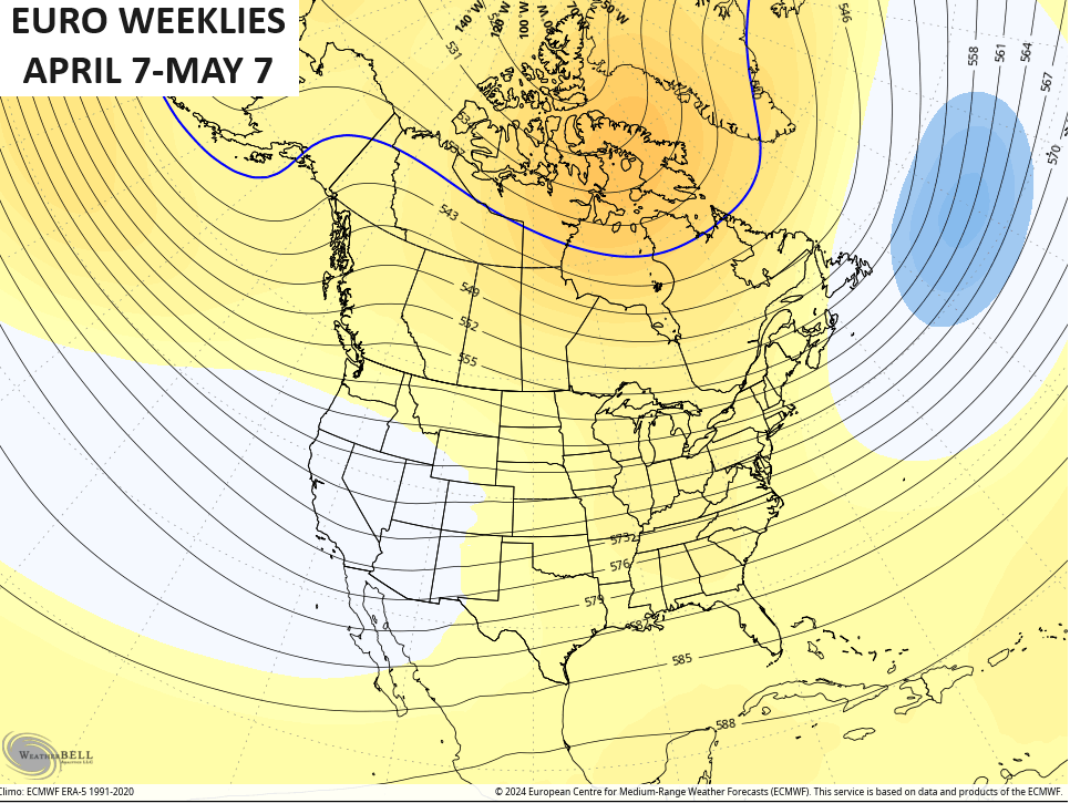
In the meantime, the EURO WEEKLIES show the pattern turning much milder for the rest of April into early May…
Bring. It. On.
Enjoy your Sunday and take care.

Ensembles = liars
what would really be a slap in the face if the ensembles turned out to be right this time…. as it stands we don’t trust them since they’ve been so wrong… but what if they turn out to be right? Then we will never know whether or not to trust them. LOL
A penumbral lunar eclipse will occur on the night of March 24-25, when the moon is scheduled to slip into the Earth’s outer shadow, the penumbra
Eclipse begins at 12:53 a.m. EDT, 11:53 p.m. CDT
Maximum eclipse will occur at 3:12 a.m. EDT, 2:12 a.m. CDT
Eclipse will end at 5:32 a.m. EDT, 4:32 a.m. CDT
Broken clock analogy.
Per MarkLex
I bet it will be cloudy during the lunar eclipse.
Because that is the way we roll here in Ky.