Good Monday, everybody. We have a potent storm system lifting from the Plains states toward the Great Lakes over the next few days. This system brings a ton of wind to the region today and tonight and may also spawn some strong to, locally, severe thunderstorms.
Let’s break down the threats of the next few days:
WINDS
- Wind gusts increase throughout the day from west to east.
- These are non-thunderstorm wind gusts through the day.
- Wind gusts of 50-60mph will be possible across the western half of the state this afternoon and evening.
- Gusts into eastern Kentucky won’t be nearly as high and should only reach 30-35mph.
- Wind damage is possible across western and central Kentucky.
STRONG/SEVERE STORMS
- A few strong storms work into western Kentucky this evening. There’s a low end threat for a few storms to go severe.
- This line of showers and storms spreads eastward across the state overnight.
- Showers and storms taper off early Tuesday with some clearing showing up.
- This clearing is along and ahead of the cold front moving through Tuesday afternoon. Temps surge toward 65-70 along and ahead of the front.
- We have to be on guard for a broken line of strong to severe storms developing with this front.
- The greatest threat for local severe storms will be across central Kentucky.
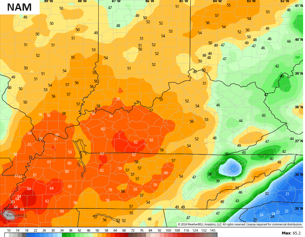
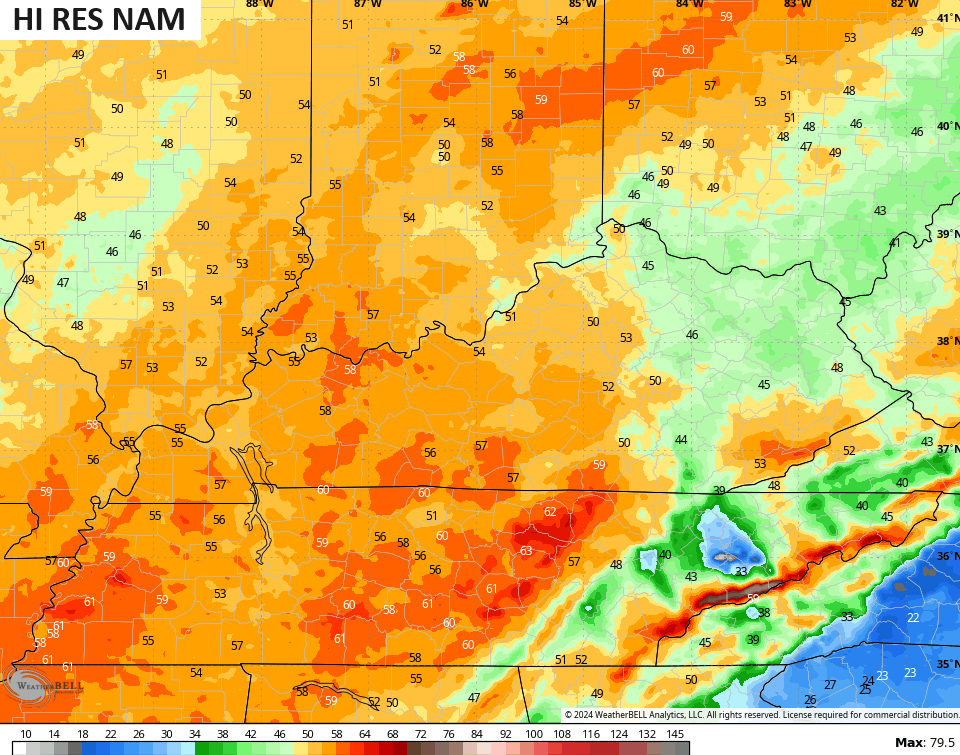
As far as the winds are concerned, the models continue to spit out some 60mph gusts across the western half of the state…
Here’s Today’s Severe Weather Outlook from the SPC…

The Storm Prediction Center continues with a low-end threat for severe storms in our region for Tuesday…

Here are the individual severe weather risks for this same time period…


Chillier winds come in behind this front for Wednesday and Thursday with the numbers going below normal once again. That’s followed up by another temp surge for the weekend as we watch a few storm systems sweep through here.
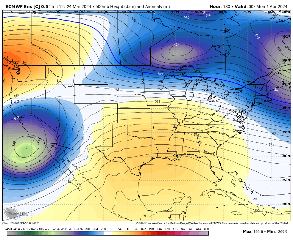
The longer range pattern into early April continues to look active as deep troughs roll across the country…
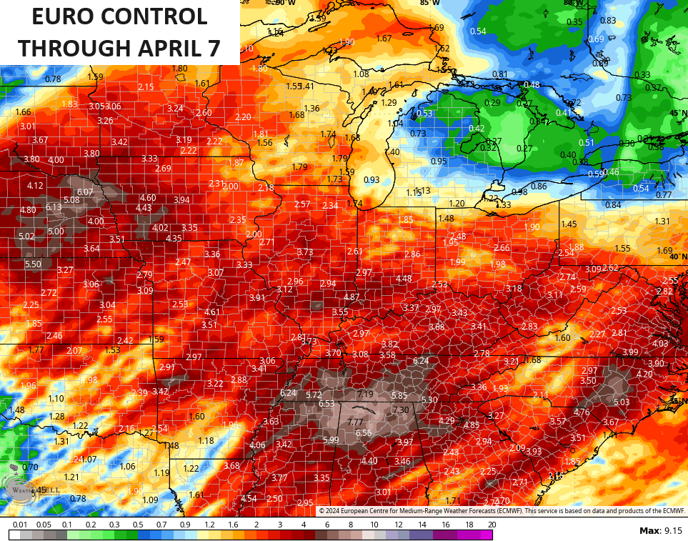
That type of a setup brings a lot of back and forth with our temperatures and that can lead to frequent rounds of showers and thunderstorms. Some of those could be strong or severe and put down quite a bit of rain during this time and the EURO CONTROL is showing this active pattern…
This is likely to be a very active spring severe weather season in our part of the world.
I’ll drop by for another update later today. Until then, I have you all set to track the severe weather to our west and southwest…

Current watches

Possible Watch Areas

Enjoy your Monday and take care.

Ensembles and weeklies cannot be trusted.
Hope the models are wrong about the wind today. We need rain here in my neck of woods, hadn’t had any in 3- 4 weeks. Surprise there’s no fire burn ban in place.