Good Tuesday, everyone. We continue to track a cold front across Kentucky today and this is bringing showers and storms across the region. Thins calm down behind this before the pattern turns active into Easter Weekend.
Rain and some thunder starts the day for central and eastern Kentucky as southwest winds continue to crank to 40mph or greater. The rain ends from west to east by late morning into the afternoon with a mix of sun and clouds showing up. Temps reach the mid and upper 60s for some areas.
As the front moves in from the northwest late this afternoon and this evening, a broken band of showers and storms develops across north central Kentucky and there’s a chance for a few strong storms.
The Storm Prediction Center continues with a low-end severe weather risk for this area…

Lingering clouds give way to some sunshine on Wednesday as cooler winds blow across the region. Temps come down into the 50s for most areas.
Those temps come up into the 55-60 degree range for Thursday with temps deep into the 60s for Good Friday.
Mild air really kicks in for Easter Weekend as temps taking off and making a run at 70…
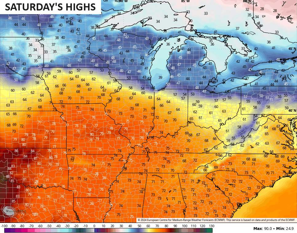
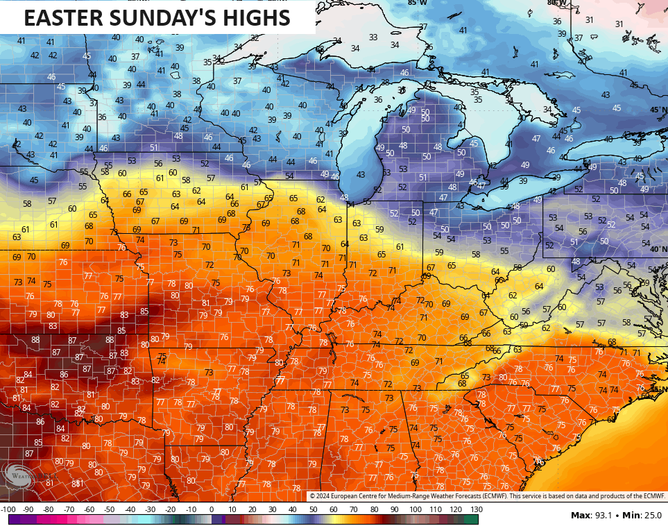
You can clearly see a healthy temperature gradient taking shape across the Ohio Valley as a boundary sets up across the region. That boundary turns active with rounds of showers and thunderstorms firing up and rolling in from the northwest this weekend. That action increases by Monday as low pressure drags a cold front in here…
This setup can result in some pretty good thunderstorm clusters with the potential for quite a bit of rain. That’s something to monitor going forward.
I have you all set to track today’s showers and storms and low-end risk for severe storms…

Current watches

Possible Watch Areas

Make it a great day and take care.

Not biting on storm potential yet for Easter.
Rain has ended in the BG area, with a total accumulation of only 0.45″. My PWS recorded a peak wind gust of 33 mph overnight.
We’re in for a bit of a rollercoaster over then next two weeks.
I guess you could call it “typical” spring weather. Big swings between above normal and below normal temps expected with numerous storm systems over the next two weeks.