Good Wednesday to one and all. It’s a much cooler and calmer day across Kentucky as a cold front continues to push to our east. This calm weather lasts through the rest of the week before we see rounds of storms and a surge of spring temps arrive for Easter Weekend.
We are seeing a mix of sun and clouds out there today with temps in the 50s for most of the state. Areas of the southeast may climb toward the low 60s for a few hours.
Thursday starts with upper 20s and low 30s with afternoon temps in the 55-60 degree range for many. This comes with a mostly sunny sky, making for a really nice overall day.
Good Friday looks even better with partly sunny skies and winds flipping around from the southwest and boosting temps into the 60s. This is ahead of a a surge of springtime temps arriving just in time for Easter Weekend.
This is also when a weak boundary drops in from the north and slows down across the Ohio Valley. This allows for rounds of showers and storms to slip in from the northwest…
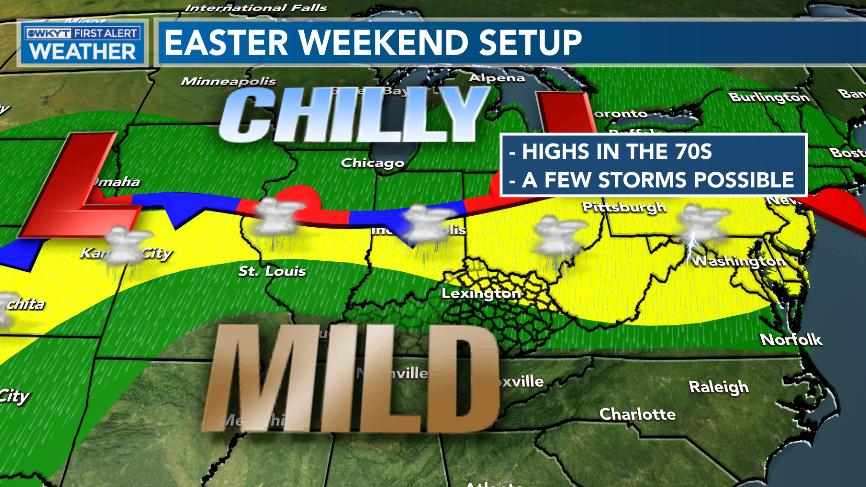
Temps make a run at 70 degrees during the holiday weekend then surge a little more by Monday. That’s when another potent system sweeps into the region with more in the way of widespread showers and storms.
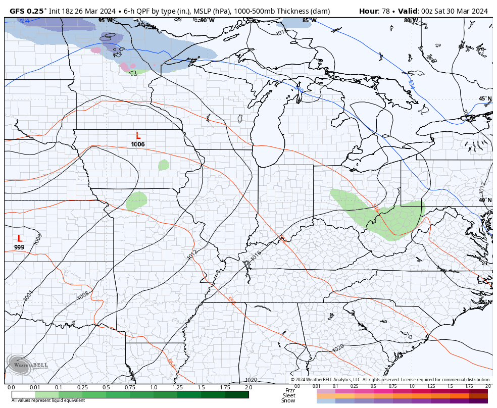
Here’s the GFS from Saturday through Tuesday…
That could lead to strong to severe storms from late weekend into early next week and could also put down a lot of rain.
The heavy rain potential is showing up in national hazards outlook from the Weather Prediction Center…

Enjoy your Wednesday and take care.

Looks like AccuWeather has been reading my posts!
https://www.accuweather.com/en/hurricane/explosive-atlantic-hurricane-season-predicted-for-2024-accuweather-experts-warn/1633944