Good Thursday, everybody. Milder weather is slowly making a comeback across Kentucky with temps really taking off into Easter Weekend. That’s also when rounds of showers and thunderstorms look to target the region, kicking off a stormy setup that takes us into early April.
Temps this morning range from the upper 20s and low 30s with frosty conditions. Sunny skies boost temps into the 55-60 range for many. This makes for a nice season opener for my Cincinnati Reds!
Good Friday looks REALLY good with temps hitting the 60s with a partly sunny sky.
Easter Weekend temps range from the upper 60s to low 70s on a strong southwest flow. This is ahead of a boundary sliding in from the northwest late Saturday into Sunday. This brings a few waves of showers and storms coming at us from the same direction during this time. That may very well interrupt some Easter Sunday plans.
Widespread showers and thunderstorms then kick in for Monday and Tuesday as low pressure rolls through the region. The overall setup from late Sunday through Tuesday is ripe for strong/severe storms and heavy rains…
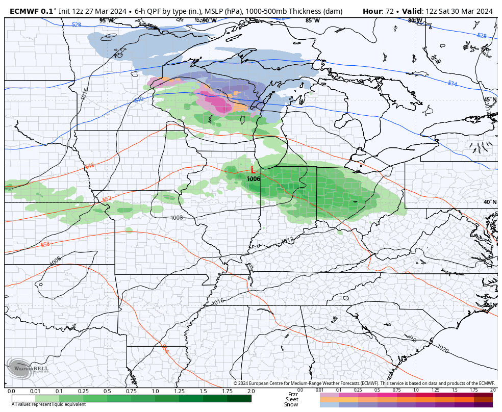
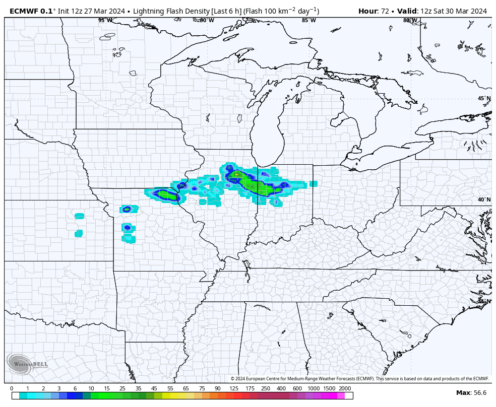
Check out all the lightning the EURO is showing with this scenario…
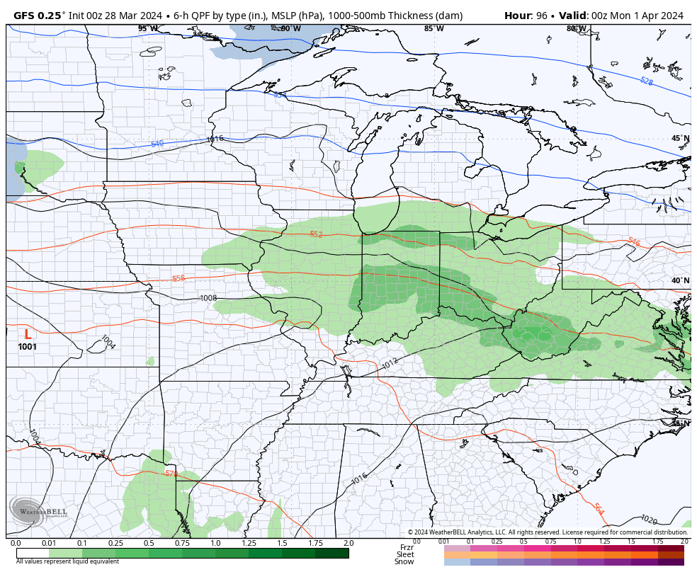
The GFS has a similar overall look, but is trying to throw a little winter weather right behind this departing storm…
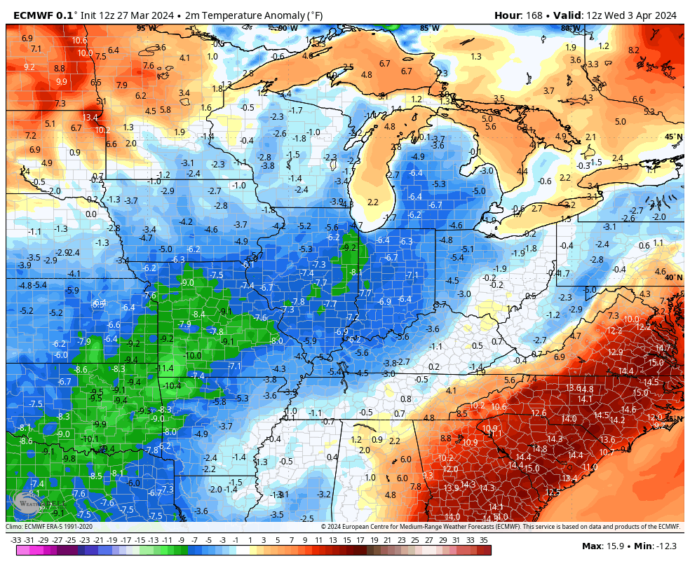
Temps behind that system drop back to below normal levels for Wednesday and Thursday but should bounce right back up later next week…
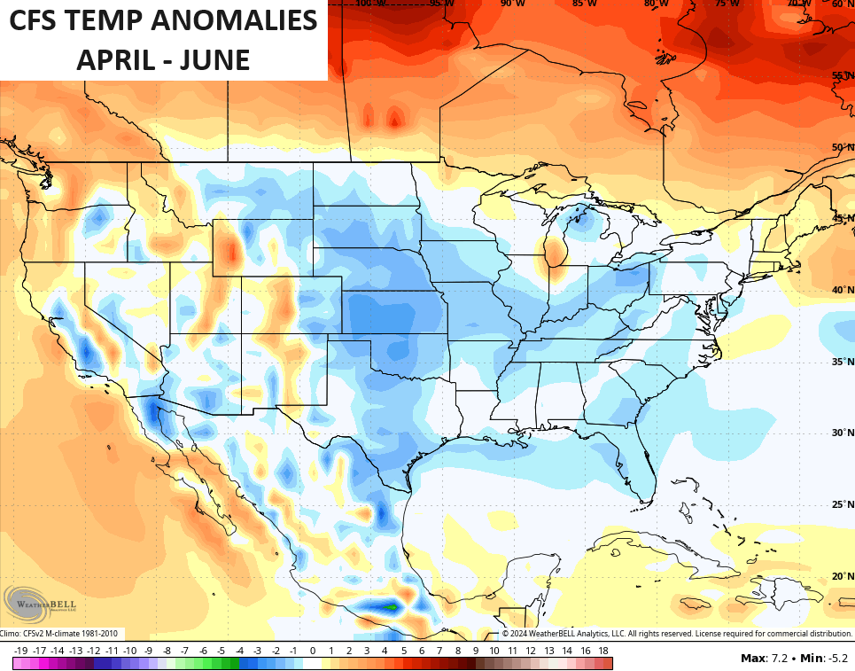
If we look at the longer range on the CFS, we find the model showing a very wet April through June for much of the country, including Kentucky…
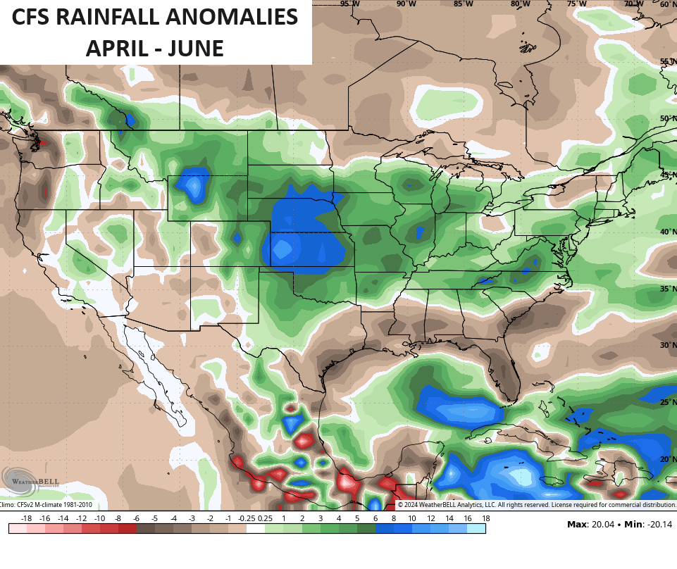
That matches up well with the stormy pattern I’m expecting this spring. The same model also keeps temps slightly below normal during this same three month period…
Have a great Thursday and take care.

As usual, long range model flip flopping. I’m not convinced we get above normal rain or below normal temps.
The CFS performance in 2023 was good.
Let’s see how it performs in 2024.
I prefer above normal temps and near normal precip in Spring and Summer.
I know 10-day forecasts aren’t reliable…. but on weatherstreet on the 10-day clouds/precip/surface map…almost the entire next week is overcast with rain on/off through the entire period after these few days of sun.. I hope that’s not the case…. also, a lot of the path of the eclipse looks cloudy too… wouldn’t that be a bummer.. Again… talking about a 10-day forecast (from the GFS, mind you) so …….
The area with the best chance for seeing the eclipse would probably be Texas, west of San Antonio, and the odds based on historical records get worse as you move northward. It’s a shame to, considering that observers will have a full minute more at totality then we had during the last eclipse. I consider myself fortunate to have been able to cross that item off my bucket list in 2017.
Joe does any of Ky get a partial view other then western part of state I was just wondering I saw some people saying they were in 70% and 90% and I thought if you are 70% what does that look like ??? I will have to read up on that I just thought you were in it or you weren’t in it at all??
Hi Crystal, you can use this link to bring up a map. Zoom in to Kentucky and wherever you click it will bring up a box that will show eclipse information for that exact place.
http://xjubier.free.fr/en/site_pages/solar_eclipses/TSE_2024_GoogleMapFull.html?Lat=36.83973&Lng=-85.40389&Elv=237.0&Zoom=8&LC=1
Crystal, the map gives you times in GMT. This site will let you convert GMT to EDT time:
https://www.worldtimebuddy.com/gmt-to-edt-converter
Wow Joe thanks so very much love that site.