Good Good Friday, everyone. Our Easter Weekend is getting underway with much milder winds surging into the region. The timing on the mild air is certainly on point, but some thunderstorms will try to crash some of those outdoor plans.
This leads us into another potent setup for the first few days of April as another storm system targets the region.
Let’s start with your Good Friday. Highs today reach 65-70 in most areas with partly to mostly sunny skies. Enjoy!
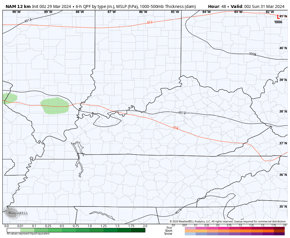
Temps this weekend then head toward 70 or a little better with a strong southwest flow ahead of a boundary dropping in from the northwest. This boundary will touch off a storm or two in the north on Saturday with a better chance for a few showers and storms on Easter Sunday. This isn’t very widespread at all…
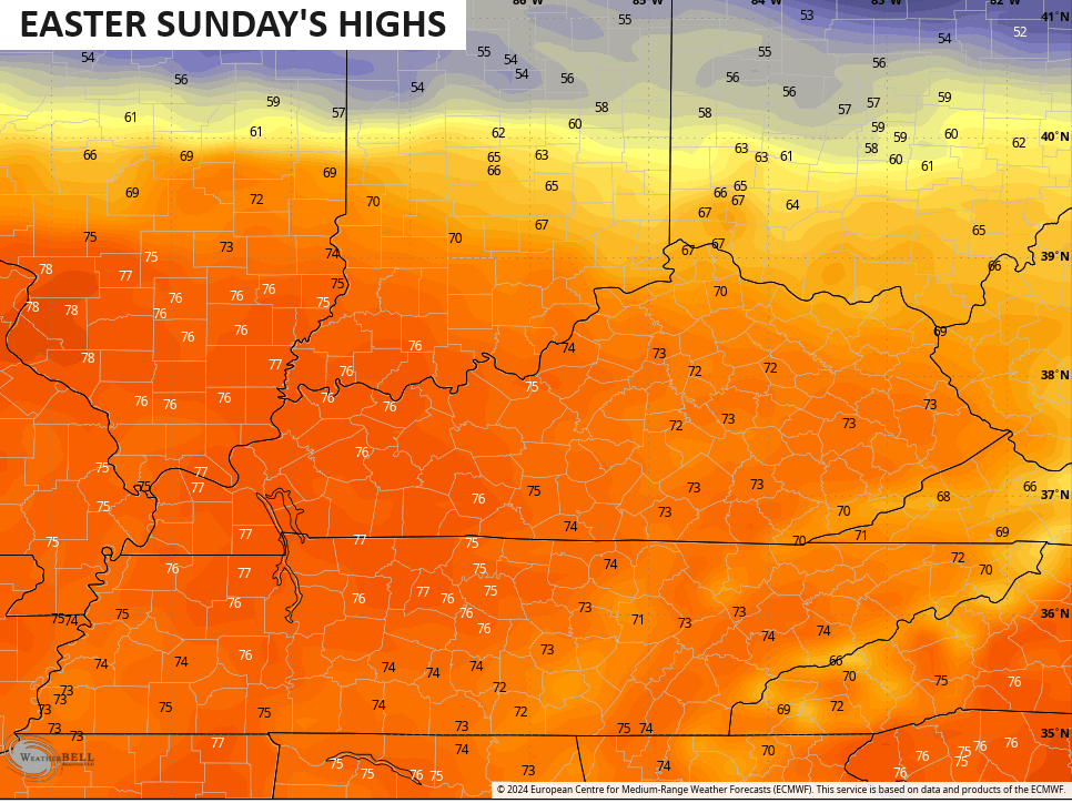
Easter Sunday highs in the low and middle 70s show up for most of the region…
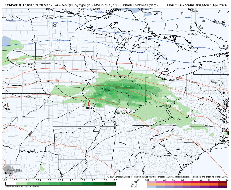
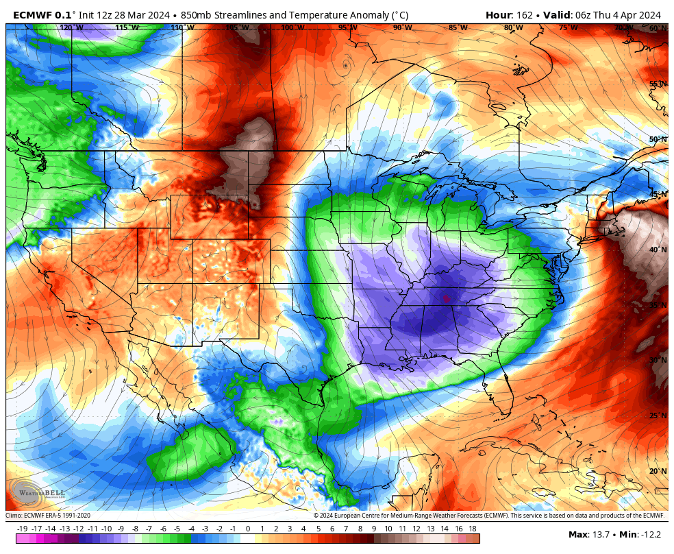
The setup from Monday through Wednesday features a strong area of low pressure rolling through the region. That brings rounds of showers and storms across the region late Monday and Tuesday, and some of those storms may be strong or severe.
As the low goes by, cold winds come in from the northwest with chilly showers and the outside chance for a few flakes. Wait… What???
Here’s the EURO with the whole evolution…
This setup has the potential to spit out some big storms around here, but this is just outside of the traditional 3 day outlook. Still, the Storm Prediction Center is showing the potential for Monday and Tuesday…
Check out how quickly our temps go from well above normal to well below normal. This animation goes from Tuesday through Friday morning…
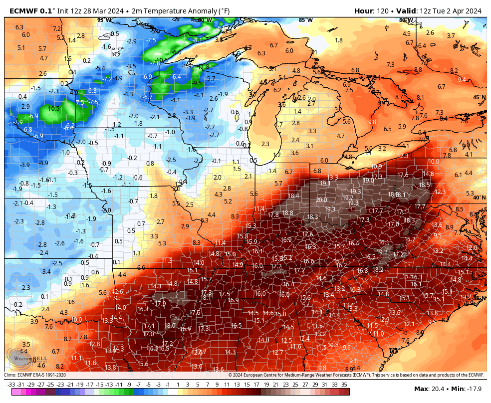
That’s showing highs in the 70s ahead of the storm system with some 20s for lows behind it. Yowza!
Temps should bounce back ahead of another big storm system developing to our west next weekend…
That could mean another big storm threat late next weekend or early the following week.
Enjoy your Good Friday and take care.

There won’t be any flakes nor seriously cold temps.