Good Sunday and Happy Easter, everyone. It’s another very mild day as a few thunderstorms race across the region. This kicks off a very stormy setup that can bring severe weather through Tuesday. After that, find the winter coats once again.
A boundary is draped across the region today and it’s touching off scattered showers and a few thunderstorms as temps generally hang out in the 70s again.
The potential is there for a few strong to severe storms with large hail and damaging winds as the main threats. The Storm Prediction Center has the northern parts of the state in the low-end risk for a few severe storms on this Easter Sunday…

Here’s a look at the individual threats for today…


This boundary goes back to the north to kick off the month of April on Monday as temps surge deep into the 70s on a stout southwest wind. This is ahead of low pressure that moves from the Mississippi Valley through the Ohio Valley into Tuesday. The exact track of this low will be the determining factor on just how great of a severe weather event we see around here. A few models track this low across Kentucky, limiting the severe threat.
Other models take this low on a track through Illinois, Indiana and Ohio. That would bring a greater risk for severe storms into Kentucky from later Monday through Tuesday evening.
Regardless of the track, cold northwest winds will usher in a taste of winter with a few snow showers showing up with the rain showers Wednesday into early Thursday.
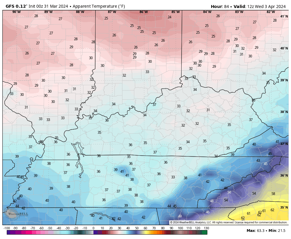
Here’s the GFS showing this whole setup…
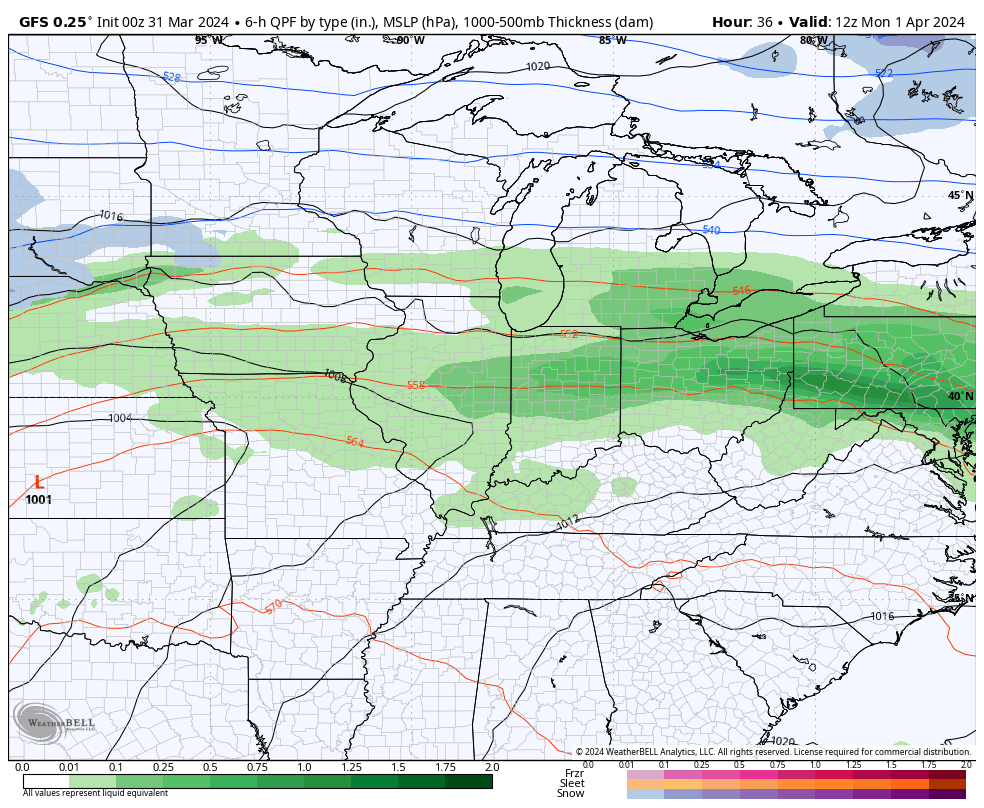
You can see how the GFS is taking the low on the northern track that would result in a greater severe storms threat for Kentucky.
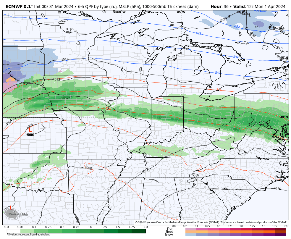
The EURO is doing the same exact thing…
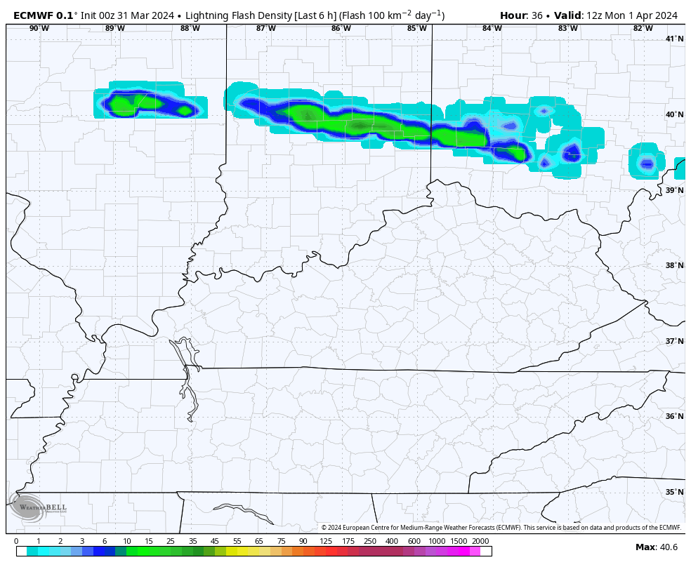
The EURO also gives us a lightning forecast. This animation goes from 8am Monday through late Tuesday evening. Pay close attention to the uptick in lighting ahead of the front Tuesday afternoon…
The above models would bring all modes of severe weather for our region later Monday through Tuesday… Damaging winds, large hail and a few tornadoes.
As far as the Monday severe threat is concerned, the best potential is to our west but the Storm Prediction Center is bringing the increasing risk for severe storms into much of Kentucky…
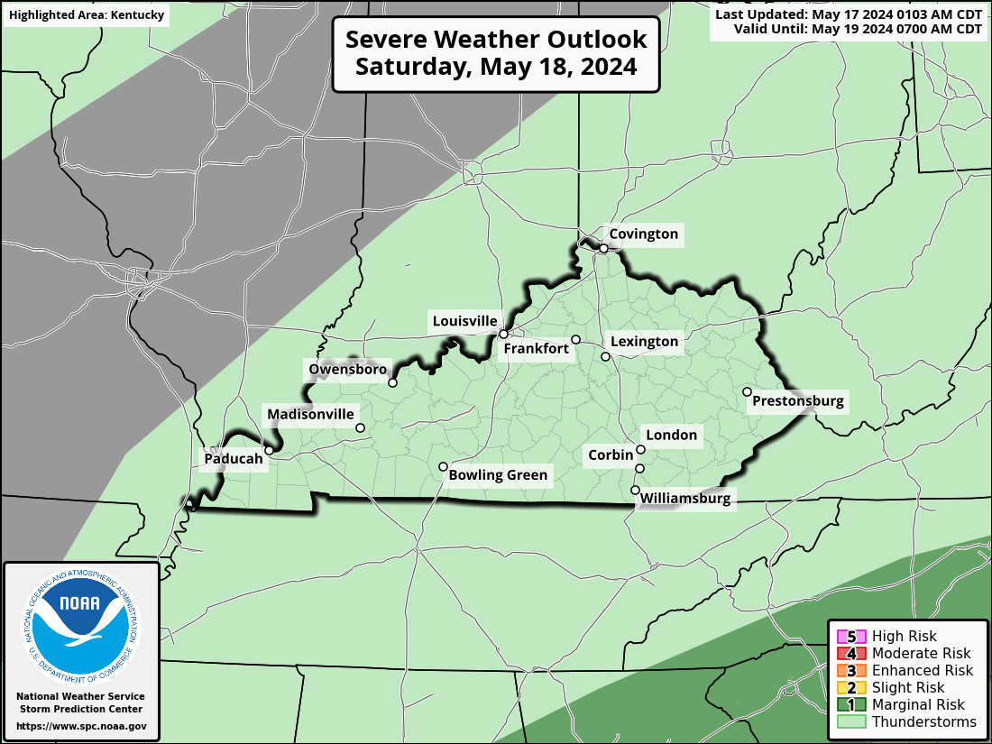
The best time for this comes late in the day and into Monday evening.
Here are the individual severe weather risks for this same time period on Monday…


This threat then focuses across much of the area for Tuesday as the front slams in from the west…

Another aspect of this storm system that’s fueling the severe threat is the major push of cold air coming behind it. We have the chance for some flakes to show up late Wednesday through early Thursday, which shows just how cold we look to get.
This air is so cold that we have to talk about wind chill once again. This wind chill animation starts at 8am Wednesday and goes through 8am Friday…
That’s just flat out nasty! It looks like colder than normal temps hang into Saturday before a quick moderation takes place to end the weekend. That’s ahead of another storm system that can bring another round of big storms that could threaten our highly anticipated Solar Eclipse on April 8th. We still have a lot of time to nail this forecast down, though.
Another update comes your way later today. Until then, I have you all set to track today’s severe threat…

Current watches

Possible Watch Areas

Have a very Happy Easter and take care.

It won’t be that cold nor will any snow happen.
As always, the potential intensity of severe storms on Tuesday hinges on whether we see an influx of Gulf moisture ahead of the frontal boundary. The wind component will be in place, as the mid-level and upper-level jet stream flows will be positioned over the Commonwealth in a southwest to northeast orientation, and will support rotation in supercells.
Supercell development will depend on whether a flow of Gulf moisture is present. There will be plenty of cold air aloft to support convection, but as usual, the timing remains uncertain.