Good evening, folks. Here’s hoping you’re having a very Happy Easter! Strong to severe thunderstorms continue to take aim at the region over the next few days and parts of the area could be looking at a significant event.
In the short-term, we continue to watch the northwestern sky for the potential for a few strong to severe storms to fire and roll southeastward into Kentucky. The Storm Prediction Center continues to highlight the north and northeast for the chance for severe storms this evening…

From there. we have to watch for the potential for waves of severe storms to impact the region Monday into Tuesday. The first wave may impact northern Kentucky late Monday afternoon into the evening. Another round may impact much of the state Monday night and Tuesday morning. The 3rd and final wave arrives Tuesday afternoon and evening as the front slides through.
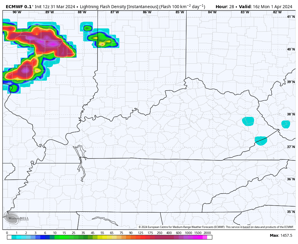
We can see all this playing out just by looking at the lightning forecast from the EURO…
The Storm Prediction Center has the entire state in the Severe Weather Outlook for Monday…
Here are the individual severe weather risks for this same time period on Monday…


You can clearly see the elevated tornado risk…

The setup for Tuesday is especially concerning as the low tracks just to our northwest, bringing the triple point into our region. This is where we are south of the warm front and just ahead of the cold front and low pressure. This environment is often where shear is enhanced and this can get storms rotating.
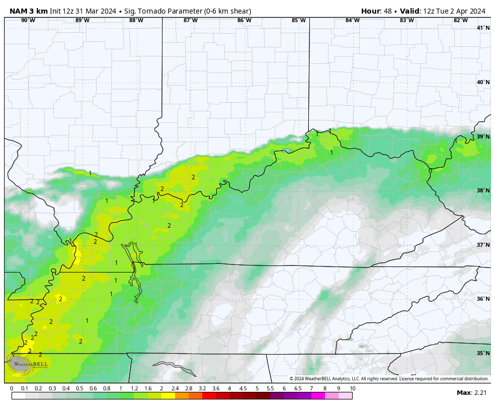
The Significant Tornado Parameter on Tuesday puts the bullseye right on top of us…
That matches up very well with the rare day 3 Enhanced Risk area from the Storm Prediction Center…

The day 3 doesn’t break down the specific threats, but the tornado threat will really be elevated during this time.
In addition to severe storms, local flooding issues will be possible with any of the storms working through here over the next few days.
Wintertime comes roaring back behind this system with rain and snow showers on Wednesday. There’s even the chance for a touch of wet snow to stick to elevated and grassy surfaces Wednesday night and Thursday morning.

Ugh!
I leave you with your storm tracking tools for the rest of your Easter Sunday…

Current watches

Possible Watch Areas

Enjoy the evening and take care.
