Good Monday, everyone. April is off and running with some wild weather rolling across the region. Rounds of strong to severe storms, heavy rains and May-like temps are with us for the first few days before winter crashes in for a few days. Buckle up, kiddos.
Today features temps back into the 70s on that same gusty southwest wind. Scattered showers and thunderstorms will be noted from time to time and some of those may be strong or severe.
The greatest severe weather risk comes later this evening, especially in the north and west. This is where the Storm Prediction Center has the highest risk for severe storms today…

Here’s a look at the individual threats for today…


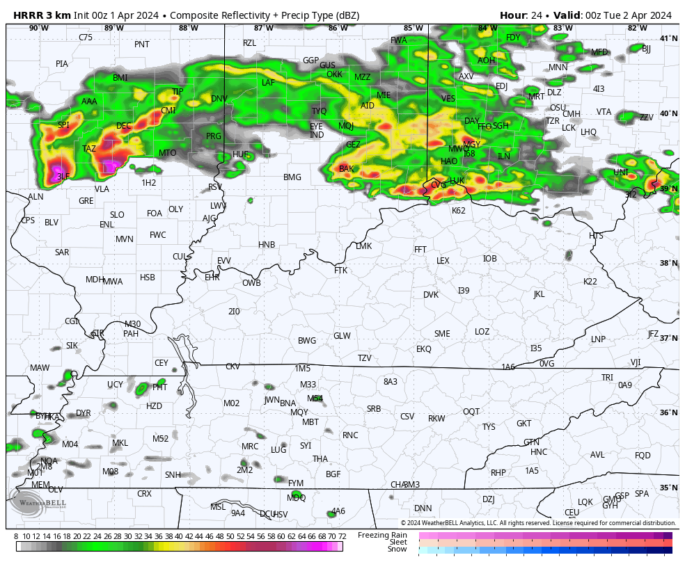
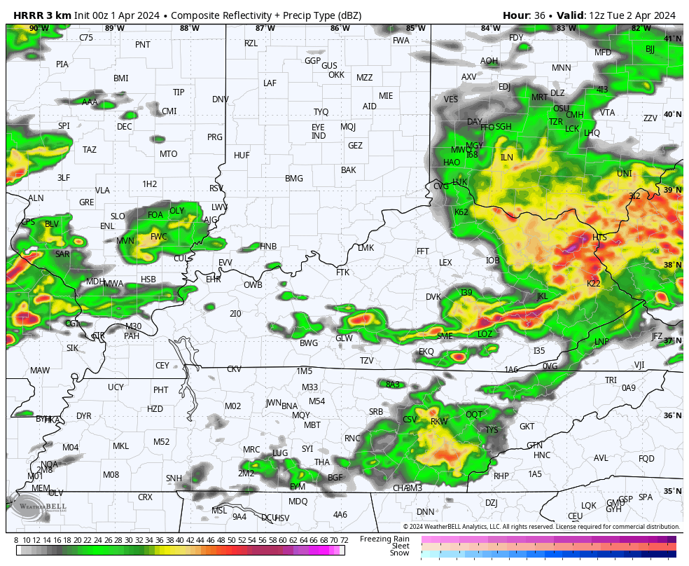
As mentioned, the greatest severe risk likely comes this evening into the overnight hours. That’s when a big complex of storms develops and rolls across the state. This shows up well on the future radar from the HRRR. This animation starts at 8 this evening and goes through 8 Tuesday morning…
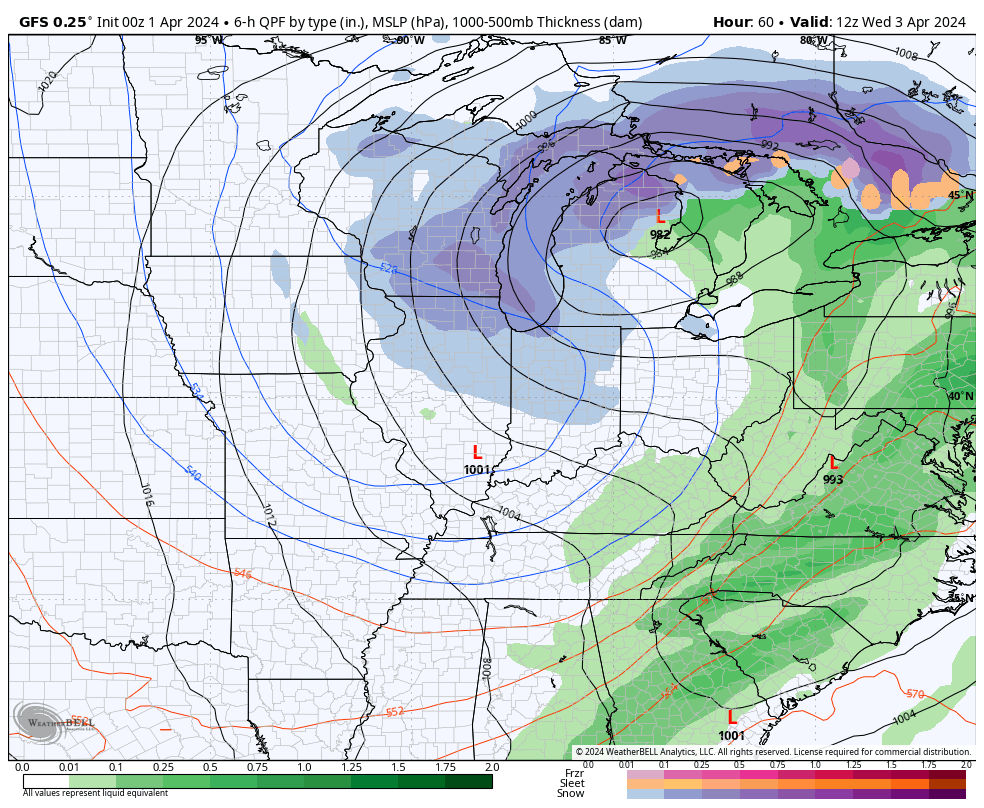
From there, additional strong to severe storms develop Tuesday afternoon and evening as the low pressure works through the Ohio Valley, bringing the triple point across our region. The future radar from the HRRR looks rather ominous from 8am through 8pm Tuesday…
It’s this part of the setup that’s especially concerning to me as all modes of severe weather will be possible, including an increased risk for tornadoes.
The Storm Prediction Center continues to paint the Enhanced Risk bullseye right on top of our region for Tuesday…
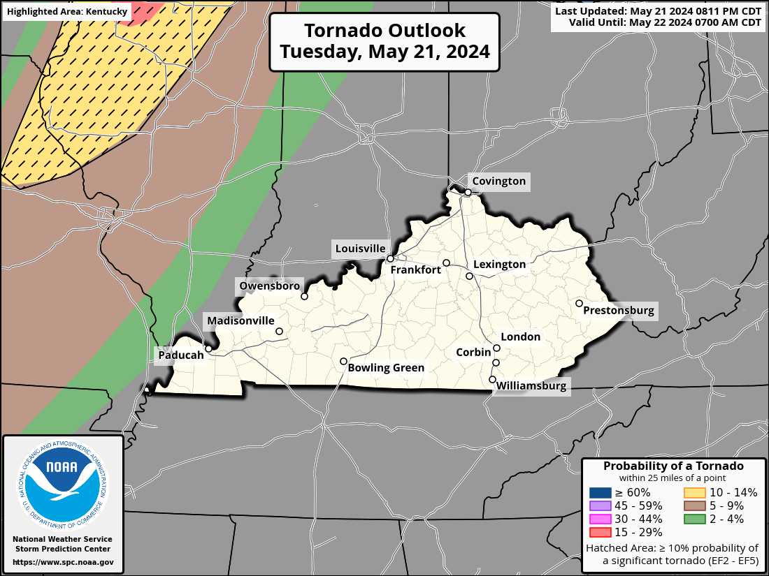
Here’s what the SPC is thinking in terms of the Tornado Outlook…

The threat for Damaging winds and very large hail is also increased…


Please stay alert to the rapidly changing conditions on Tuesday, folks.
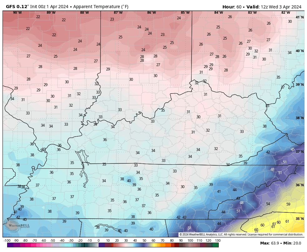
All of this is being fueled by a major blast of cold air surging into the region from Wednesday through Friday. This highly anomalous setup will mean temps that are frigid for early April and we also run the risk for snow showers to put some light accumulations down on grassy and elevated surfaces, especially Wednesday night and early Thursday.
The GFS tries to keep a few flakes going all the way into Friday across eastern Kentucky…
Wind chills are brutal for this time of year. Check out the numbers from 8am Wednesday through 8am Friday…
Temps won’t get to normal until Sunday or Monday at the earliest. Monday is the big solar eclipse and I’m watching a potent system that can bring clouds and some scattered showers and storms into our part of the world.
I will have another update or two later today and will have the latest on WKYT-TV starting at 4pm. As always, I have your storm trackers to help you through the day…

Current watches

Possible Watch Areas

Enjoy the day and take care.

I’m not concerned about the “cold” at all.
If residual clouds from Monday’s storm hang around into Tuesday, that will be a good thing, as it will help the air remain more stable, but a period of prolonged sunshine on Tuesday could spell bad news, especially for south central and central Kentucky. Strong jet stream winds are forecasted to overlay the area ahead of the cold front tomorrow, and their presence will enhance rotation in supercells that develop. As Chris said, this is a very serious setup, so stay informed to stay safe!
Coming upon the 50th anniversary of the Super Tornado Outbreak of April 3, 1974 . I remember that awful night well, even though I was only 11 years old. Setup for tomorrow eerily mirrors the similar conditions that were present during that event.clets pray history doesnt repeat its self. Everyone take care.