Good evening, folks. A significant severe weather outbreak is underway across the Plains states and this extends into Kentucky later tonight and Tuesday. The setup for Tuesday afternoon and evening is especially concerning as the tornado risk increases.
A few strong storms are possible this evening across northern Kentucky, but the greatest risk for severe storms comes late tonight as a complex of storms rumbles in from the west.
The Storm Prediction Center continues to highlight northern and western Kentucky for the highest risk of greatest impact from these storms…

Here’s a look at the individual threats for the rest of this day one outlook…


That tornado risk is for the cluster of storms coming in late tonight and early Tuesday. As that moves away, we see the chance for a few strong to severe storms going up during the late morning hours.
This is ahead of the low pressure working into the region during the afternoon and evening. We are south and east of the triple point I talked about and this puts our region in the greatest tornado risk area.
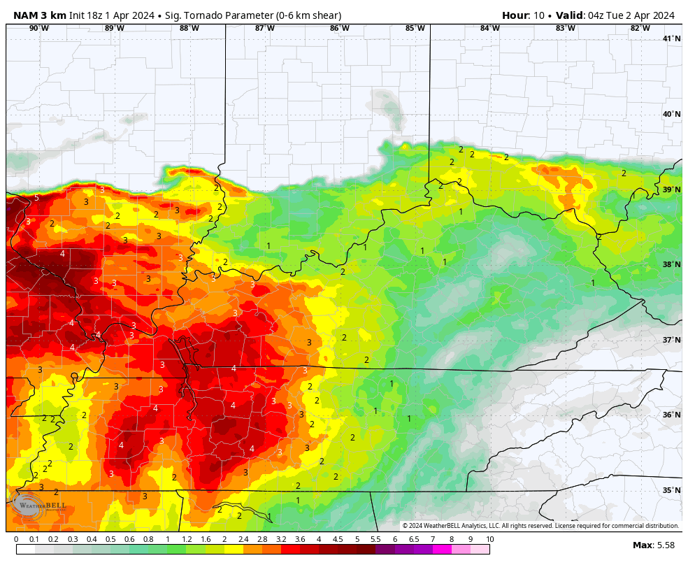
The Significant Tornado Parameter from the Storm Prediction Center is scary for Tuesday afternoon and evening, especially central and northern Kentucky…
The Storm Prediction Center expanded the Enhanced Risk area and upgraded northern Kentucky to a Moderate Risk for Tuesday…
That Moderate Risk may get pushed a bit farther south in time.
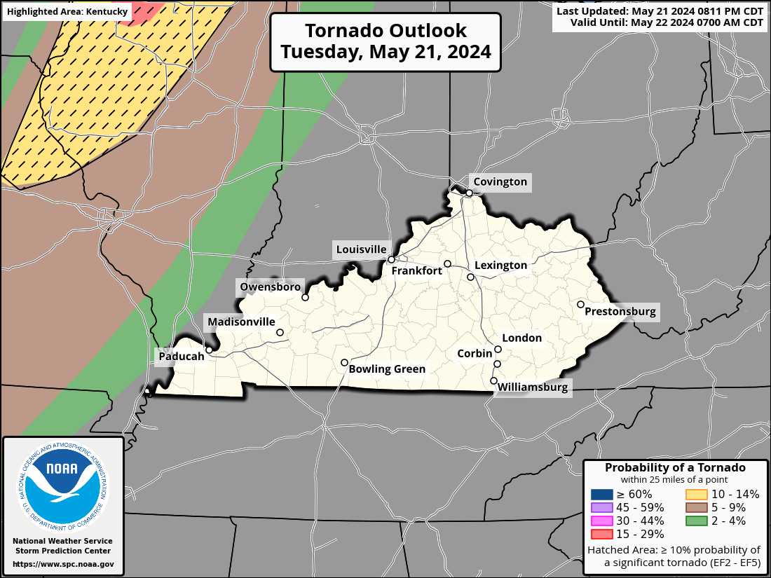
The Tornado Outlook from the SPC is highlighting the Hatched Area for an increased threat of significant tornadoes…

The threat for Damaging winds and very large hail is also increased…

As in the large hail potential…

Please stay weather aware!
I will have the latest on WKYT News at 10pm on the CW Lexington and on WKYT at 11pm. As always, I have your storm trackers to help you through the day…

Current watches

Possible Watch Areas

Enjoy the day and take care.

why can’t we just have NORMAL spring storms and showers…. why???
Mark, I hate to say it, but as our atmosphere continues to warm, it’s only going to get more extreme. This is the new normal.