Good Wednesday to one and all. Our severe weather is over as Old Man Winter pays one last visit (we hope) to the region. This taste of winter is complete with the chance for light accumulations later tonight and early Thursday.
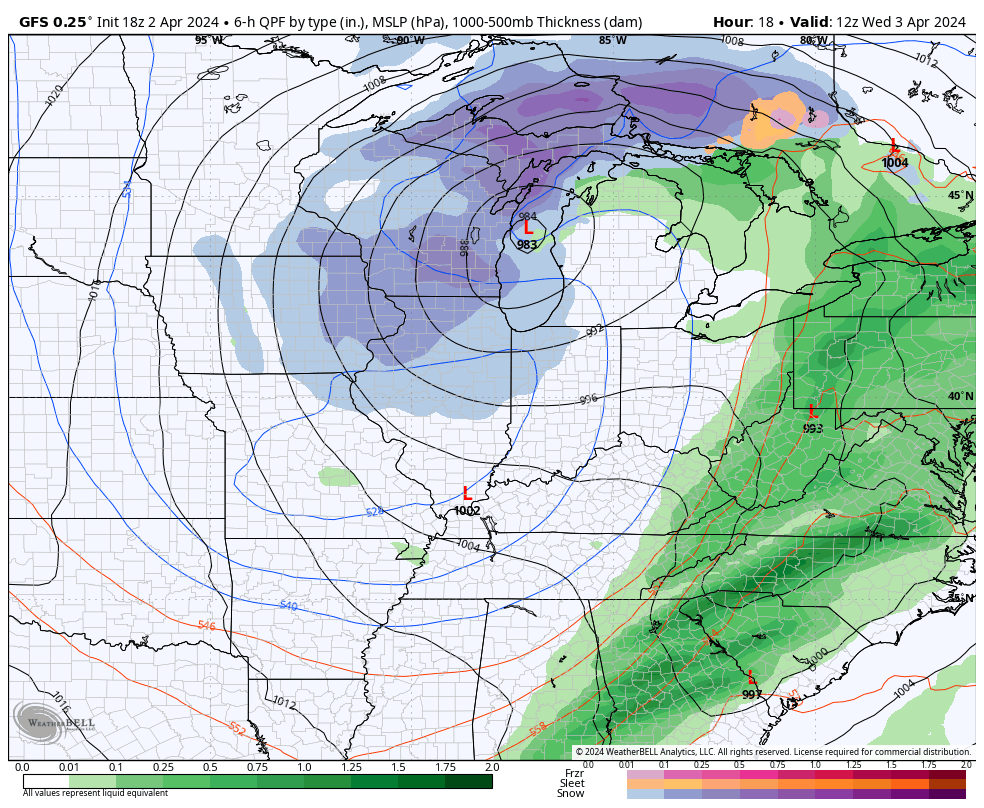
Much colder air is pushing in from the northwest as a huge upper low spins on top of the region. This cold air aloft will spawn gusty showers and a rumble of thunder through the afternoon and early evening. Some small, soft hail will be possible during this time. I’ve also seen situations like this spit out a few cold air funnels… even with temps in the 40s.
Here are your radars to follow along…

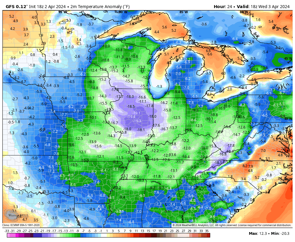
This is a really cold air mass setting up from today through the start of the weekend. Temps are MUCH colder than normal…
With this system spinning through here over the next few days, some snow showers will get into the mix from time to time. There’s the chance for a slushy accumulation to show up on elevated surfaces and the grass late tonight and early Thursday. There’s also a small chance for that to happen again Friday morning across the east.
This animation shows just how ugly this weather is from today through Friday…
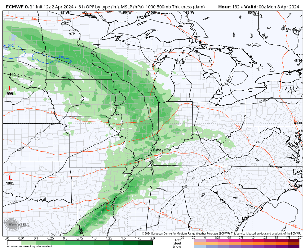
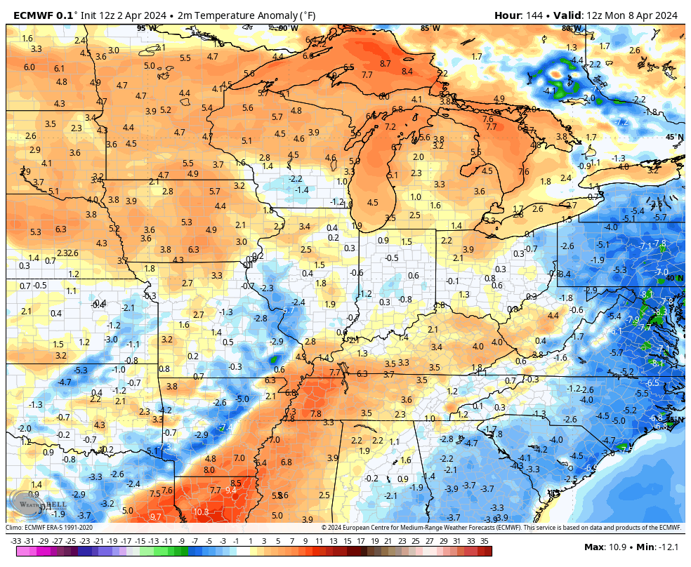
Temps will rebound some over the weekend but will still be below normal. This will be ahead of a storm system coming at us early next week. This may bring a few showers into the region for the big solar eclipse day on Monday. That will be followed up by another shot at some big thunderstorms a few days later…
The EURO is taking temps well above normal ahead of this system…
Make it a wonderful Wednesday and take care.

Thanks Chris for all your time and work today and everyday.
Snow is on the way for the Chicago Metro Area this morning, with slushy accumulations of an inch or so on gra-ssy areas. NW IL and Southern WI received more significant accumulations.
We’ve only received a grand total of two inches of snow since January 19th.
This brief cool spell is no big deal.
We had two tornado warnings with no damage in my section of Warren County, but I recorded 2.65 inches of rain between 8:00 am CDT and 6:30 pm CDT yesterday.
Our new normal continues to give forecasters and their models fits!/
It looks like Eclipse day exactly like the winter will be a bust.
The skies in Jasper Indiana is forecasted to be partly cloudy maybe that will be enough to receive the full effect. At around 3pm is when it is forecasted to begin in Jasper it will last for about 3:42 seconds.
Today marks the 50th anniversary of the April 3-4th SuperOutbreak of Tornadoes back in 1974!
It was the most violent tornado outbreak ever recorded, with 30 F4/F5 tornadoes confirmed, 148 in total, trekking 2,600 miles.
I can’t believe it’s been 50 years since that disaster. I was in my final year at Murray State University. Hoping that scenario never repeats. We were sure lucky yesterday. Only a few thunderstorms that gave our area 1.40 ” of rain.
Here’s more on the April 3rd, 1974 tornado super outbreak from NOAA :
https://www.noaa.gov/news/50-years-later-remembering-1974-tornado-super-outbreak#:~:text=Infamously%20known%20as%20the%201974,and%20%24600%20million%20in%20damages.
Just drove through a torrential downpour near Bowling Green, with a bit of hail and ice pellets mixed in, just to make things interesting.